Crickets Ham
Crickets Ham
A field of the Newton Surmaville Estate
Crickets Ham (Parcel 850), was a large field forming part of the Newton Surmaville Estate that was not leased out as Newton Farm.
There is documentary evidence that the 'Crickets' element of the name refers to the de Cricket family of Cricket St Thomas who held Newton Surmaville in the second half of the thirteenth-century. The second element 'Ham' comes from the Old English hamm, meaning an enclosure or land beside a river.
At the time of the 1846 Tithe Apportionment, Crickets Ham was owned and occupied by George Harbin. It was recorded as a meadow for growing hay and measured 14a 3r 8p.
Crickets Ham (Parcel 850) was bordered on the west by Newton Road and Coppice (Parcel 849), to the north it was bounded by Dodham Brook and on the east by the River Yeo. To the south it was bounded by Rookery (Parcel 848).
For details on historic land measurement (ie acres, roods and perches) click here.
maps

This map, based on the descriptions in the 1589 Terrier and the 1846 Tithe Map of Yeovil shows the approximate boundaries of the Manors of Kingston and Hendford as well as the manorial three-field system used in Kingston.
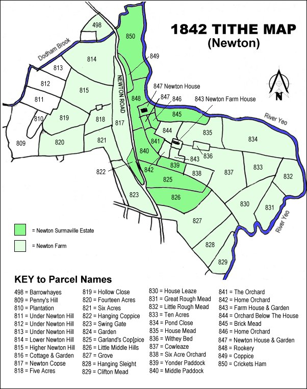
The 1842 Tithe Map showing the Newton Surmaville Estate shaded mid-green and the parcels of Newton Farm shaded light green. Crickets Ham (Parcel 850) is at top centre.