addlewell lane
addlewell lane
Also known as Frogg Street
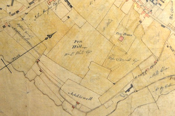
Addlewell Lane appears on Watt’s map of 1806 and at that time was the only road skirting the southern flanks of Penn Hill. Addlewell Lane was presumably named because it led to Addlewell and not vice versa. In fact, calling it a lane would be somewhat generous since, especially at its western end it was little better than a very steep footpath or bridleway.
At the time neither Park Street nor Penn Hill had been laid out, although part of the latter is shown as the tree-lined track to the east of Penn House. Addlewell Lane originally started not at South Street, almost as it does today, but was only named as such after the spur running east which today is the road running past the Gateway and leading to the old ski slope. From this spur to South Street it was called Frogg Street..
However, instead of terminating southeast of Penn Hill, it continued west, more or less as a footpath or bridleway unsuitable for carts, etc. It followed the route of today's Aldondale Gardens, then following the route of the later Chant's Path to join Hendford to the north of the present Brunswick Street junction with Hendford.
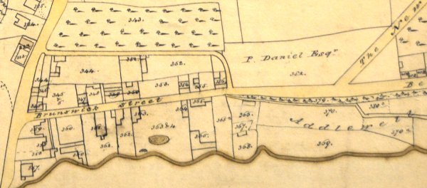
The importance of Addlewell Lane as the steep and narrow route between South Street and the bottom of Hendford Hill had diminished following the building of Park Street / Belmont / Brunswick Street by Peter Daniell in the 1830's. Bidder's map of 1843 shows Addlewell Lane simply petering out but, with the arrival of the Durston and Yeovil branch of the Great Western Railway in the 1850's, Addlewell Lane's fate was sealed and it has remained little better than a dead-end lane to this day.
That part of the original Addlewell Lane that worked its way up the side of the steep hillside, along the line of what would become Aldondale Gardens, was never little more that a footpath until at least the mid-1880s. The first two dwellings in what would become Aldondale Gardens appear on the 1886 Ordnance Survey but the road itself was not established until the twentieth century.
maps
Edward Bullock Watts' map of 1806 showing Addlewell Lane joining Hendford at top left and South Street at top right. The western or left section was later called Chant's Path. After the construction of Brunswick Street in the 1830s, this section of Addlewell Lane was effectively cut off, as shown in Bidder's map of 1843, shown below.

An enlargement of the above 1806 map showing the section of Addlewell Lane (at right) that would later become Chant's Path joining Hendford (at left).
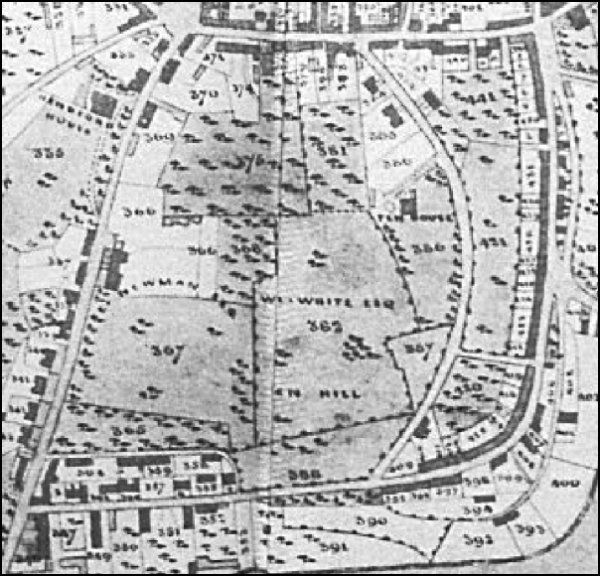
The section of Edward Bullock Watts' map of 1831, showing Peter Daniell's newly-built Brunswick Street. It was constructed around 1825 and, at the same time, Daniell built the road today called Penn Hill but on this map shown as the New Road. Note how Addlewell Lane, not annotated but above the word "Addlewell", joins the new road opposite Chants Steps. Today's Aldondale Gardens is today the western end of Addlewell Lane and runs from the junction with Brunswick Street as far as the "ll" at the end of Addlewell on the map, although the kink was later ironed out.
Bidder's map of 1843 shows Addlewell Lane petering out, its importance replaced by the newly-built Park Street.
Gallery
Courtesy of
Roger Froude
The northern end of Addlewell Lane, with Park Street at right, photographed in the 1950s.

Courtesy of
Roger Froude
... and looking back to Park Street, in a colourised photograph of the 1950s.

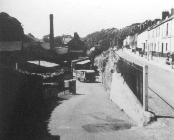
A 1960's photograph taken from Park Street (at left) with Addlewell Lane (at centre) with the sign of Males Garages Ltd on the Addlewell Lane dog-leg.

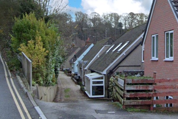
Aldondale Gardens, looking east. Before the construction of Brunswick Street by Peter Daniell in 1824-5, this was the stretch of the western end of Addlewell Lane as it approached Chant's Path. Just beyond the last bungalow seen in the distance, the lane is completely blocked off. Photographed in October 2024.

Aldondale Gardens, looking west towards Brunswick Street and photographed from roughly the same spot as the previous photograph. Photographed in October 2024.

The western end of Aldondale Gardens, looking west towards Brunswick Street which is just beyond the tarmac rise. Photographed in October 2024.
Aldondale Gardens, once part of Addlewell Lane, photographed from Brunswick Street in 2021. At this point Addlewell Lane cut across to the steps of Chants Path, seen in the next photograph.
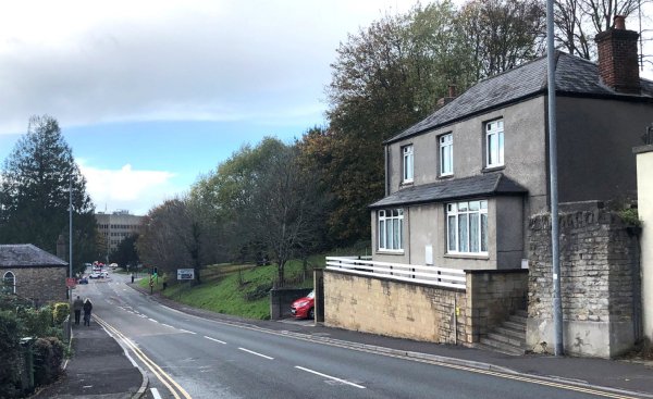
The same view as above seen today. The steps at right are the last remains of this end of Chant's Path. The house in this photograph, was built on the eastern part of the freehold plot referred to in the 1825 Indenture. It is almost certain that this is the house known to have been built on this plot by William Saint, called Brunswick Villa. Aldondale Gardens, opposite, is the last remains of Addlewell Lane seen on the 1806 and 1831 maps above. Photographed in November 2023