the history of yeovil's pubs
PUBS HOME PAGE |
PUBS INTRODUCTION |
PUBS BY NAME |
BEERHOUSES |
armoury
1 The Park
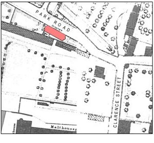 The
Armoury (shown
in pink on the
map at right)
was, funnily
enough, built as
an armoury. It
was the arms
repository of
the 16th
(Yeovil) Rifle
Volunteer Corps.
The
Armoury (shown
in pink on the
map at right)
was, funnily
enough, built as
an armoury. It
was the arms
repository of
the 16th
(Yeovil) Rifle
Volunteer Corps.
In 1859 the Corps had a Captain, Lieutenant, Ensign and about sixty other ranks. By 1870 it was occupied by Drill Instructor Symes and his family and in 1908 it was occupied by Sergeant Instructor Thomas Clothier. It is said that powder and ammunition was stored in the cellar.
In 1879 the Post Office Directory noted "16th Somerset Rifle Volunteers (Armoury, The Park) - Captain Harbin; Lieutenant Hunt; 2nd Lieutenant Marsh; Chaplin, Rev. R Newman; Acting Surgeon, WF Tomkyns; Sergeant Instructor, W Symes; Band-master, Alfred Beare." Alfred Beare was listed in the 1881 census as living at the Beehive Inn in Huish, that had been run by his father, Hubert. For further images of the band click here.
A newspaper cutting of 1876 reads as follows "RIFLE CORPS - Order for 19th Nov. 1876. The Corps will parade in the Borough at 10am on Sunday next, the 19th inst, and march to Preston Church to attend Divine worship. If gloves are worn, they are to be of the same colour as the belts. Band will attend. Lance Corporal T Brown is to be promoted to full Corporal, vice Giles from this date. The following members having qualified by examination, are to be Lance-Corporals from this date:- Priv. R McAuley, Priv. J Bambury, Priv. J Bartlett. Any recruits wishing to join the Corps will leave their names at the Armoury at once."
The building was converted to licensed premises, known as the Armoury, in the early 1980's.
gallery
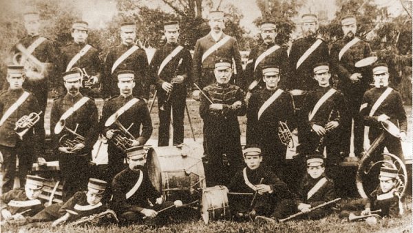
A nice sepia photograph of the Yeovil Military Band in 1892. At centre, with the beribboned tunic and holding the baton is band leader Alfred Beare. Officially this was the band of Yeovil F Company, 2nd Battalion, Prince Albert's Somerset Light Infantry.
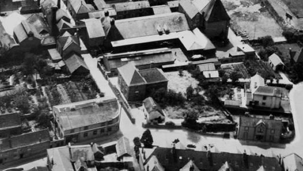
This 1935 aerial photograph shows Clarence Street running diagonally down the left of the photograph to join with Park Road at bottom right. Towards top left of the photograph is the high-level walkway spanning Clarence Street, with the Brutton's brewery building to the left and the malthouse buildings to the right. The Armoury, before its rear extension was added, is seen at bottom right.
From the Cave
Collection
(colourised),
Courtesy of South Somerset Heritage Collection
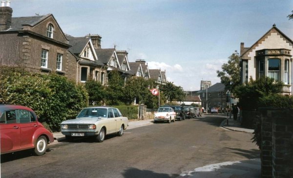
This photograph, taken in the 1960s, looks east along Park Road towards Clarence Street, and shows the Armoury at right. All the buildings at left were demolished for the construction of Queensway.
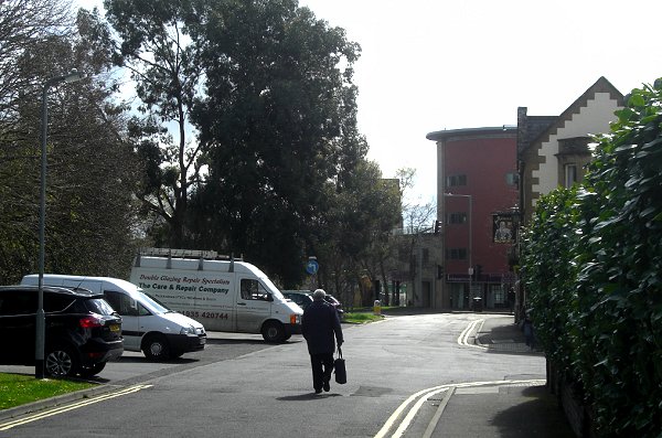
The same scene photographed in 2015.
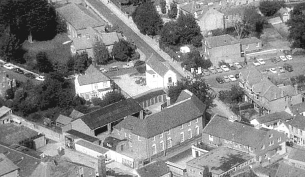
An aerial photograph of 1972 shows the Armoury as the long, thin white building at the centre of the photograph and completely lacking the huge extensions seen in the following image. Also, compare this pre-Queensway image with the following photograph.
Courtesy of
Chris Rendell
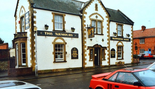
The Armoury photographed in 1989.
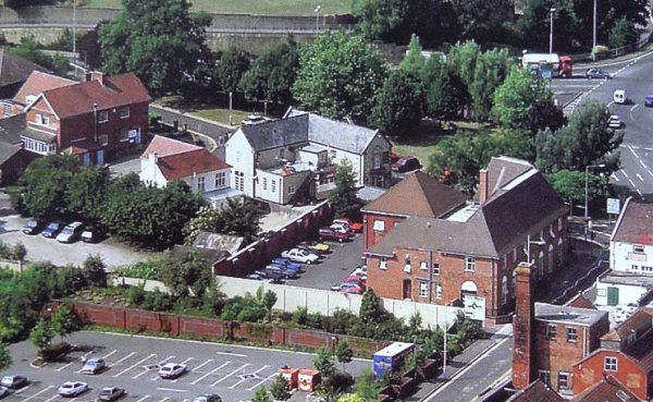
The Armoury is the white building at the centre of this 1994 aerial photograph, although a glance at the map and photograph above will show that there are now more extensions than the original building facing The Park. Behind the trees at the top of the photograph Queensway runs to join the Hospital Roundabout at top right. Clarence Street runs diagonally across the bottom right of the photograph and at bottom left is Tesco's car park when it was still one-storey. The large building in the right half of the photo is Telford House, built as a telephone exchange and later became Council Offices (where I worked in the early 1970's in the Architect's drawing office).
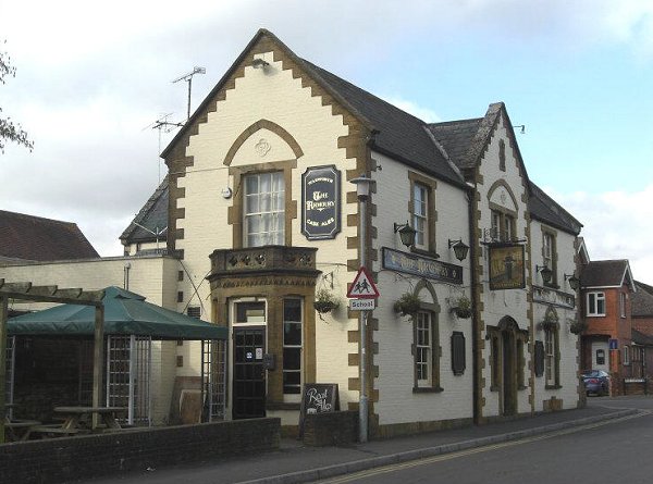
The Armoury. Photographed in 2012.