Cogan's Mead
Cogan's Mead
A former part of the great West Field of Kingston Manor
Cogan's Mead (Parcel 1352) was an field of Larkhill Farm and was bounded to the north by Thorne Lane, to the east by Lower Grubhams (1353 and 1353a), to the south by Lockyer's Mead (1351) and to the west by Dampier's Mead (1350).
The 1846 Tithe Apportionment recorded Cogan's Mead as 4a 2r 20p and noted its use as meadow - grassland not regularly grazed by livestock but allowed to grow unchecked in order to produce hay. Strangely, the ownership of Cogan's Mead is not recorded in the Apportionment.
Today the site of the former Cogan's Mead is occupied by the houses and gardens of Thorne Lane and Wessex Road.
For details on historic land measurement (ie acres, roods and perches) click here.
maps

This map, based on the descriptions in the 1589 Terrier and the 1846 Tithe Map of Yeovil shows the approximate boundaries of the Manors of Kingston and Hendford as well as the manorial three-field system used in Kingston.
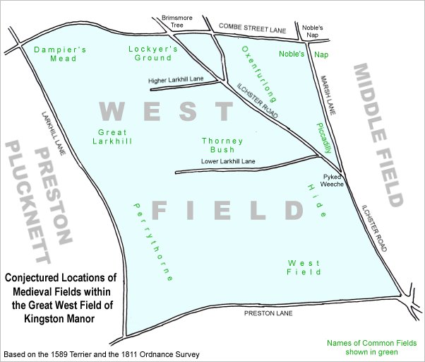
A conjectural map of the great West Field of Kingston Manor showing ancient sub-fields, most likely common fields, within the overall bounds of West Field.
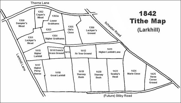
The Larkhill area reproduced from the 1842 Tithe Map. Cogan's Mead is top left.
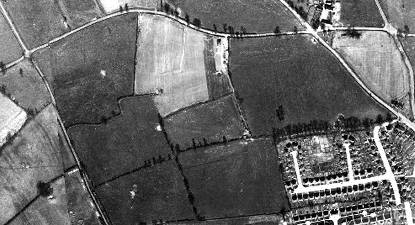
The 1946 aerial photograph showing Cogan's Mead as the left side of the light field at centre (the right half is Lower Grubhams and the staggered boundary between them shows as a feint whiter line).
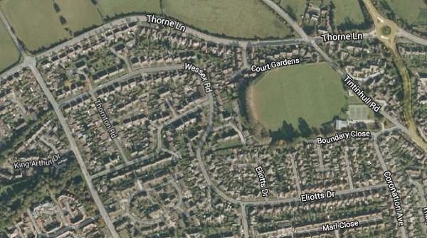
The same area today 'borrowed' from Google maps.
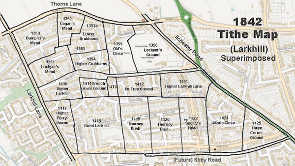
The 1842 Tithe Map superimposed (slightly out at the bottom) over a modern map.