FourACre Mead
Fouracre Mead
A field within the great manorial East Field
Fouracre Mead (Parcel 954), also known as The Mead, was (as its name suggests) a four-acre meadow.
At the time of the 1846 Tithe Apportionment, Fouracre Mead was owned by by Captain William Jones Prowse of Enham House, Southampton, Retired Captain RN, son of George Bragge Prowse of Kingston Manor House and Lord of the Manor of Kingston. Fouracre Mead was let to James Tucker. At this time, it was used as meadow for making hay and measured 4a 0r 10p.
Fouracre Mead was originally reached by a farm access track that was a northern spur of Sydling's Lane (the western end of today's Rosebery Avenue). The northern spur would become the southern half of Monmouth Road.
Fouracre Mead was bounded on the west by Quarry Ground (Parcel 953), on the east by Harbin's Ground (Parcel 930) and Cox's Close (Parcel 928). On the south it was bounded by Lower Hather Mead (Parcel 955).
By the time of the 1946 aerial photograph seen below, Fouracre Mead was still an open field.
Today Fouracre Mead is bounded by Monmouth Road on its eastern edge, while the former field now contains houses and gardens of the eastern end of Greenfield Road and the northern half of Welland Road.
For details on historic land measurement (ie acres, roods and perches) click here.
maps

This map, based on the descriptions in the 1589 Terrier and the 1846 Tithe Map of Yeovil shows the approximate boundaries of the Manors of Kingston and Hendford as well as the manorial three-field system used in Kingston.

A map of the great medieval East Field of Kingston Manor showing conjectured locations of several fields based on descriptions in the 1589 Terrier.
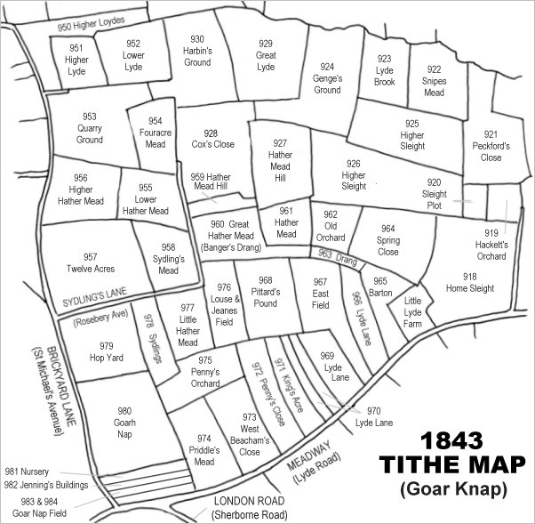
Drawn from the 1846 Tithe Map with field names added from the 1846 Tithe Apportionment, with Fouracre Mead (Parcel 954) in the top left quadrant.
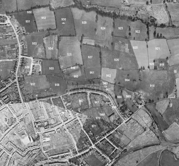
The 1946 aerial survey photograph (somewhat mis-aligned at bottom left) with parcel numbers of 1846 plotted on. At this time, Fouracre Mead was still an open field.
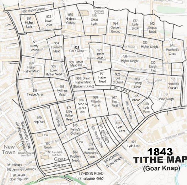
The 1843 Tithe Map overlaid onto a modern map of the area.
Gallery
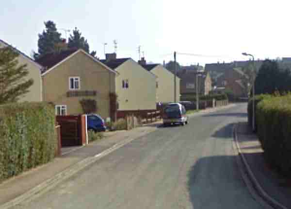
Looking south along Welland Road from its junction with Greenfield Road - essentially most of the former Fouracre Mead.