Gas Lane
Gas Lane
Running around the Town Gas Works from Middle Street to Stars Lane
Before Yeovil Town Station was built, a lane known as Coach Lane ran from Newton Road to Dodham. It ran across the site of the proposed station and goods yard and was a public thoroughfare. The London and South Western Railway Company tried to stop it. However, Levi Ridout - builder of South Western Terrace - took the railway company to court and won his case. Coach Lane eventually became known as Gas Lane since it skirted the Town Gas Works.
Gas Lane was a lane that ran from the junction of Middle Street and Station Road (today's Old Station Road), passing between the Town Gas Works on the west and the railway shunting sidings of Yeovil Town Station and the coal yard started by William Skinner in the 1850s, later Burt's coal yard. The site of the entrance to Gas Lane from Middle Street is now occupied by the former Key Markets House, converted to a Premier Inn in 2014.
As it approached the British Rail Parcels Office attached to the railway station, Gas Lane turned to the southwest to skirt the southern boundary of the gas works. It then ran alongside a former wool store that was, during the 1950s and 1960s occupied by scrap merchant EJ Farr.
Gas Lane finally exited at Stars Lane, directly opposite Summerhouse Terrace.
The gas works closed in 1957 and the site cleared in the early 1960s. Gas Lane disappeared with it.
MAP & Aerial photograPH
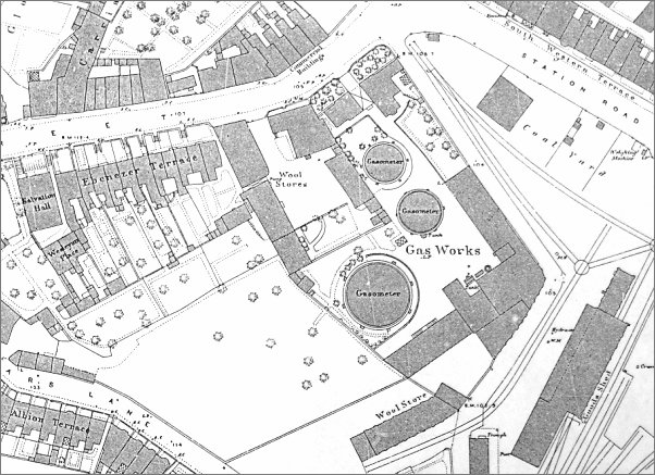
The 1886 Ordnance Survey shows the location and size of the gasworks at this time. Gas Lane starts at top right, almost on the corner of Middle Street and Station Road, runs southeast alongside the gas works buildings then turns southwest. It eventually ran past the building noted as a Wool Store at bottom right of centre (in the 1950s and 1960s this became the premises of EJ Farr, scrap merchant) and joined Stars Lane.
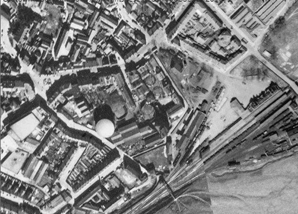
This 1946 aerial photograph shows the gasworks, at centre, which had by this time extended as far as Stars Lane next to the new, large gas holder just left of centre. The right-hand side is occupied by Yeovil Town railway station. Gas Lane is the narrow white 'J'-shaped road just right of centre
gallery
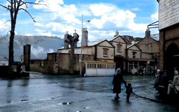
This colourised photograph, taken around 1960 from Central Road, is looking across Middle Street with the junction of Station Road (now Old Station Road) at extreme left. Right of centre the three-gabled building was the Town Gas Works offices, originally also accommodation for the Gas Works Manager and his family, (most recently, after an art deco makeover in the 1970s, converted to the shop of St Margaret's Somerset Hospice, but now vacant). At extreme right the building with the 'Middle Street Centre' sign was the earlier Railway Inn, now the site of the William Dampier. The entrance to Gas Lane was between the two trees at left, the site is now occupied by the former Key Markets House, later (2014) converted to a Premier Inn.
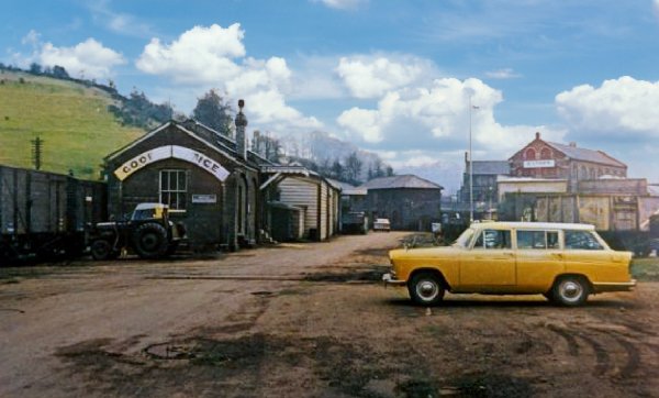
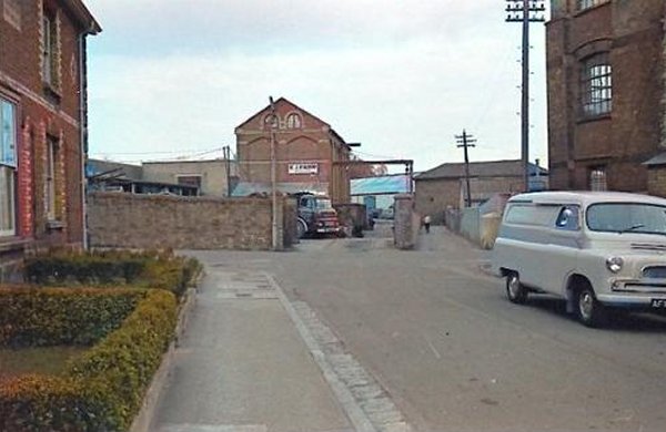
In this colourised photograph the photographer has walked down Gas Lane for a hundred yards or so and has turned around to see the former Town Gas Works offices left of centre and the former Railway Inn directly ahead. At left the gas works have been all but demolished. At right a railway wagon sits on the shunting sidings that ran all the way to Middle Street through the coal yard started by William Skinner in the 1860s (it later became Burt's coal yard). The fence running alongside Gas Lane was made of railway sleepers and was used to contain huge heaps of coal.
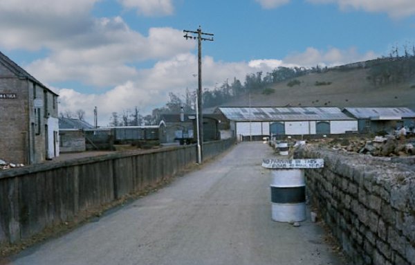
Turning once again to the south, with Summerhouse Hill in the background, the coal yard is at left with more sidings and the British Rail Parcels Office ahead. The area occupied by the railway buildings had originally been filled with pens for sheep and cattle but was later used for offloading goods and coal.
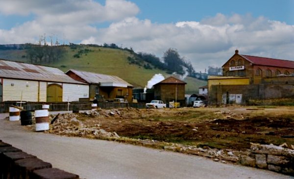
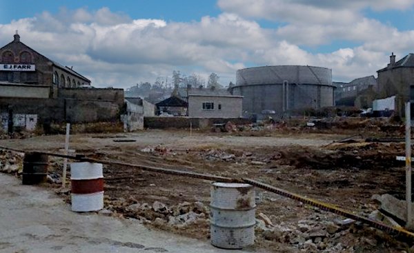
As it reached the British Rail Parcels Office Gas Lane turned to the southwest. The gas works site has been cleared at right and in the distance at right the large building had originally been a wool store (see the map above) but by this time was the premises of scrap merchant EJ Farr & Co, founded at the end of the nineteenth century by later mayor of Yeovil Ernest John Farr.
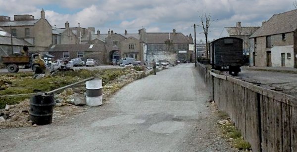
Turning the corner of Gas Lane, this colourised photograph now looks more southwest, with the station's goods office at left and Farr's premises in the distance at right.
From my
collection
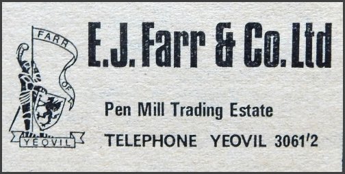
EJ Farr & Co Ltd's advertisement in the 1970 edition of Kelly's Directory indicating that by this time the company had moved premises to the Pen Mill Trading Estate.
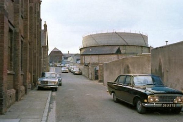
Having turned the corner in Gas Lane, this colourised view looks west with Farr's building at left and the partially-cleared gas works site at right. At centre, to the left of the gas holder, are seen the chimneys of Albion Terrace in Stars Lane. The gas works site would, for many years, become Town Station Car Park.
In this colourised photograph, the photographer is now standing in Summerhouse Terrace, with the first house in the terrace at left and Foundry House at right, looking to the junction with Stars Lane running across the photograph. The other end of EJ Farr & Co's building (Ernest Farr had died in 1946) and the entrance to his scrapyard takes up much of centre left while to its right, with the man seen walking along, is the Stars Lane entrance to Gas Lane.
Another colourised photograph, taken from the very bottom of Stars Lane, looking north, with Foundry House at left and the gas works at right.