Grove Avenue
Grove Avenue
Originally in Preston Plucknett
Grove Avenue was laid out during the 1890s in open fields at the eastern edge of the fields of Preston Lower Farm. The eastern boundary of the farm was a small brook that flowed south and became a tributary of Dodham Brook. As well as being the boundary of the farm, this brook was also the parish boundary of Preston Plucknett and Yeovil Town. When Grove Avenue was built, the rear gardens of properties on the eastern side of the road were delineated by the brook. Therefore Grove Avenue was originally in Preston Plucknett.
The new road was named Grove Avenue after Grove House - a late eighteenth century grand house situated in Preston Road almost opposite the northern end of Grove Avenue.
The 1901 map below shows that, by this time, fourteen houses had been built on the eastern side of the new Grove Avenue and one on the western side. West Park had also been built, connecting Grove Avenue with The Park. By the time of Collins' 1907 Yeovil Directory, twenty-three properties were listed in Grove Avenue. There was no street numbering in Grove Avenue at this time and all the houses were named.
Map
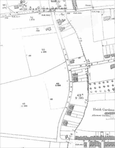
This map is based on the 1901 Ordnance Survey, at which time Grove Avenue was less than ten years old. At its northern end is Preston Road, while at its southern end Huish runs off to the east and a farm track across open fields runs to the west. At the bottom of the gardens of the houses on the eastern side of Grove Avenue runs a small stream that eventually joins with Dodham Brook. This, at the time, was the Yeovil Town boundary and shows that Grove Avenue was originally within Preston Plucknett.
gallery
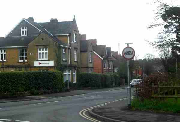
The 'top', or northern, end of Grove Avenue seen from Preston Road. Photographed in 2013.
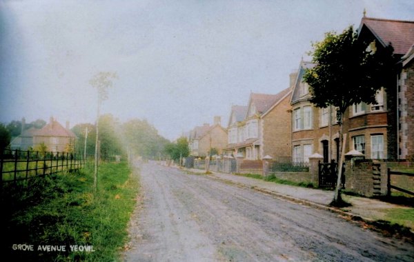
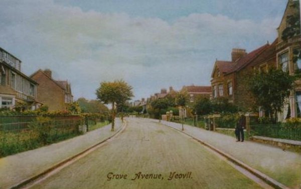
Grove Avenue seen in a colourised postcard of 1905. The view is the northern end of the road and looks towards Preston Road (at the tree-line in the distance).
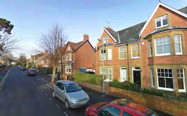
The same view as the previous image, seen in 2008 - almost 100 years later.
Courtesy of Dave
Sims
... and in a colourised postcard of 1910.
From the Cave
Collection
(colourised),
Courtesy of South Somerset Heritage Collection
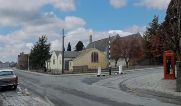
Huish at the junction with the southern end of Grove Avenue, in the mid-1960's. This was as far as Huish ever went and from this point onwards was fields until Preston Grove, at left, was built in the 1920's. Many older Yeovilians remember St Andrew's 'tin church' on the corner.
Courtesy of Jack
Sweet. This
photograph
features in my
book "Now
That's What I
Call Yeovil"
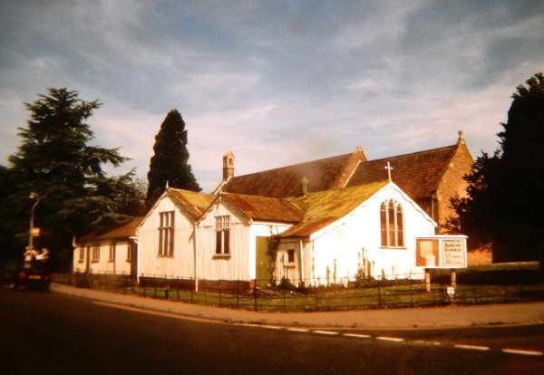
The same junction, showing the famous 'tin hut'. Photographed during the 1980s.
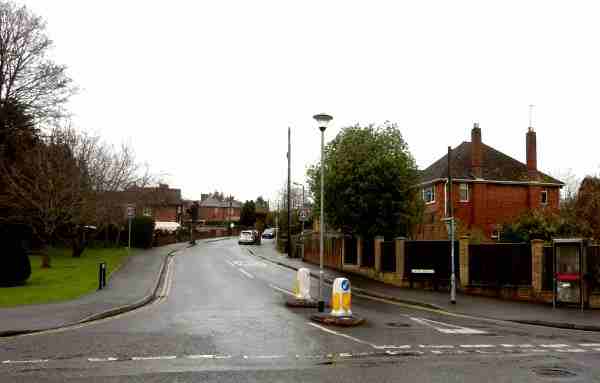
The southern end of Grove Avenue, photographed from Preston Grove / Huish in 2016.