Hett's Orchard
Hett's Orchard
Of Stone Farm, a detached part of Preston Plucknett
In his
'Agricultural
Survey of
Somerset' of
1797, John
Billingsley
refers to the
large number of
orchards for
which the land
is "peculiarly
adapted". The
large acreage
devoted to this
purpose in the
Yeovil area
reflects the
county's
reputation for
cider making.
The low wages
being paid at
that time to
agricultural
workers were
augmented by an
allowance of
cider; a
labourer
received one
shilling a day
in winter 'with
cider' and one
shilling and
fourpence with
cider in summer.
The latter
amount was also
paid for mowing
grass per acre
and one gallon
of cider, while
reaping wheat
was paid for
with four
shillings per
acre and 2½
Hett's Orchard was a square(ish) orchard to the north of Stone Farm House.
This area is actually a detached part of the parish of Preston Plucknett, known as Preston in Stone, and the Preston Plucknett Tithe Map of 1849 shows Hetts Orchard as Parcel 171. It was bounded on the north by Higher Ground (Parcel 168), to the east by Hartwells Orchard (Parcel 169), to the south by Home Close (Parcel 175) and to the east by Plantation (1 - Parcel 172), Cottage & Garden (Parcel 173) and Plantation (2 - Parcel 174).
The Preston Plucknett Tithe Apportionment of 1848 notes that Hett's Orchard was in the ownership of Henry Goodford Esq. of Chilton Cantello and occupied by Mrs Phillis Coles, as indeed was the whole of Stone Farm at this time. The Tithe Apportionment reckoned the area of Hetts Orchard to be 5a 3r 5p.
Other known owners / occupiers had been James Harris (1800), Mr Pester (1810), Mr Spear (1818), Stephen Coles (c1821-1827). Phillis Coles, in her later years assisted by her sons, ran Stone Farm after the death of her husband Stephen until her own death in 1877. Her son Edmund ran the farm after her death until his death in 1885. By 1886 a Mr Russell was farming Stone Farm but his widow sold up and retired in February 1900. In 1901 the tenant farmer was John Sawtell.
As seen in the aerial photograph of 1946, shown below, Hett's Orchard remained an orchard at this time. Today however, the apple trees are gone and the field is used as pasture.
For details on historic land measurement (ie acres, roods and perches) click here.
maps and aerial photographs
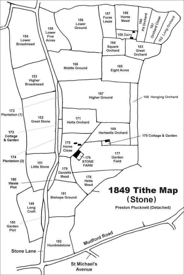
The Stone area reproduced from the 1849 Tithe Map. Hett's Orchard is just north of Stone farm House.
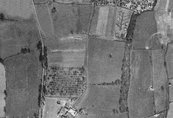
The 1946 aerial photograph showing Hett's Orchard as the orchard field to the north of Stone Farm House and still retaining its apple trees at this time.
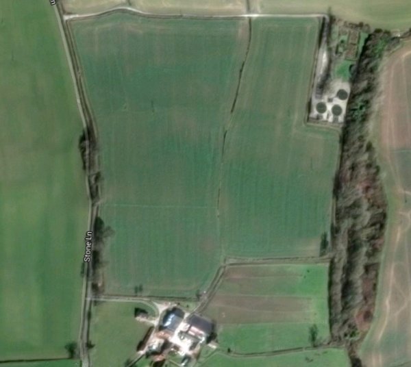
The modern aerial view showing Stone Farm at centre bottom and what had been Hett's Orchard immediately above it, with the ghost of the former boundary just visible as a faded line.
Gallery
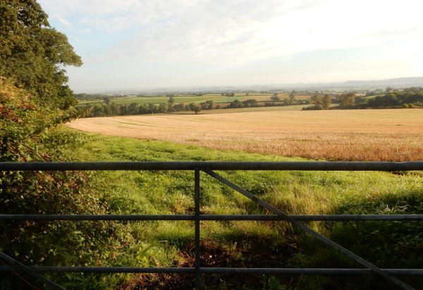
The former Hett's Orchard the other side of the gate, now part of a single large field. Photographed in 2015.