Higher Marle Close
Higher Marle Close
A former part of the great West Field of Kingston Manor
Marl (from the Old French marle) was originally an old term loosely applied to a variety of materials, most of which occur as loose, earthy deposits consisting chiefly of a mixture of clay and calcium carbonate. It has been used as a soil conditioner and acid soil neutralising agent and was spread on sandy soil by the Celts before the Roman occupation. Its value was realised, and its use revived, by the 'improvers' of the seventeenth and eighteenth centuries.
On the other hand, Marl was also an ancient term used to describe human waste and remote areas of sunken ground were used as a dumping ground and designated as 'marl pits'.
Marle Close had been a very long, thin field running south from a field access track called Lower Larkhill Lane that would become today's Stiby Road. By the time of the 1846 Tithe Apportionment Marle Close had been split into two fields; Higher Marle Close (Parcel 1440) and Middle Marle Close (Parcel 1440a).
The 1846 Tithe Apportionment noted Higher Marle Close as 2a 3r 35p and used as pasture for grazing livestock. The Apportionment noted that the owner was John Moody and the tenant was John Turner (who were also the owner and occupier of Middle Marle Close).
Higher Marle Close was bounded on the north by the field access track called Lower Larkhill Lane, on the west by Guppy's Mead (Parcel 1441), to the south by Middle Marle Close and to the east by Parcroft Orchard (Parcel 1438).
Today the former Higher Marle Close, Middle Marle Close and the Brickyard (Parcel 1457) are occupied by the houses and gardens of Westfield Road as it joins Stiby Road and Preston Road.
For details on historic land measurement (ie acres, roods and perches) click here.
maps & Aerial Photographs

This map, based on the descriptions in the 1589 Terrier and the 1846 Tithe Map of Yeovil shows the approximate boundaries of the Manors of Kingston and Hendford as well as the manorial three-field system used in Kingston.
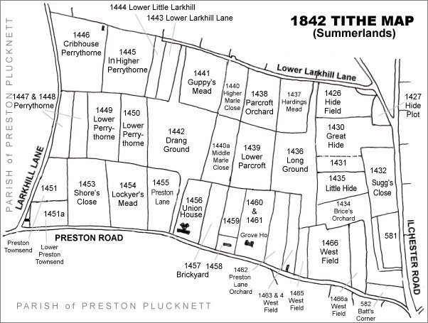
The Larkhill area reproduced from the 1842 Tithe Map. Higher Marle Close is at centre top.
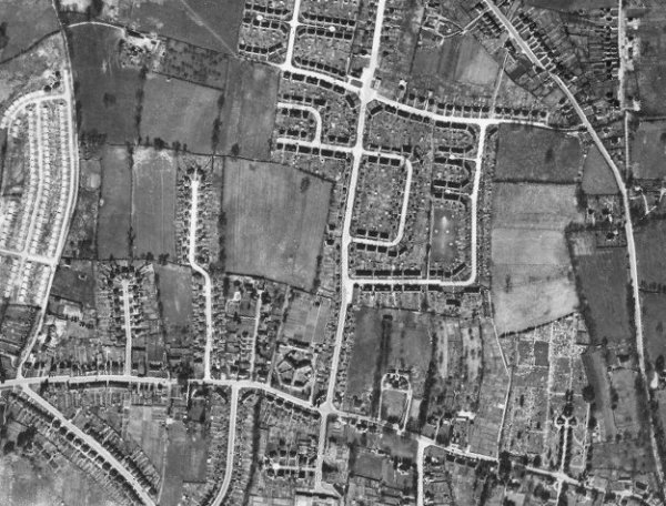
The 1946 aerial photograph - Westfield Road running from its junction with Stiby Road at top centre to join Preston Road at bottom, was built on the former Higher Marle Close, Middle Marle Close and Brickyard.
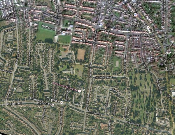
The same area today 'borrowed' from Google maps.
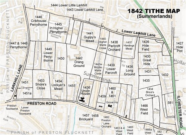
The 1842 Tithe Map superimposed (only very slightly out at the bottom) over a modern map.