hooper's lower field
hooper's Lower Field
Now occupied by Windermere Close
Hooper's Lower Field was a long field bounded by West Coker Road to the north, Turners Barn Lane to the south, Hoopers Higher Field (Parcel 726) to the west and Corner Close (Parcel 728) to the east.
The
1846 Tithe
Apportionment
described
Hooper's Lower
Field (Parcel
727) as
arable and
measuring 6a 0r
0p. It noted
that draper and
grocer
John Glyde
was the owner
and it was
occupied by
Lionel Harrison,
a sailcloth
weaver of East
Coker.
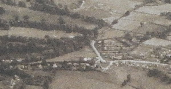
As seen in the aerial photograph of 1946 below, at this time just a couple of houses facing West Coker Road had been built on the northern edge of the field, the remainder of which appears to have been under cultivation.
Today the former
Hooper's Lower
Field has
Windermere Close
occupying its
northern half, a
grassed area and
allotments in
the southern
half, with
housing off
Turners Barn
Lane at its
southern end.
MAPs & Aerial Photographs
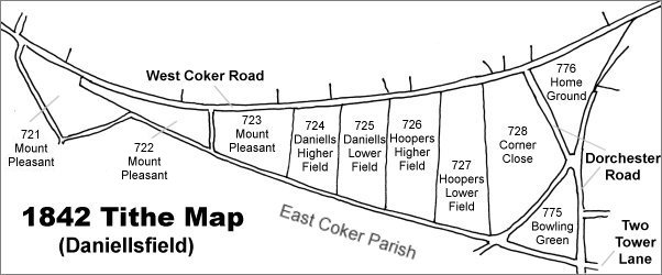
Map based on the 1842 Tithe Map with field names added from the 1846 Tithe Award. Hooper's Lower Field is right of centre.
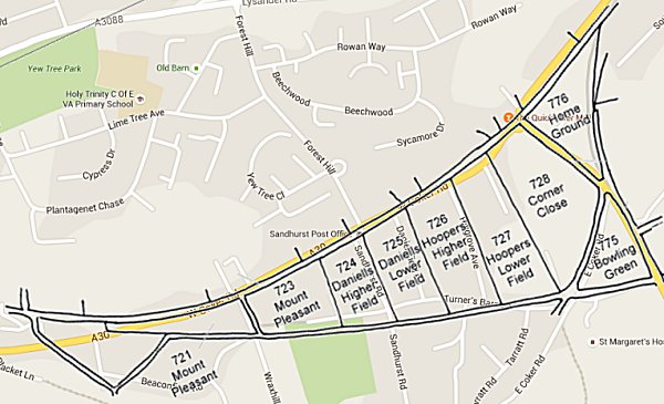
The 1842 Tithe Map superimposed over a modern map of the area. Although the field boundaries do not align precisely, remember that the 1849 survey was undertaken by hand using primitive surveying equipment.
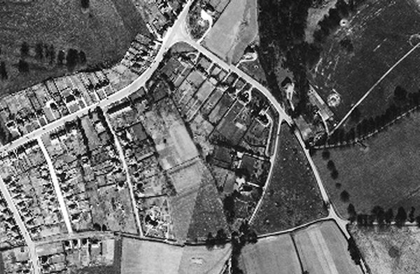
The 1946 aerial photograph with West Coker Road running from centre left to centre top and Dorchester Road running from top centre down to bottom right of centre. Hooper's Lower Field is the field left of centre that has not been built on at this time.
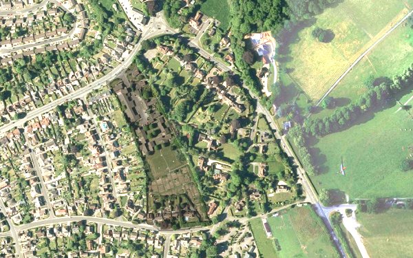
The modern satellite image shows the former Hooper's Lower Field with Windermere Close occupying its northern half, a grassed area and allotments in the southern half, with housing off Turners Barn Lane at its southern end. The rest of the image has been lightened to make Hooper's Lower Field stand out.
This is an aerial photograph taken in 1941 and looking south. West Coker Road runs across the width of the lower part of the photograph and Dorchester Road is seen at right of centre running up and across towards top right. Hooper's Lower Field is seen at right, divided in two with a very light-coloured section and a darker section closer to West Coker Road.