long Orchard
long Orchard
Of Stone Farm, a detached part of Preston Plucknett
In his
'Agricultural
Survey of
Somerset' of
1797, John
Billingsley
refers to the
large number of
orchards for
which the land
is "peculiarly
adapted". The
large acreage
devoted to this
purpose in the
Yeovil area
reflects the
county's
reputation for
cider making.
The low wages
being paid at
that time to
agricultural
workers were
augmented by an
allowance of
cider; a
labourer
received one
shilling a day
in winter 'with
cider' and one
shilling and
fourpence with
cider in summer.
The latter
amount was also
paid for mowing
grass per acre
and one gallon
of cider, while
reaping wheat
was paid for
with four
shillings per
acre and 2½
Long Orchard was a long narrow orchard, one of several in the northeast corner of Stone Farm.
This area is actually a detached part of the parish of Preston Plucknett, known as Preston in Stone, and the Preston Plucknett Tithe Map of 1849 shows Long Orchard as Parcel 162. It was bounded on the west by Orchard Close (Parcel 161), on the south by Great Orchard (Parcel 163), on the east and to the north by a small brook marking the parish boundary, the other side of which are fields in the parish of Mudford.
The Preston Plucknett Tithe Apportionment of 1848 notes that Long Orchard was in the ownership of Henry Goodford Esq. of Chilton Cantello and occupied by Mrs Phillis Coles, as indeed was the whole of Stone Farm at this time. The Tithe Apportionment reckoned the area of Long Orchard to be 3a 0r 14p.
Other known owners / occupiers had been James Harris (1800), Mr Pester (1810), Mr Spear (1818), Stephen Coles (c1821-1827). Phillis Coles, in her later years assisted by her sons, ran Stone Farm after the death of her husband Stephen until her own death in 1877. Her son Edmund ran the farm after her death until his death in 1885. By 1886 a Mr Russell was farming Stone Farm but his widow sold up and retired in February 1900. In 1901 the tenant farmer was John Sawtell.
At some time before 1946 Long Orchard was merged with Orchard Close (Parcel 161) to form the field shown in the aerial photograph below. More recently this new field was merged with all the other fields in this northeast corner of Stone Farm to form the very large present-day field shown in the recent aerial photograph below.
Today all the orchard trees in the northwest corner of Stone Farm have gone.
maps and aerial photographs
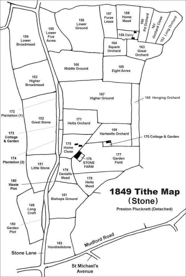
The Stone area reproduced from the 1849 Tithe Map. Long Orchard is in the top right corner.
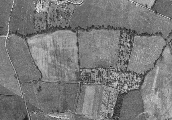
The 1946 aerial photograph showing Pit Orchard, still containing its apple trees, in the top right quadrant of the photograph with the combined field comprising the former Long Orchard and Orchard Close in the top right corner. The dark wavy band running across the top third of the photograph and then running down the right side of the photo is a tree and bush-lined brook that forms the parish boundary between Preston in Stone and Mudford to the north and east.
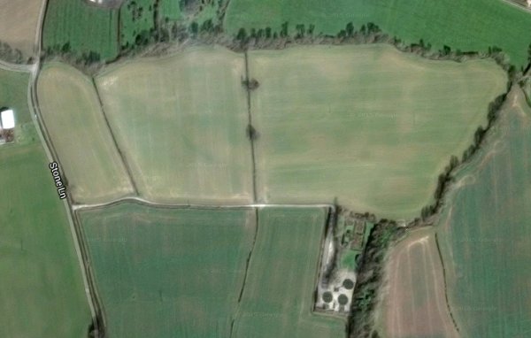
The modern aerial view showing the large field at top right formed by the merging of Furze Leaze, Home Mead, Dairy House Plot, Pit Orchard, Orchard Close, Long Orchard, Square Orchard and Great Orchard. At left the boundary hedge between Lower Five Acres and Lower Ground has been removed very recently to form a similarly large field.
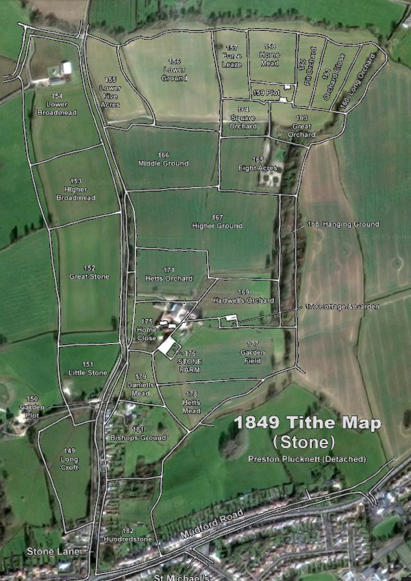
The 1849 Tithe Map superimposed over the current Google Earth image. Although the field boundaries do not align precisely, remember that the 1849 survey was undertaken by hand using primitive surveying equipment. The location of the former Long Orchard is the top right corner.
Gallery
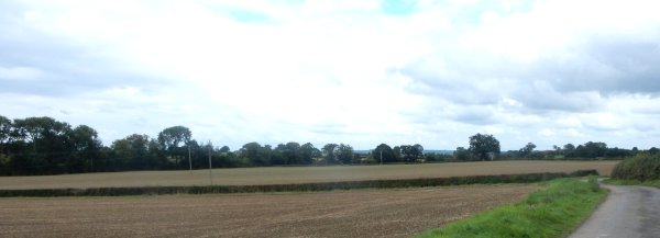
Between the hedge and the tree line, both running the full width of this photograph, is the large modern field comprising the former Furze Leaze, Home Mead, Dairy House Plot, Pit Orchard, Orchard Close, Long Orchard, Square Orchard and Great Orchard. Photographed in 2015.