Lynchets
Lynchets
A reminder of medieval farming practices on the slopes of Summerhouse Hill
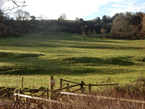
During the Middle Ages farming was one of the most important livelihoods in the market town of Yeovil and its immediate neighbourhood. Traces of medieval farming practices still exist today in the form of lynchets (from the Old English hlinc meaning 'ridges, terraces of sloping ground') on the lower slopes of Summerhouse Hill - showing as a series or flight of stepped terraces, visible on the now grassy hill-side.
A lynchet, also known as a strip lynchet, is a bank of earth that builds up on the downslope of a field ploughed over a long period of time where the disturbed soil slips down the hillside to create a lynchet. As such lynchets represent the legacy of ploughing, although not necessarily consciously created as a feature in themselves, though some initial construction may have been required on the steepest ground, the lynchets are the result of the repeated action of the plough's mould-board turning the loosened soil outwards and downwards; over time forming a level strip or tread for cultivation with a scarp slope (a 'riser') down to the next strip below. Reflecting the practical nature of their creation, they follow the contour lines of the natural slope.
Some believe that these were artificial terraces intentionally created so the steep-sided slopes could be ploughed and were formed to prevent erosion and slippage of the ploughed slope. However others believe they may have been passively formed under the long-term action of gravity and weathering (soil creep) on the loosened soil of a ploughed slope.
Whichever is the case, the northern flanks of Summerhouse Hill still retain these reminders of a medieval farming past, as seen in the photograph below.
The remains of lynchets were to be found on Forest Hill (see Gallery) before the area was covered in housing.
gallery
This photograph
features in my
book 'Secret Yeovil'.
The legacy of medieval farming practices - the remains of lynchets on the side of Summerhouse Hill. Photographed in 2016.
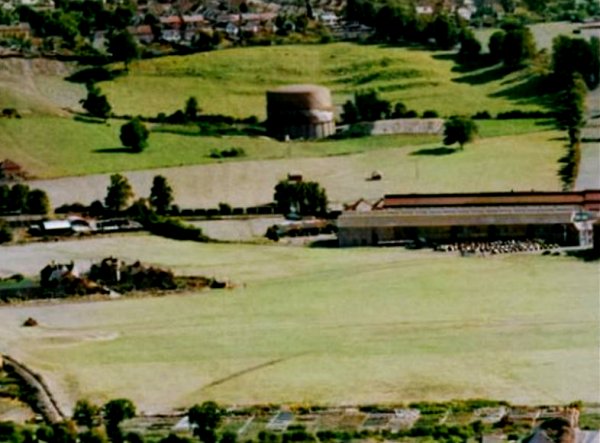
Lynchets on Forest Hill behind the Lysander Road gas holder (before Lysander Road was even thought of) in a photograph of 1953. Westland airfield covers the lower half of the photograph with the start of the factory buildings at centre right.