Middle Ground
Middle Ground
Of Stone Farm, a detached part of Preston Plucknett
Middle Ground was a large rectangular field off Stone Lane in the northern part of Stone Farm.
This area is actually a detached part of the parish of Preston Plucknett, known as Preston in Stone, and the Preston Plucknett Tithe Map of 1849 shows Middle Ground as Parcel 166. It was bounded on the south by Higher Ground (Parcel 167), to the west by Stone Lane, on the north by Lower Five Acres (Parcel 155) and Lower Ground (Parcel 156) and on the east by Eight Acres (Parcel 165).
The Preston Plucknett Tithe Apportionment of 1848 notes that Middle Ground was in the ownership of Henry Goodford Esq. of Chilton Cantello and occupied by Mrs Phillis Coles, as indeed was the whole of Stone Farm at this time. The Tithe Apportionment reckoned the area of Middle Ground to be 8a 3r 15p.
Other known owners / occupiers had been James Harris (1800), Mr Pester (1810), Mr Spear (1818), Stephen Coles (c1821-1827). Phillis Coles, in her later years assisted by her sons, ran Stone Farm after the death of her husband Stephen until her own death in 1877. Her son Edmund ran the farm after her death until his death in 1885. By 1886 a Mr Russell was farming Stone Farm but his widow sold up and retired in February 1900. In 1901 the tenant farmer was John Sawtell.
As seen in the aerial photograph of 1946, shown below, Middle Ground appeared to be pasture.
Today Middle Ground has been combined with Higher Ground and Eight Acres to form a single large arable unit although remnants of the boundary hedge between Eight Acres and Middle Ground still remain as seen in the photograph below.
maps and aerial photographs
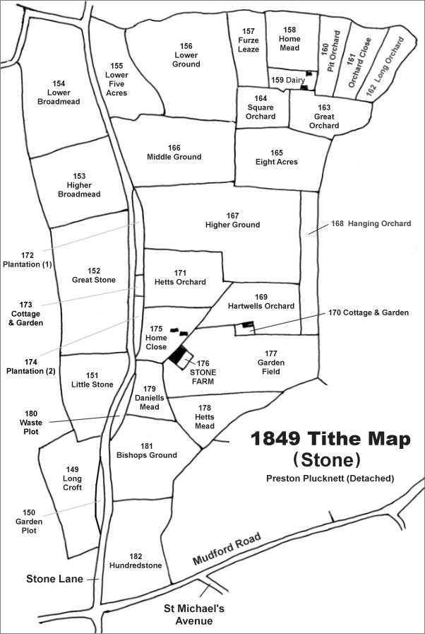
The Stone area reproduced from the 1849 Tithe Map. Middle Ground is towards the top, left of centre.
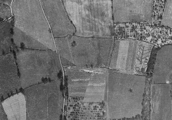
The 1946 aerial photograph showing Middle Ground at centre.
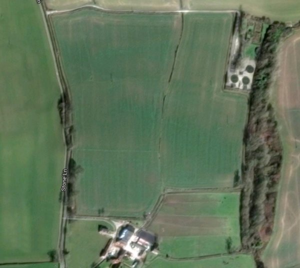
The modern aerial view showing the large field formed by merging Middle Ground, Eight Acres, Higher Ground and Hetts Orchard. Remnants of the boundary hedge between Middle Ground and Eight Acres are visible.
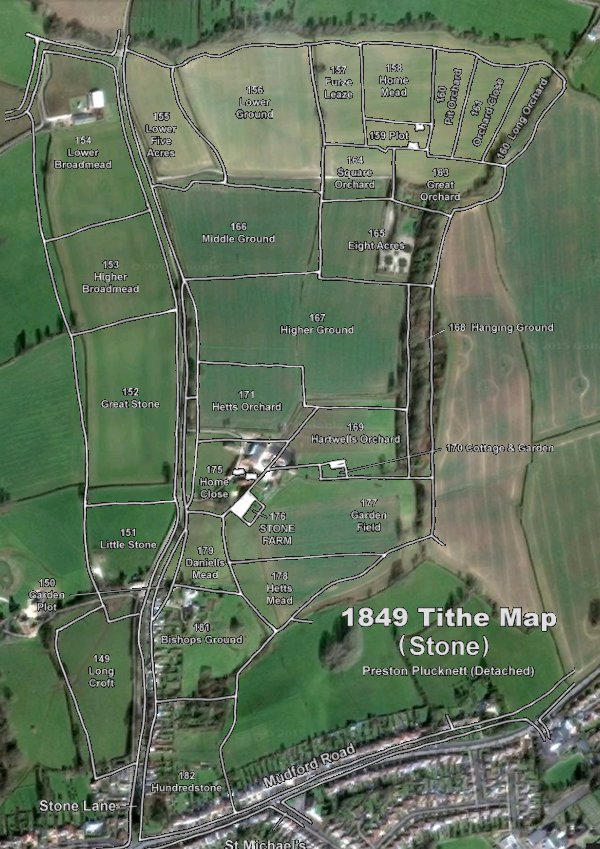
The 1849 Tithe Map superimposed over the current Google Earth image. Although the field boundaries do not align precisely, remember that the 1849 survey was undertaken by hand using primitive surveying equipment. Middle Ground is towards the top, left of centre.
Gallery
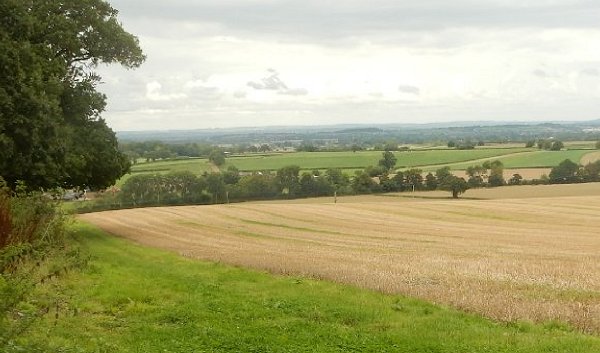
This photograph looks northeast across the modern large open field (much of which in the foreground is the former Higher Ground) with the former Middle Ground at centre. At centre right is seen the remnants of a hedge with a single tree - the former Middle Ground lay to the left and Eight Acres lay to the right of this hedge. Photographed in 2015.