penn house
penn house
The home of town developer, Peter Daniell
Penn House is a fine late 18th Century town house set in its own extensive grounds and built high on the hill behind South Street. When it was built it was the only building on the hill although the name of the builder is unknown.
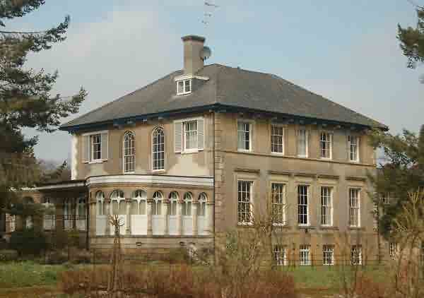
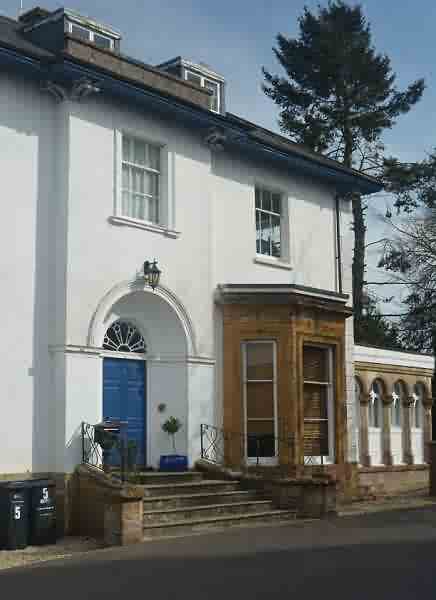
Penn House is rendered with stone dressings under a hipped slate roof with a wide soffite supported by pairs of wood corbel brackets at intervals. Of two and a half storeys, the west entrance facade is of three bays with the centre bay projecting. A segmental sweep of five steps (with modern wrought iron railings) leads to pair of doors set in a deep hollow-chamfered semi-circular arched recess with arch and impost mouldings and a cast iron radial fanlight over the door. The south garden elevation has four bays: the ground floor being obscured by a substantial stone colonnaded conservatory with flat roof, the openings have semi-circular headed arches and are part glazed. The east elevation has a plain five bay facade, with basement window in addition. To the north elevation is a modern extension.
The sale details of 1877 (see below) indicate that Penn House had an entrance hall, dining room, drawing room, morning room, library and WC on the ground floor, five bedrooms, dressing room, WC and housemaid's closet on the first floor, five bedrooms on the second floor and, in the basement, a kitchen and scullery, butler's pantry, large fire-proof muniment room, smoking room, housekeeper's room, large larder, good wine and beer cellars, WC and a coal house. In the extensive grounds were vineries, a pinery, an orchid house, and other conservatories, stabling for five horses and two double coach houses with accommodation over,
Certainly in 1806 it was owned by wealthy mercer and town developer Peter Daniell (1764-1834) after whom Peter Street is named. He was the son of wealthy glover William Daniell who had a mansion on Middle Street. In 1828 it was let to a Miss Blandy but it appears that from 1831 Peter Daniell lived there himself.
Between 1840 and 1851 Penn House was the home of owner/occupier John Slade, one of eight wealthy solicitors living in large Yeovil houses and in the 1851 census he was recorded there with his wife Mary, their eight children, a visitor and five servants.
From 1861 it was owned by Miss Elizabeth Neal, youngest daughter of John Neal Esq. until her death on 25 February 1877. In July 1877 Penn House was sold, with extensive lands, to corn and timber merchant Jabez Bradford for £5,400 (in excess of £4 million at today's value). In the 1891 census the house was occupied by 62-year old general merchant Jabez, his 39-year old wife Annie, six children, a governess, cook, housemaid, nurse and undernurse. After Bradford’s death in 1894 his wife Annie continued in residence at Penn House until her death in 1930.
From 1931 it was a boys private prep school, called St Nicolas School, run by Vernon Ball. Around 1957 the school was bought by Major Harry Greenwood, who moved it to West Coker House in 1960.
In the 1970’s it was the base of the Borough of Yeovil Parks Department, it is now divided into flats.
map
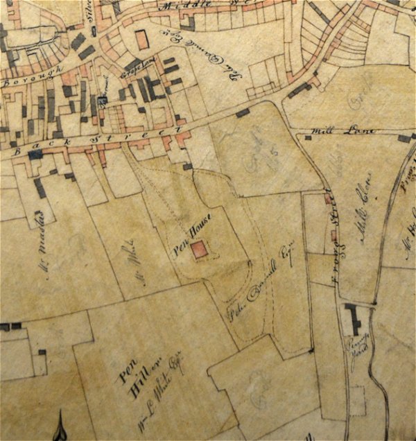
E Watts' map of 1806 clearly shows the extensive lands owned by Peter Daniell. At top centre (with his name written upside down) Peter Daniell's town centre land stretched from Middle Street down to Back Street (today's South Street) and across to where he would later build Union Street, Bond Street and Peter Street (named after himself). At top left, immediately above the bend in Grope Lane (today's Wine Street), the red rectangle was the Middle Street mansion he inherited from his father. At centre is his home, Pen House, surrounded by the extensive grounds annotated with his name.
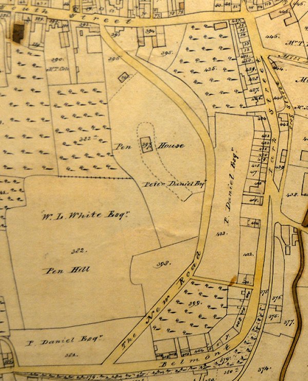
E Watts' map of 1831 showing Peter Daniell's Pen Hill estate. By this time he owned land stretching across Pen Hill from South Street to Belmont and he had built 'The New Road' (today's Pen Hill).
gallery
Courtesy of Dave
Shorey
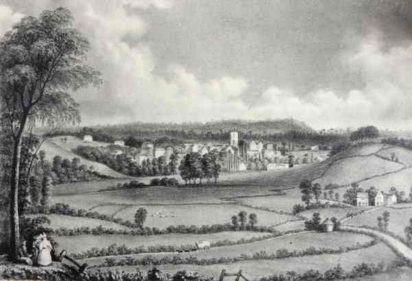
Yeovil seen from Babylon Hill in the late 18th century from a lithograph by T Jerome. Penn Hill is seen at left, surmounted by Penn House, and Wyndham Hill is seen at right with the buildings of Pen Mill at its foot.
From my
collection
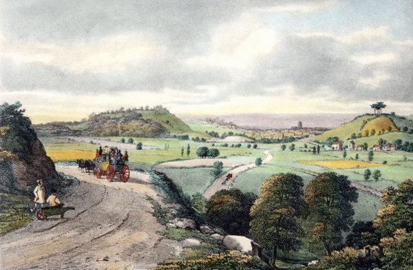
'View of Yeovil from Babylon Hill' in a stone lithograph by Henry Burn (c1807-1884) and published by William Porter and Henry Marsh Custard in 1839. With Summerhouse Hill at left, with Penn Hill behind it, surmounted by Penn House, and Wyndham Hill at right. The buildings at Pen Mill are seen at the base of the latter, with the tower of St John's church above and to the left. At centre, a coach is seen on the Sherborne Road before it was re-aligned.
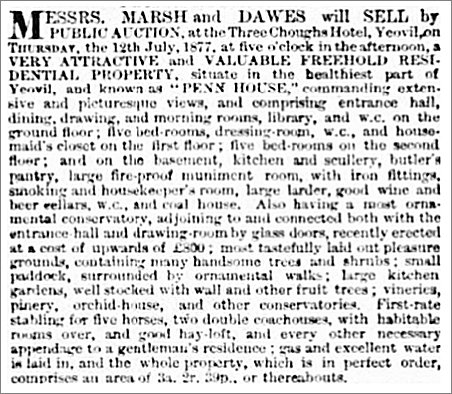
The sale details of Penn House placed in the 20 July 1877 edition of the Western Gazette. At this sale the property was bought by Jabez Bradford for the sum of £5,400 (over of £4 million at today's value).

Courtesy of
Richard David
Penn House, photographed around 1890 when Jabez Bradford was in residence. Note that, at this time, the single-storey extension had domed roofs - absent in later photographs.
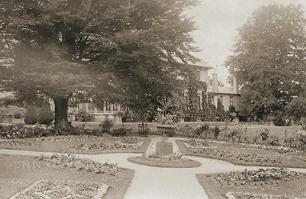
Penn House garden, photographed around 1910.
St Nicolas School, photographed in the late 1950s.
This colourised photograph
features in my
book 'Yeovil
From Old
Photographs'
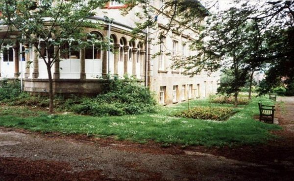
Penn House, south elevation, photographed in 1968. Note the 'ghosts' of the former domed roofs of the single-storey extension evident on the render of the main wall of the house.
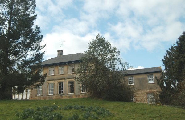
Penn House, east elevation. Photographed 2013.
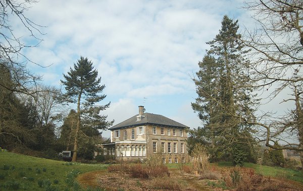
Penn House set in its still-extensive grounds. Seen from the southeast and photographed 2013.
This photograph
features in my
book "Yeovil
In 50 Buildings"
Close-up of Penn House from the southeast. Photographed 2017.
This photograph
features in my
book "Yeovil
In 50 Buildings"
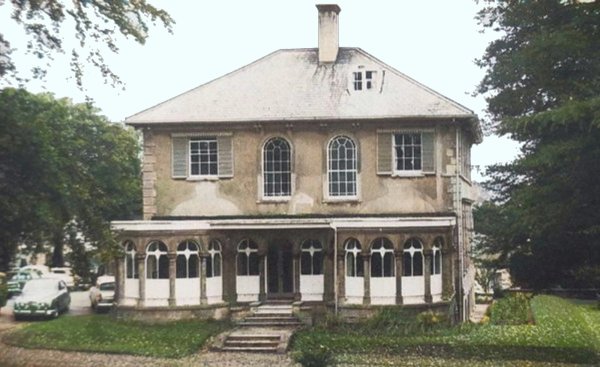
Penn House, entrance on the west elevation. Photographed 2017.
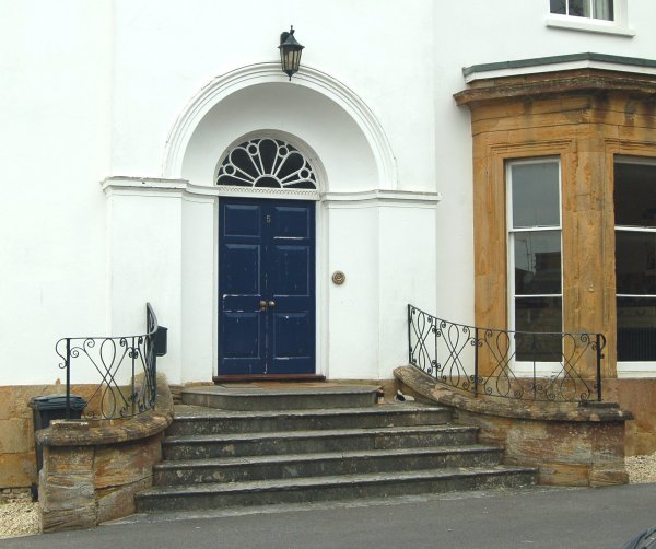
The impressive entrance. Photographed 2013.
Courtesy of
Terry Gillard
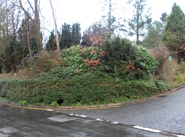
The overgrown boundary wall of Penn House seen from Pen Hill before Yeovil Country Park Rangers and volunteers had a massive tidy-up. Photographed February 2015.
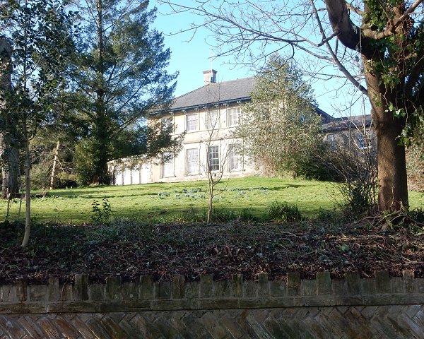
Penn House, seen for the first time in many years from the road after the shrubs and undergrowth were removed (February 2015) to reveal the beautiful stone boundary wall. Photographed in 2015.

The boundary wall running alongside Penn Hill as far as the entrance to Penn House. For many years hidden from view by excessive undergrowth. Photographed in 2015.
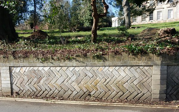
.... and a detail photograph of the stone boundary wall. Photographed in 2015.