Pitney House
Pitney House
Home of William Lambert White, later Doctor Garland
Pitney House was a large, 5-bay, two-storey house on the west side of Kingston, immediately opposite the Red Lion Hotel and Red Lion Lane, with views across the grounds of Kingston Manor House that would, after 1916, become Bide's Gardens. Although the frontage of the house was impressive, it was actually three times deeper than the width as seen on the map below. It also had impressive and extensive gardens that reached all the way to Park Road to the south.
It is not known when Pitney House was built but it does appear, without the extensions to the rear, on Watts' map of 1806. The rear extensions had been completed by 1831 and are shown on both Day's map and Watts' map of that year. Indeed Watts' map indicates that it was owned by solicitor and banker William Lambert White who used it as his home and law practice. Pitney House was attacked by the rioting mob during the 1831 Reform Riot. White died in 1845 and his widow Anne remained in the house until her death in 1852.
By the time of the census in 1861 it was occupied 39-year old Stephen Harris - a 'Master builder employing 3 men & 2 boys' - who lived there with his wife Mary Ann and their seven children.
By 1871 Pitney House was the residence (and, most likely, the practice) of Physician and Surgeon Edward Garland, his wife Elizabeth, their three children William, Charles and Ethel, together with a cook and a housemaid. By 1881 the elder son William had left home and there was another servant, a Ladies' Maid, living in. They also had a boarder, Mary Hartwell, living with them who was recorded as a lunatic. Mary was still living with them ten years later in 1891.
It was in the 1891 census that Dr Garland gave his occupation as 'Physician & Surgeon (only registered General Practitioner)' - being a dig at Dr Ptolemy Colmer who was actually Mayor of Yeovil at the time, who Garland considered to be unqualified since he had trained in Scotland!!
Pitney House was demolished between 1890 and 1901 - it was present on the Ordnance Survey of the former date but by the time of the latter a terrace of impressive three-storey villas built on the site (see second photograph below). These, in turn, were demolished in 1976 as part of the Queensway dual carriageway project.
MAP
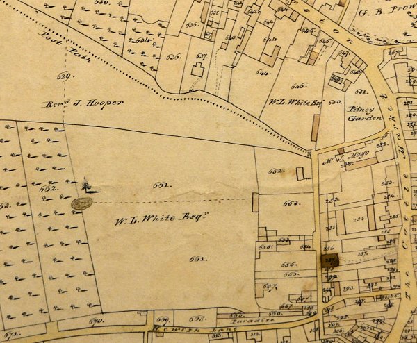
E Watts' map of Yeovil of 1831 shows Pitney House, Kingston, at top right with the name of William Lambert White in the large garden. Also the large field at lower left of centre accessed off Hewish Lane (today's Huish), annotated with his name would later become Yeovil's football ground with its famous sloping pitch. The site is now occupied by Tesco's store and much of its car park.
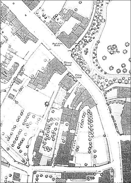
This map, based on the 1886 Ordnance Survey, shows Pitney House at upper centre, opposite the Red Lion Hotel and the grounds of Kingston Manor that would become Bide's Gardens after 1916. The extensive gardens of Pitney House stretched all the way down to Park Road, seen running across the bottom of the map.
gallery

This colourised photograph
features in my
book 'Yeovil
From Old
Photographs'
This remarkable photograph was taken in November 1861 and looks north along Kingston as seen from just outside what would become Bide's Gardens. Towards the left is Pitney Villa with its impressive set of double steps. To its right is Pitney House. The small grocer's shop at left is that of JT Foole who had recently taken the shop over from Gerard Samson.
From my
collection
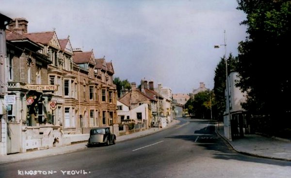
In this colourised photograph of 1956 by HA 'Jack' Cooper, Pitney Villa in its guise as the Kingston Hotel remains, but Pitney House has been replaced by a short terrace of three-storey villas.
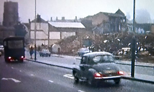
From a home movie, the buildings of the previous photograph have been demolished ready for the construction of Queensway.