Plantation
Plantation
A hillside field within the Manor of Hendford
Plantation (Parcel 810) was a large, steep-sided field, falling east to west, within the Manor of Hendford. It was bounded on the west by the Ninesprings Stream and forms the eastern bank and the hill behind of that stream for about half its lower length. Now a managed mixed woodland, it forms a part of the Yeovil Country Park.
At the time of the 1846 Tithe Apportionment, Plantation was owned and occupied by the Rev. Edward Hansford Daniell. It was, as its name would suggest, a wooded plantation as a long-term cash crop investment and measured 2a 0r 30p.
Plantation (Parcel 810) was bounded to the north by Under Newton Hill (Parcel 811) to the east by Hollow Close (Parcel 819) and to the south and west by Penny's Hill (Parcel 810).
Today, Plantation has been absorbed into the surrounding fields and appears to be scrub and semi-wooded.
For details on historic land measurement (ie acres, roods and perches) click here.
maps

This map, based on the descriptions in the 1589 Terrier and the 1846 Tithe Map of Yeovil shows the approximate boundaries of the Manors of Kingston and Hendford as well as the manorial three-field system used in Kingston.
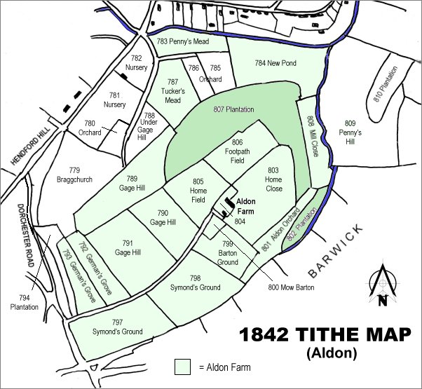
The 1842 Tithe Map showing the Aldon area and the parcels of Aldon Farm shaded light green. Plantation (Parcel 810) is at the top right.