talbot street
talbot street
Tucked away behind Summerhouse Terrace
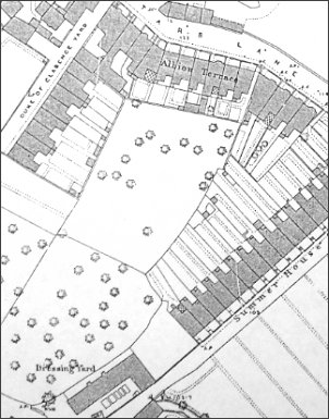 Talbot Street
was 'infill
housing' built
during the 1890s
on orchards
between
Summerhouse
Terrace and
Duke of Clarence
Yard. The
1890 Ordnance
Survey, seen at
left, shows the
area still as
orchards while
the 1901
Ordnance Survey,
below,
shows the
newly-built
Talbot Street
complete with
its single
terrace of
houses.
Talbot Street
was 'infill
housing' built
during the 1890s
on orchards
between
Summerhouse
Terrace and
Duke of Clarence
Yard. The
1890 Ordnance
Survey, seen at
left, shows the
area still as
orchards while
the 1901
Ordnance Survey,
below,
shows the
newly-built
Talbot Street
complete with
its single
terrace of
houses.
It was a short
street off
Summerhouse
Terrace with its
entrance between
the terrace of
housing in
Summerhouse
Terrace and the
dressing yard at
the bottom of
Mill Lane. After
taking a 90°
bend, it
comprised a
single run of
ten south-facing
terraced houses
facing the backs
of Summerhouse
Terrace.
Talbot Street
was demolished
around 1965 and
the site is now
the upper part
of Stars Lane
car park.
map
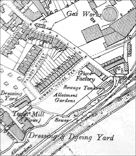
Based on the 1901 Ordnance Survey, Talbot Street is seen left of centre with its entrance off Summerhouse Terrace which, at this time, only went as far as the Town Mill. (Surprising to see Dodham Brook labelled as a 'sewer').
gallery
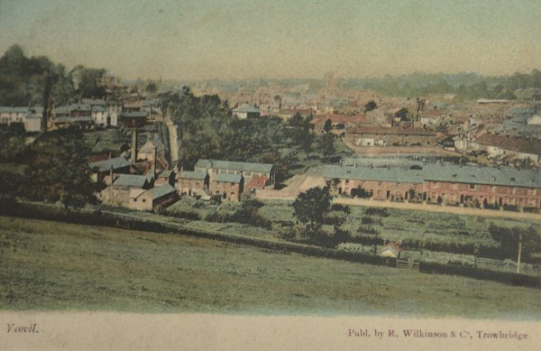
A view from Summerhouse Hill dating to about 1898. At this time Summerhouse Terrace is seen at centre right but Talbot Street has yet to be built behind it. Notice the allotments facing Summerhouse Terrace.
This
colourised
postcard
features in my
book 'Yeovil
- The Postcard
Collection'.
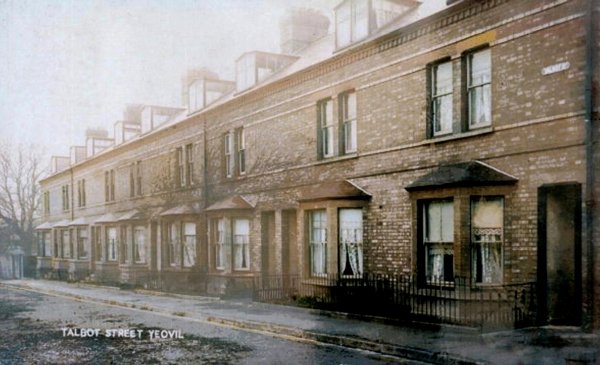
A postcard of Talbot Street, posted in 1905.

Talbot Street in a colourised photograph of around 1910.
From my
collection
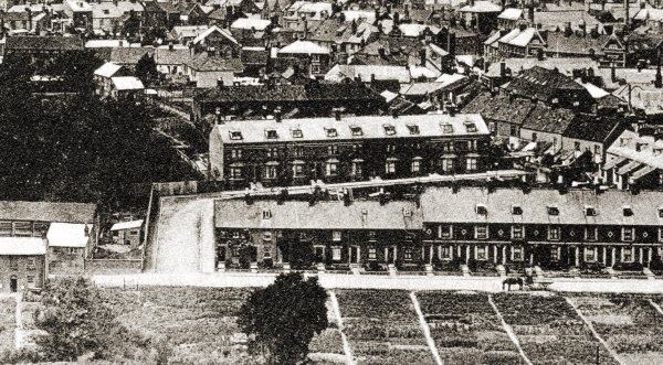
This postcard, taken from Summerhouse Hill, dates to about 1910 and shows Talbot Street at centre, behind the row of houses in Summerhouse Terrace. At the left end of this terrace is the entrance to Talbot Street. Notice that the pair of large semi-detached houses at the entrance to Talbot Street have yet to be built and the orchard belonging to glove manufacturer Thomas Fooks still occupies the top left quadrant of the image.
From my
collection
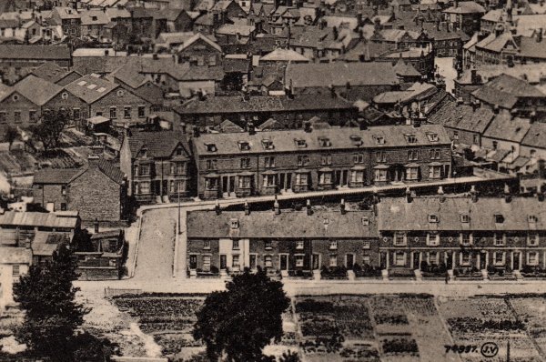
This is an enlargement of a postcard, sent in 1922, with the large, semi-detached houses in Talbot Street now at centre left.
Courtesy of Bill and Audrey Robertson
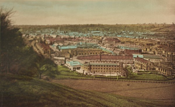
Another hand-coloured postcard view from Summerhouse Hill but dating to about 1910 and the large glove factory in the middle ground has been built on the site of the old allotments.
A similar, but closer, view of Talbot Street running across the centre of this 1930s postcard.
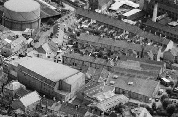
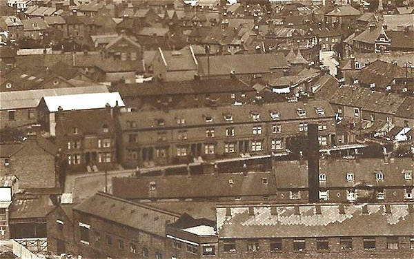
.... and seen from a different angle in 1953. At top left is the gas holder adjacent to Stars Lane and at bottom left is the Gaumont Cinema. Duke of Clarence Yard is at the centre of the picture above and right of the Gaumont. Further up are the backs of the houses in Talbot Street and further still the backs of the houses in Summerhouse Terrace.

A colourised
photograph of
the houses in Talbot
Street, decorated
for the Queen's
coronation in
1953.
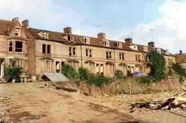
A colourised photograph of Talbot Street, empty and awaiting demolition in the early 1960's.