Thomas' Cross
Thomas' Cross
A lane-width field
In the seventeenth century the field known as Thomas' Cross, or St Thomas' Cross, was referred to in the 1633 Survey of Kingston "John Perry holds.... a close adjoining St Thomas Crosse". It was later also known as Ford's Close and a Declaration dated 1700 refers to a "close of arable ground called Ford's Close, 4 acres, or Thomas Cross, adjoining John Taylor's land on south and Richard Roach's land on north".
A 1706 Deed noted "1 acre close St Thomas Cross on north side of highway to Pen Mill".
In his will of 1719, John Saunders the Elder referred to his Close called Thomas Cross.
A Deed dated 1787 referred to "One close of pasture called Gore Napp otherwise St Thomas Cross".
In his will of 1828 William Row stated ".... my Close of Pasture or Orchard called Saint Thomass Cross containing five acres and a half purchased of [space] Wright....". The 1846 Tithe Apportionment noted that Thomas' Cross was owned by Thomas Binford and occupied by John Pitcher (the son of William Row). By this time however Thomas' Cross only measured 1a 0r 28p and it was used as arable for growing crops.
Thomas' Cross was bounded on the north by Shen's Lower Ryalls (994 - noted above as owned by Richard Roach in 1700), by Turnpike Orchard (987 and 988) to the east, London Road (today's Sherborne Road) to the south and Sunhouse Orchard (523) on the west.
Thomas' Cross was clearly still a field in 1912 as shown by the map below, but today the former field called Thomas' Cross has been built on and now contains the houses and road called St Thomas Cross.
For details on historic land measurement (ie acres, roods and perches) click here.
maps

This map, based on the descriptions in the 1589 Terrier and the 1846 Tithe Map of Yeovil shows the approximate boundaries of the Manors of Kingston and Hendford as well as the manorial three-field system used in Kingston.
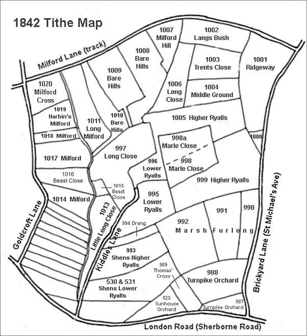
This map is based on the 1842 Tithe Map with field names added from the 1846 Tithe Award.
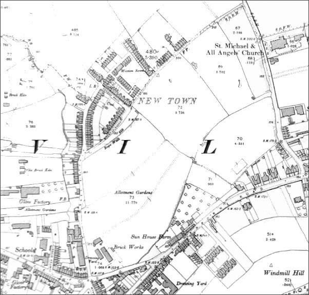
The 1912 Ordnance Survey showing the fledgling New Town surrounded by fields.
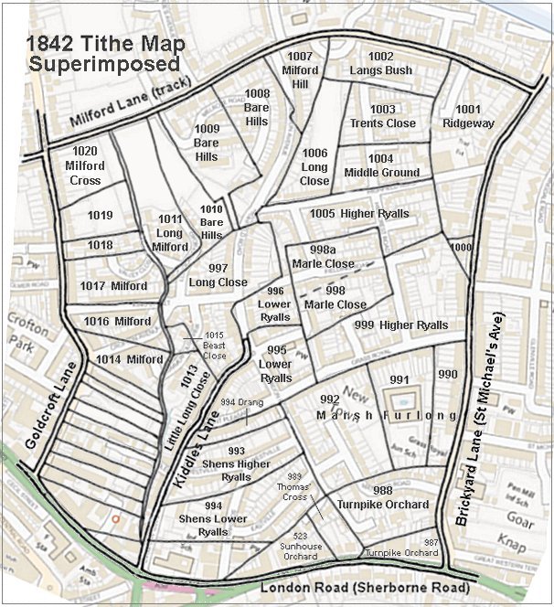
The 1842 Tithe Map superimposed (roughly) over a modern street map showing where several modern roads, for example Gordon Road, Grass Royal and Highfield Road, follow former field boundaries.