waste Plot
Waste Plot
Of Stone Farm, a detached part of Preston Plucknett
Waste Plot was, as the name suggests, a small plot of waste ground adjoining Stone Lane and lying southwest of Stone Farm House.
This area is actually a detached part of the parish of Preston Plucknett, known as Preston in Stone, and the Preston Plucknett Tithe Map of 1849 shows Waste Plot as Parcel 180. It was bounded on the west by Stone Lane and to the east by Daniells Mead (Parcel 179) and Bishops Ground (Parcel 181).
The Preston Plucknett Tithe Apportionment of 1848 notes that Waste Plot was in the ownership of Henry Goodford Esq. of Chilton Cantello and occupied by Mrs Phillis Coles, as indeed was the whole of Stone Farm at this time. The Tithe Apportionment calculated the area of Waste Plot to be 0a 1r 27p and described it as "Inclosed from the Waste"..
Other known owners / occupiers had been James Harris (1800), Mr Pester (1810), Mr Spear (1818), Stephen Coles (c1821-1827). Phillis Coles, in her later years assisted by her sons, ran Stone Farm after the death of her husband Stephen until her own death in 1877. Her son Edmund ran the farm after her death until his death in 1885. By 1886 a Mr Russell was farming Stone Farm but his widow sold up and retired in February 1900. In 1901 the tenant farmer was John Sawtell.
As seen in the aerial photograph of 1946, shown below, remnants of Waste Plot survived although the southern end had been absorbed into the residential housing. Today the remainder of Waste Plot has been merged with Daniells Mead.
map and aerial photographs
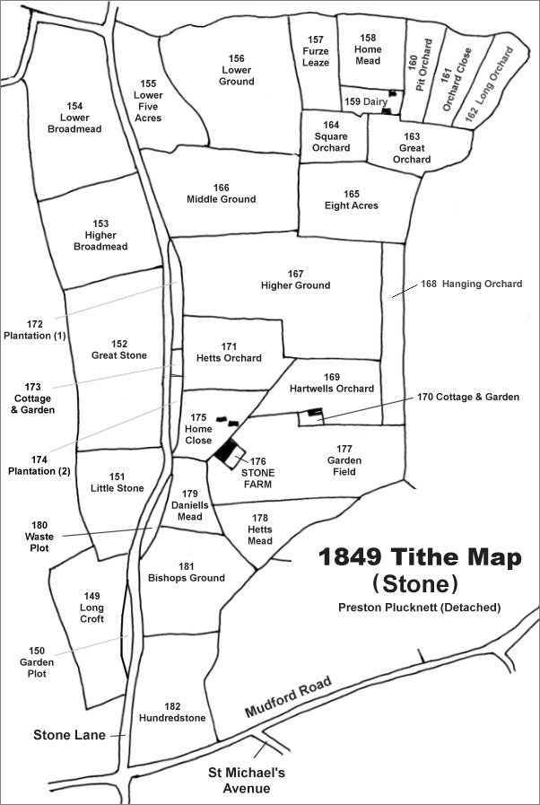
The Stone area reproduced from the 1849 Tithe Map. Waste Plot is southwest of Stone Farm House.
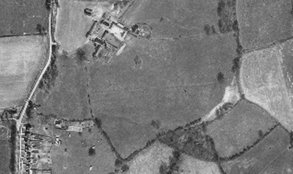
The 1946 aerial photograph showing Daniells Mead at centre left. It appears that the remnants of Waste Plot, at left, were still evident.
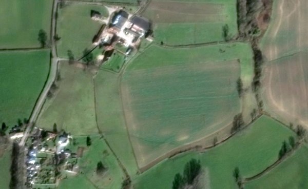
The modern aerial view showing Daniells Mead at centre left. By this time Waste Plot had been absorbed into Daniells Mead and just a hedgerow with a couple of trees forming the boundary against Stone Lane.