Weir Mead
Weir Mead
Once part of the great medieval East Field of Kingston Manor
Weir Mead was a long narrow field bordering the River Yeo that had originally formed part of the great medieval East Field of Kingston Manor. The name derives from the fact that it lay close to a weir near Compton Mill. The word 'mead' comes from the Old English 'maed'. Before grass seeds were obtainable this was the only hay land of the community. It usually consisted of land near streams since that was the only kind of land on which hay grew in any quantity.
Although Weir Mead is shown on the 1842 Tithe Map as Parcel 885, the 1846 Tithe Apportionment makes no reference to it at all. It is known from other sources, however, that it was used as meadow and measured 8a 1r 30p.
Weir Mead (Parcel 885) was bounded on the southeast by the River Yeo, on the northwest by Long Close (Parcel 883) and on the north by Against the River (Parcel 887).
Today Weir Mead is chiefly wooded and forms part of Yeovil's Riverside Walk in Yeovil Country Park.
For details on historic land measurement (ie acres, roods and perches) click here.
maps & Aerial photographs

This map, based on the descriptions in the 1589 Terrier and the 1846 Tithe Map of Yeovil shows the approximate boundaries of the Manors of Kingston and Hendford as well as the manorial three-field system used in Kingston.

A map of the great medieval East Field of Kingston Manor showing conjectured locations of several fields based on descriptions in the 1589 Terrier.
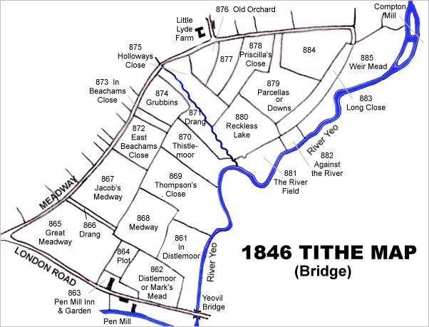
This map is based on the 1842 Tithe Map with field names chiefly added from the 1846 Tithe Apportionment.
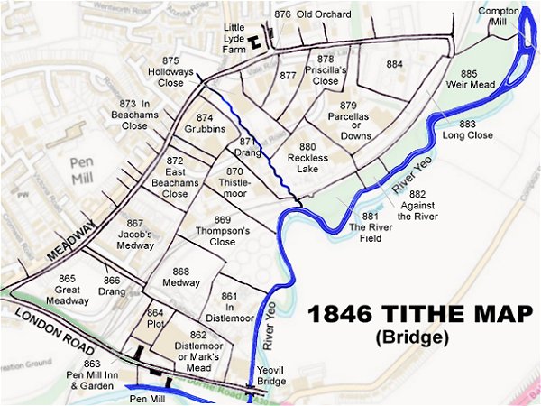
The 1842 Tithe Map superimposed (roughly) over a modern street map. Bearing in mind the relatively primitive surveying equipment of the 1840s they weren't all that far out.
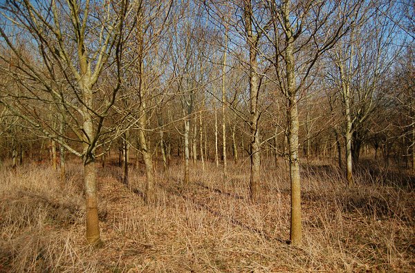
Today much of Weir Mead is covered with relatively recently planted young woods. Photographed in 2010.