wellington street
wellington street
Named for the Duke of Wellington
Wellington
Street was named
after the Duke
of Wellington
(1769-1852),
hero of the 1815
Battle of
Waterloo and
Prime Minister
of England
between 1828 and
1830. Wellington
Street probably
dates from the
time of
Wellington's
premiership as
it was not shown
on Watt's map of
1806 but it was
built on a field
called
Waterloo
Gardens, named
as such after
the 1815 battle
had taken place.
Wellington Street was certainly laid out and much built on by the time of the 1841 census by which time 31 families were recorded living there. Within these families 21 people were involved in the gloving industry - two of these were aged under 11, four under 16 and 11 were women. By 1851, 38 families were working for glove manufacturers including 11 under 16 and 14 women.
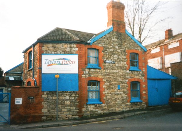
The street connected Huish with West Hendford and was almost entirely terraced housing although there were two pubs, the Wellington Inn which operated from at least 1859 until the 1960's and the Rose Inn that flowered briefly for a few years in the 1860's. In its eastern side a narrow alleyway led to Picketty Row and on the southwest corner with West Hendford was the former 19th century candle factory, later Taylor's paint store (see below).
Wellington Street was completely demolished around 1968 to make way for the new Wellington Flats housing development.
The final two photographs in the gallery below were taken around 1968 when Wellington Street was being demolished to make way for the Wellington Flats. The first photograph of the two was taken from Hendford Grove with West Hendford running across the photograph and Wellington Street, on the opposite side of West Hendford, from the buildings at left to the demolition works towards top right. The buildings at left were Taylor's paint store and had been a 19th century candle factory. The white building to the right of the telegraph pole at centre is the Wellington Inn being demolished.
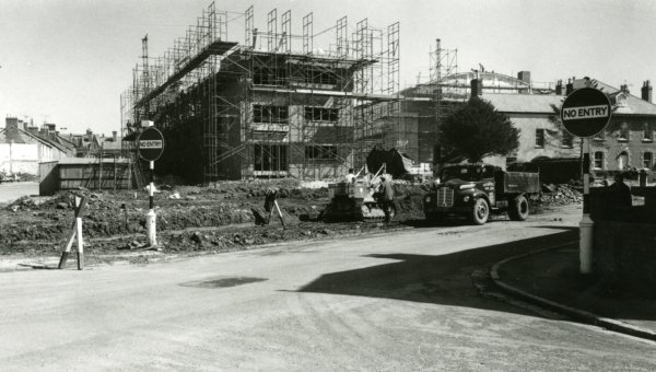
The final
photograph looks
along Wellington
Street and shows
the Wellington
Inn being
demolished at
left. Like a
phoenix rising
from the ashes
of Wellington
Street, the new
Wellington Flats
take shape at
right. At the
far end of the
road is Huish
County Infants
School, now part
of Tesco's.
map
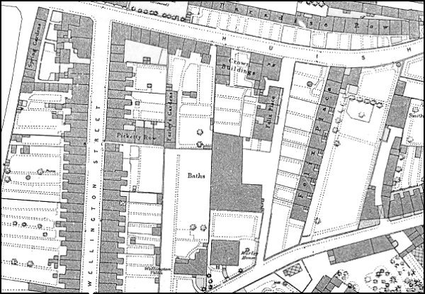
1886 Ordnance Survey showing Wellington Street at left.
gallery
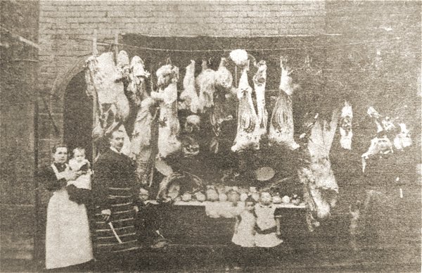
This photograph dates to December 1894 and shows Joe Rousell and his wife Jane with their young family and a butcher's assistant outside their home and butcher's shop premises near the end of Wellington Street.
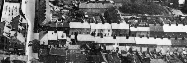
This aerial photograph dates to 1935 and shows much of Wellington Street running across the picture from its junction with Huish at left. At far left is the National School.

This
colourised photograph
features in my
book "Lost Yeovil"
Wellington Street, seen from Huish in the mid-1960s.
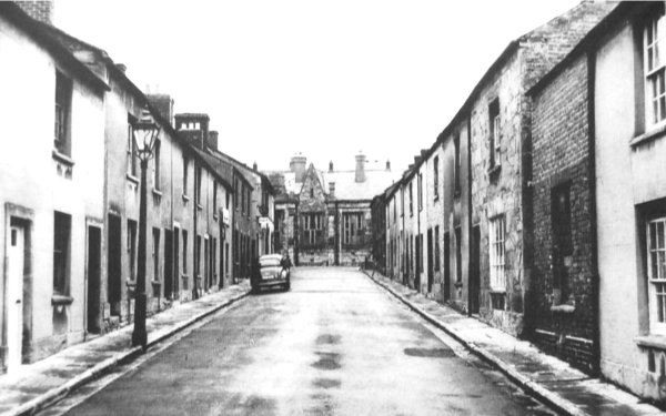
The top end of Wellington Street with the National Day School in Huish at the end. Photographed in 1957.
From the
Cave
Collection
(colourised),
Courtesy of South Somerset Heritage Collection
This photograph was taken around 1968 when Wellington Street was being demolished to make way for the Wellington Flats. The photograph was taken from Hendford Grove with West Hendford running across the photograph and Wellington Street, on the opposite side of West Hendford from the buildings at left to the demolition works towards top right. The buildings at left were Taylor's paint store and had been a 19th century candle factory, seen at the very bottom of the map above. The white building to the right of the telegraph pole at centre is the Wellington Inn being demolished.
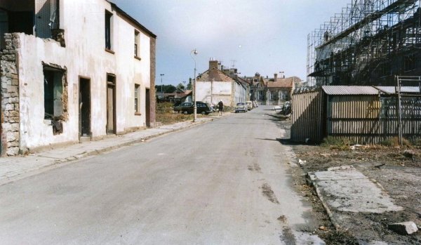
From the
Cave
Collection
(colourised),
Courtesy of South Somerset Heritage Collection
Wellington Inn being demolished at left together with the rest of Wellington Street in 1968. At right are Wellington flats.
From the Cave
Collection,
Courtesy of South Somerset Heritage Collection
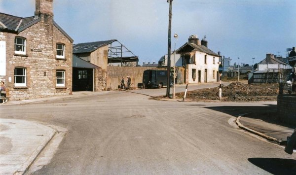
The construction of Wellington Flats, seen from the junction of West Hendford and Hendford Grove in the 1960s.
Courtesy of
Vivien and John
Cornelius.
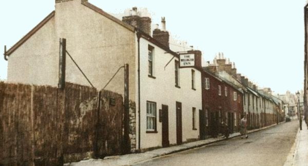
The last remaining building from the original Wellington Street. Photographed in 1998 at which time it was the premises of Taylor's Paints, who had taken over what had originally been the old candle factory at the junction of Salthouse Lane and Wellington Street with West Hendford.
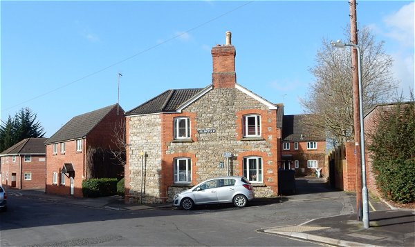
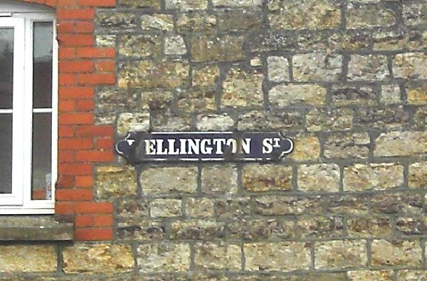
The vestiges of Wellington Street, including the old enameled street nameplate (see below), photographed in 2015.
Photographed in 2014.
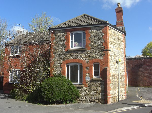
The same building photographed from West Hendford in 2014.