Babylon Hill
Babylon Hill
The approach to Yeovil from the east
Babylon Hill (actually in Dorset) and its associated north-south ridge, forms Yeovil's immediate skyline as you leave the town heading east towards Sherborne along the A30. Alternatively, if you are travelling from the east, Babylon Hill gives you your first glimpse of Yeovil.
The hill was the site of a minor skirmish, the Battle of Babylon Hill, during the English Civil War, which resulted in the Earl of Bedford's Parliamentarian forces driving back Sir Ralph Hopton's troops to Sherborne.
As demonstrated by the 1811 map shown below, the old London Road (today's A30) took a completely different route across Babylon Hill. From Yeovil Bridge the road ran along what is today's Compton Road as far as the bend in the road by the houses before continuing east-southeast across today's fields. This direct assault on the hillside meant that the gradient was steep and at the top of the hill was an 'S'-curve.
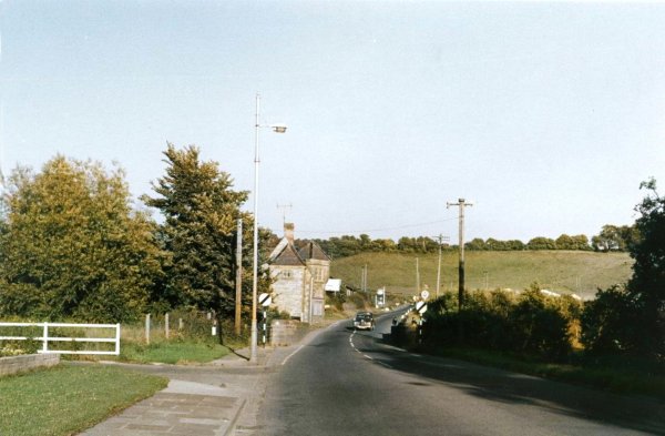
The steep climb up Babylon Hill on the turnpike road led the Turnpike Trustees to reroute the road based on a plan produced by Mr Percy in 1825. The work was carried out under the direction of Mr McAdam in 1827-8. The new line of the road (at this time still single-carriageway) swept around the northwest-facing slopes of the hill to take advantage of the hill's contours to lessen the gradient and at the same time eliminating the dangerous 'S'-bend. The lower edge of the 'S' survives and now forms the parking lay-by still used today - as the road descends, the parking lay-by is on the left.
During the 1960s the A30 road was made into a dual carriageway, as seen in the Gallery below, using the new alignment.
In 1977 part of Babylon Hill was designated as a 2.2 hectare (5.4 acres) geological Site of Special Scientific Interest.
Maps & Aerial photographs
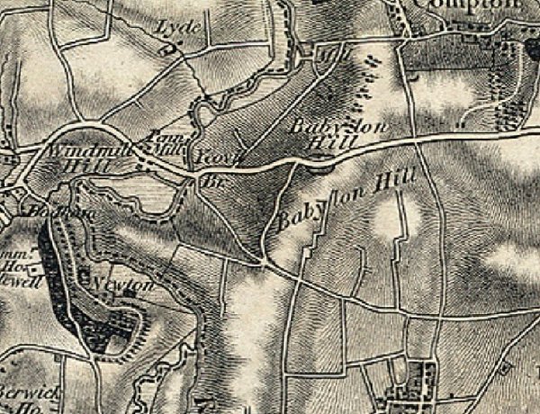
The 1811 topographical Ordnance Survey map of Babylon Hill and the eastern approaches to Yeovil. At this time the London Road (today's A30) took a completely different route across Babylon Hill, highlighted below. From Yeovil Bridge the road ran along what is today's Compton Road as far as the bend in the road by the houses before continuing east-southeast across today's fields. This direct assault on the hillside meant that the gradient was steep and at the top of the hill was a dangerous 'S'-curve.
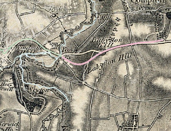
This overlay of the modern Ordnance Survey over that of 1811 shows the line of today's A30 in pink, highlighting the difference in routes.
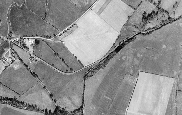
This aerial photograph of Babylon Hill dates to 1946 and shows the re-aligned single carriageway A30 taking a gentler approach to the hill by using the contours of the hillside. The 'ghost' of the original road is discernible from the bend in the Compton Road to the 'S'-bend at top right which is enlarged below.
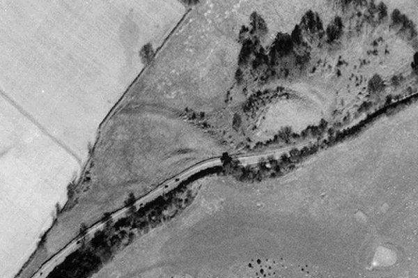
An enlargement of the previous 1946 aerial photograph showing the line of the earlier road approaching from centre left before developing into the 'S' bend. At the lower edge of the 'S', outlined with a row of trees, is the part of the surviving earlier road now used as the parking lay-by still used today - as the road descends, the parking lay-by is on the left.
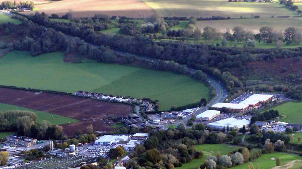
This modern aerial photograph 'borrowed' from Google shows a 'ghost' of the former road running from the bend in the Compton Road across the centre of the photograph to the brown outcrop north of today's road towards centre right, which was the original 'S' bend location.
Courtesy of
Steve Wills
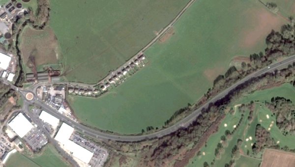
A 2013 aerial view of Babylon Hill. The line of the old road is discernible left of centre, marked by a distinct change of colour running across the field.
gallery
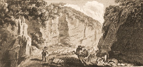
Taken from an almanac dated 1801, this engraving is entitled "Babilon Hill, near Yeovil, Somerset".

Yeovil seen from Babylon Hill in the late 18th century from a lithograph by T Jerome. Penn Hill is seen at left, surmounted by Penn House, and Wyndham Hill is seen at right with the buildings of Pen Mill at its foot.
From my
collection
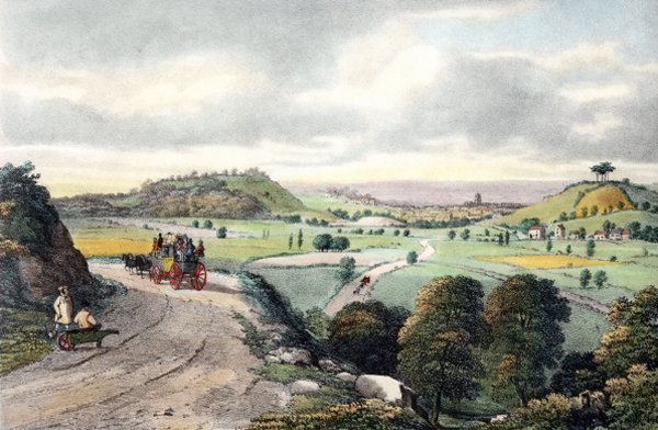
'View of Yeovil from Babylon Hill' in a hand-coloured stone lithograph by Henry Burn (c1807-1884) and published by William Porter and Henry Marsh Custard in 1839. With Summerhouse Hill at left, with Penn Hill behind it, surmounted by Penn House, and Wyndham Hill at right. The buildings at Pen Mill are seen at the base of the latter, with the tower of St John's church above and to the left. At centre, a coach is seen on the Sherborne Road after it was re-aligned.
From the Cave
Collection
(colourised),
Courtesy of South Somerset Heritage Collection
The single carriageway A30 leaving Yeovil for Sherborne in the 1960s. The car is passing over Yeovil Bridge, with the Toll House to the left.
The approach to Yeovil along the single carriageway A30, seen here in a colourised photograph of 1959.
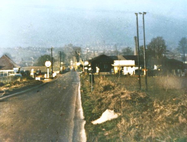
Work begins on making the A30 dual carriageway in the mid-1960s. This colourised photograph was taken from the Yeovil Bridge Toll House. At lower left is the start of Compton Road, line of the original road to London. The buildings right of centre in the mid-distance were Guppy's garage and petrol filling station.
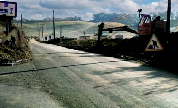
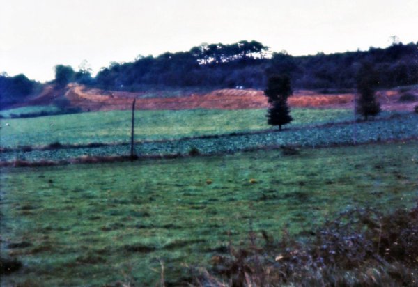
This mid-1960s (colourised) photograph shows the Babylon Hill section of the A30 being converted to dual carriageway. Rock and soil was taken from the top of the hill by the 'S'-bend and used to fill the low-lying field alongside the existing road seen here.
![]()
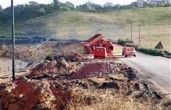
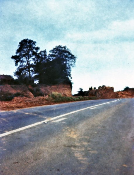
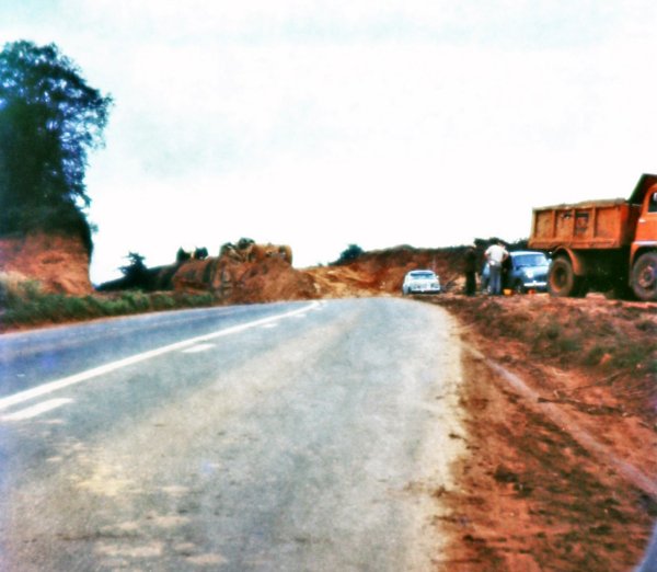
The following three photographs, the first one taken from Compton Road, then two taken at the top of Babylon Hill during this section of the A30 being converted to dual carriageway, are courtesy of Andy Coombs and were taken by his father during the mid-1960s.
Courtesy of
Andy Coombs
Courtesy of
Andy Coombs
Courtesy of
Andy Coombs
![]()
Seen from Yeovil Bridge in a colourised photograph of the 1960s, with the Toll House at left, the new dual carriageway begins its ascent of Babylon Hill in the distance.

Colourised photographed by
Geoff Bowler,
courtesy of Sue
Bowler
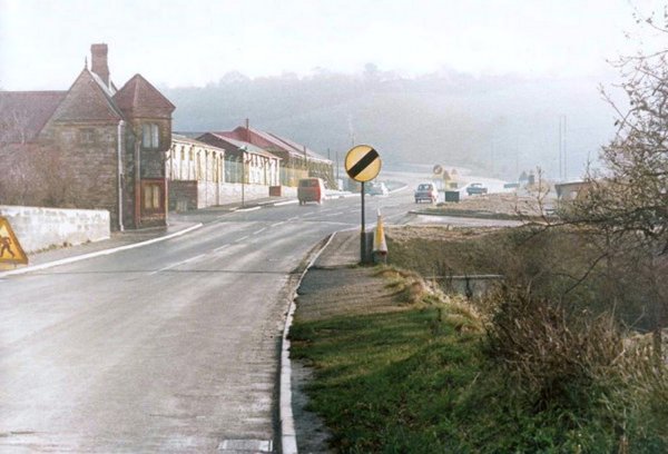
The new dual carriageway approaches Yeovil Bridge in 1969.
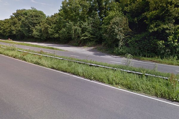
At centre is the remaining section of the old road, now used as a car lay-by. And no, I didn't use my camera while hurtling along to Sherborne - I nicked this from Mr Google.
Courtesy of Nick
Hickman
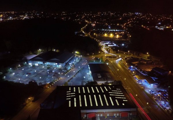
Babylon Hill at night. Photographed in 2016.