Great Stone
Great Stone
A detached part of Preston Plucknett
Great Stone is a field west of Stone Farm on the west side of Stone Lane.
This area is actually a detached part of the parish of Preston Plucknett, known as Preston in Stone, and the Preston Plucknett Tithe Map of 1849 shows Great Stone as Parcel 152. It was bounded on the south by Little Stone (Parcel 151), on the west by Barn Close (Parcel 1107) and Higher Great Long Croft (Parcel 1119) - both in the Parish of Yeovil - to the north by Higher Broadmead (Parcel 153) and on the east by Stone Lane.
The Preston Plucknett Tithe Apportionment of 1848 recorded Great Stone as 11a 2r 23p and noted that the owner was William Jones Prowse Esq. and the tenant was James Martin (see also 149 Long Croft and 151 Little Stone). Captain William Jones Prowse RN, was the last of the family to live in Kingston Manor House.
Today Great Stone, Higher Broadmead and Lower Broadmead are combined to form one very large field, with a portion of the latter fenced off to form a paddock. The whole field remains as pasture - see photo below.
maps
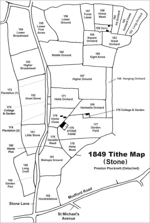
The Stone area reproduced from the 1849 Tithe Map. Great Stone is at centre left.
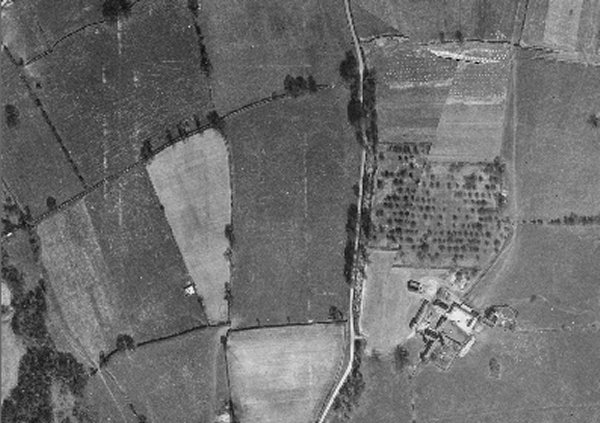
The 1946 aerial photograph showing Great Stone at centre. Stone Lane runs vertically just right of centre and Stone Farm is at bottom left.
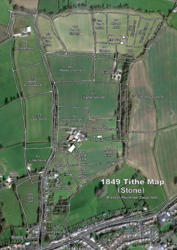
The 1849 Tithe Map superimposed over the current Google Earth image. Although the field boundaries do not align precisely, remember that the 1849 survey was undertaken by hand using primitive surveying equipment. Great Stone is at centre left.
Gallery
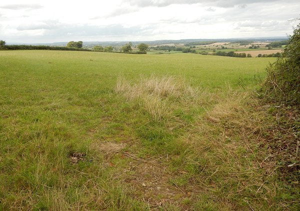
Great Stone, looking northwest from the southeast corner. The lower slopes seen in this photograph are the former Higher Broadmead which is today combined with Great Stone to form one large field. Photographed in 2015.