Springfield Road
Springfield Road
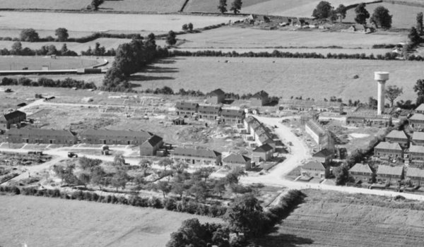
New housing off Stiby Road
As seen from the
first photograph
in the Gallery,
Springfield Road
was constructed
in 1953.
Following the
break-up of
Larkhill Farm,
two of its
fields,
Great Larkhill
(Parcel 1418)
and
Thorney Bush
(Parcel 1419)
were sold off as
building land.
Springfield Road was built on the southern half of both Great Larkhill and Thorney Bush. The road was built in a crescent, with both ends joining Stiby Road. However until this time Stiby Road, or Lower Larkhill Lane as it was known, only ran from Ilchester Road in the east and stopped as a made-up road at the western end of the Marl Close estate. From here, as far as Larkhill Road, it continued as a farm track. This western section of Lower Larkhill Lane was constructed in 1953 at the same time as Springfield Road and renamed Stiby Road.
gallery
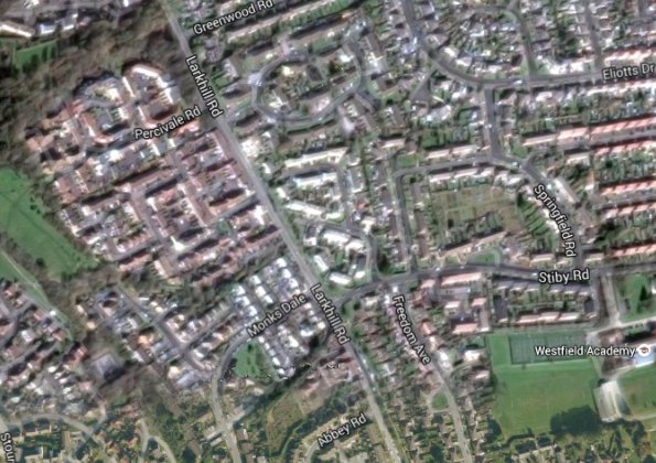
The same area today 'borrowed' from Google maps.
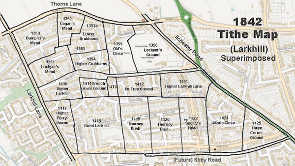
The 1842 Tithe Map superimposed (slightly out at the bottom) over a modern map.
Courtesy of Rob
Baker
The houses of Springfield Road under construction in 1953. To the right is what was to become known as the Springfield Road water tower. Also at the right is just glimpsed the Marl Close estate that was built in the early 1940s. Stiby Road runs across the bottom of the photograph.
That part of Springfield Road, right of centre, leading to Stiby Road was built on Thorney Bush (Parcel 1419) while to the left of the photograph the construction of Springfield Road is in its primary stages on the southern half of Great Larkhill (the field beyond is the northern half of Great Larkhill and Thorney Bush.
Courtesy of Rob
Baker
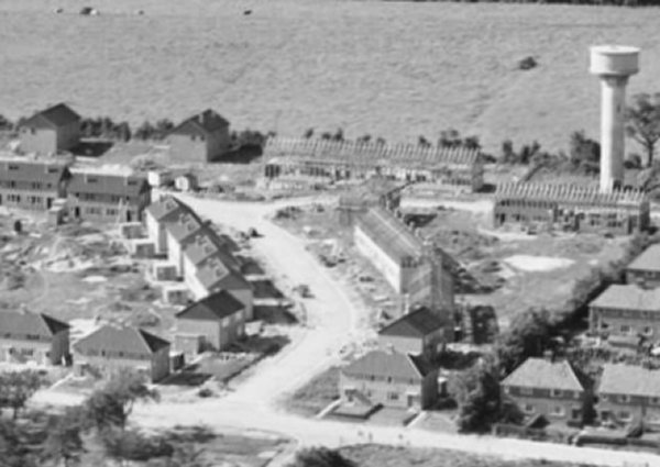
An enlargement of part of the previous 1953 photo, showing the houses of Springfield Road under construction.
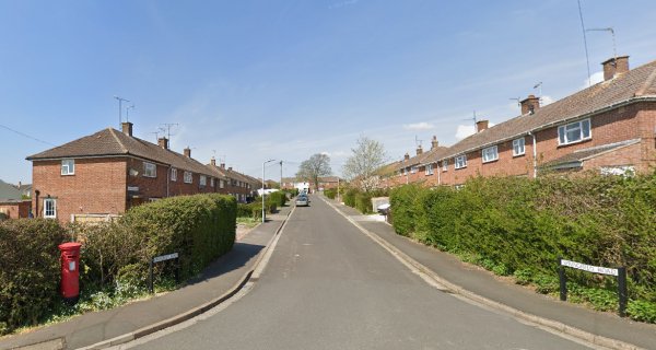
Springfield Road - its western junction with Stiby Road, seen in 2021.
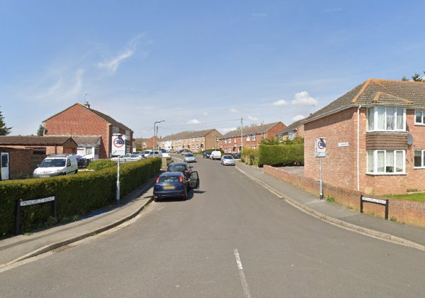
Springfield Road - its eastern junction with Stiby Road, seen in 2021.