Barrowhayes
Barrowhayes
A field within the Newton Surmaville Estate
Barrowhayes (Parcel 498) was a field in the Newton Surmaville Estate. The name Barrowhayes derives from the Old English beorg, meaning a hill or mound, and geheog or hege, meaning an enclosure.
The 1743 Terrier referred to "Dodham to Cake Bridge... Knipe's Barrowhayes two acres meadow". It is probable that at one time this parcel formed part of Coldharbour Farm, however this farm disappeared from the records in the 1830s.
At the time of the 1846 Tithe Apportionment, Barrowhayes was owned by George Harbin and let to William Pope as part of Newton Farm. It was recorded as pasture for grazing livestock and measured 3a 2r 16p.
Barrowhayes (Parcel 498) was bordered on the east by Newton Road and to the south by Dodham Brook. It became the site of Yeovil Town station, which opened in 1861.
Today, the former Barrowhayes is occupied by the Yeo Leisure Park and its car park.
For details on historic land measurement (ie acres, roods and perches) click here.
maps

This map, based on the descriptions in the 1589 Terrier and the 1846 Tithe Map of Yeovil shows the approximate boundaries of the Manors of Kingston and Hendford as well as the manorial three-field system used in Kingston.
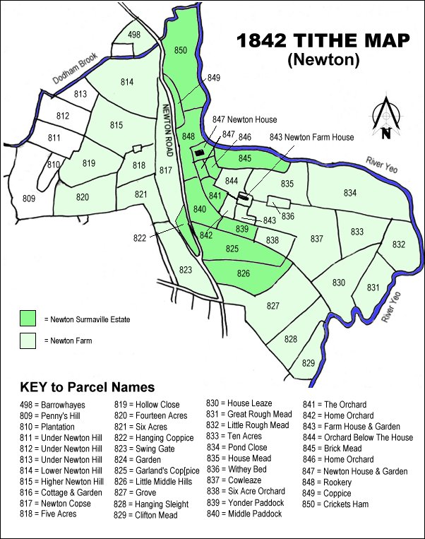
The 1842 Tithe Map showing the Newton Surmaville Estate shaded mid-green and the parcels of Newton Farm shaded light green. Barrowhayes (Parcel 498) is at the top, left of centre.
Gallery
Courtesy of Jack
Sweet
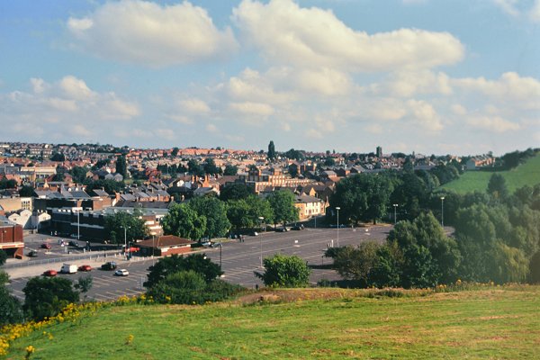
After the demise of Yeovil Town Station, the former Barrowhayes became Old Town Station car park. Photographed from Summerhouse Hill in the 1980s.
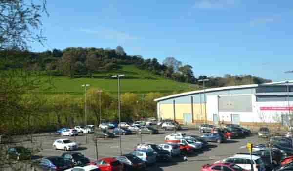
The former Barrowhayes (Parcel 498) is now occupied by the buildings and car park of Yeo Leisure Centre. Photographed in 2021.