court ash
court aSH
Home to several glove manufacturers
The 'Court' part of the name Court Ash takes its name from the former manor of Kingston Manor, originally held by King Alfred. Known to history as Alfred the Great, he was King of Wessex and lord of Yeovil from 871 to 899. The 'Ash' part of the name most likely derives from an ash tree that would have served as a prominent marker there.
The 1633 Survey of Kingston recorded that Geoffrey Miller held "a half tenement and a close of pasture 5a lying near Court Ash". The 1633 Survey also noted "Joan Clothier widow, Valentine Jacobb and John Jacobb hold by copy 28 September 1574 granted by John lord Stourton, on the surrender of Joan, and fine of £50, a cottage or barn and close of pasture called Court Ash." indicating that a field existed with the name Court Ash before the road existed.
In his 1684 will, William Phelps recorded "All my right title and Interest which I have or ought to have of and in the Tenement called Court Ayshe or Kings living with the lands thereunto belonging".
A lease dated 24 July 1759 between George Prowse of Yeovil, Esq., and William Daniell the Younger of Yeovil, Glover, refers to "A piece of ground at Court Ash on the north side of the highway running up to the brook (ie, the Rackle Brook) that runs from Kingston to the Horse Pond in Yeovil measuring 300ft long and 3ft wide with full liberty of William Daniell to erect a wall and take the water course into and through his own garden."
Running between Kingston / Princes Street to the west and Silver Street / Market Street to the east, at one time Court Ash was not a through-road as E Watts' map of 1829 shows the western end as a "New Lane" connecting it with 'Kingstone'. The 1886 Ordnance Survey clearly shows the western end of Court Ash blocked by 'posts' at its junction with Kingston / Princes Street.
In 1907 the telephone company's ‘call office’ was at 2 Court Ash, Miss Adams being the only operator.
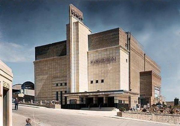
On the northern edge of the 'old' town, Court Ash has never been densely populated. To the south was originally open ground called the Kennels and was used for archery practice, badger-baiting, cock-fighting, etc. It was later known as Sheep Fair and Fair Ground by the nineteenth century (not to be confused with Fairfield off Huish and Salthouse Lane). To the north, at its western end, was Bide's Gardens donated to the town in 1916 and originally the gardens of Kingston Manor House. Next was the short road called Court Ash Terrace that joined Court Ash with today's Reckleford at the point at which Higher Kingston became Reckleford Hill. From this point until its eastern end were just a couple of large houses, including Court Ash House that was demolished for the Odeon cinema in the mid-1930s, and two glove factories.
The affluent glove manufacturers who lived in Court Ash included Henry Collins, William Willmington and George Atherton.
MAP
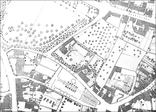
Map based on the 1886 Ordnance Survey with Court Ash seen running from Kingston at extreme left centre then down to lower right where it joins Silver Street / Market Street opposite the Pall. The open area at top left is Bide's Gardens.
Gallery
A 1937 colourised photograph of the Odeon cinema from Court Ash and including a glimpse, at bottom left, of the public lavatories.
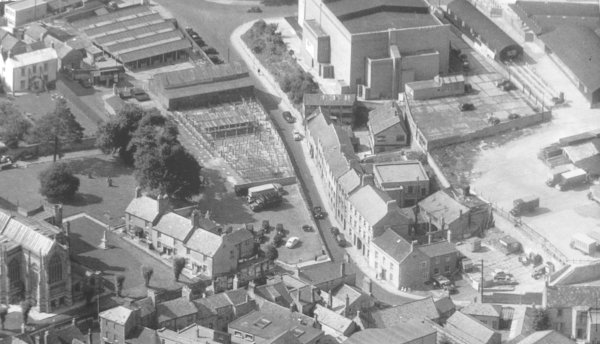
An aerial view of Court Ash taken in 1955 with the Fair Ground to its left, clearly showing the numerous buildings and sheep pens. St John's church is at bottom left and the Odeon cinema at top right with the cattle market at far right.
During the Second World War, the Fair Ground market area was designated as an area for the decontamination of foodstuffs by airing and washing.
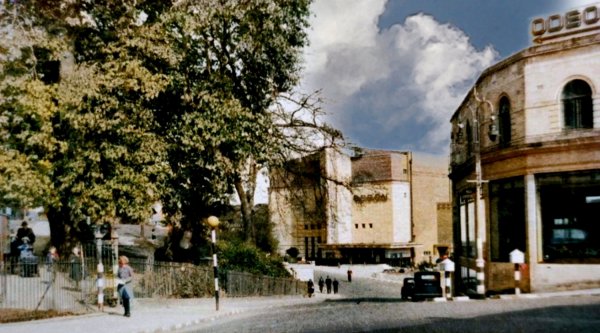
Court Ash seen from Kingston in a colourised photograph of around 1946. Bide's Gardens is at left, the Odeon Cinema, dating to 1937, lies ahead with Court Ash Terrace running to the left in front of it while Court Ash proper runs to its right, out of sight in this photograph. At right is Vincent's car showrooms.
From the Cave
Collection
(colourised).
Courtesy of
South Somerset
Heritage
Collection
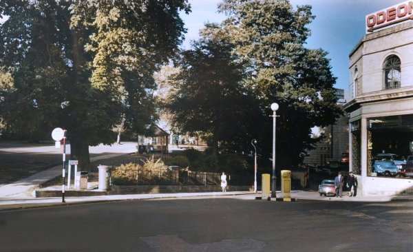
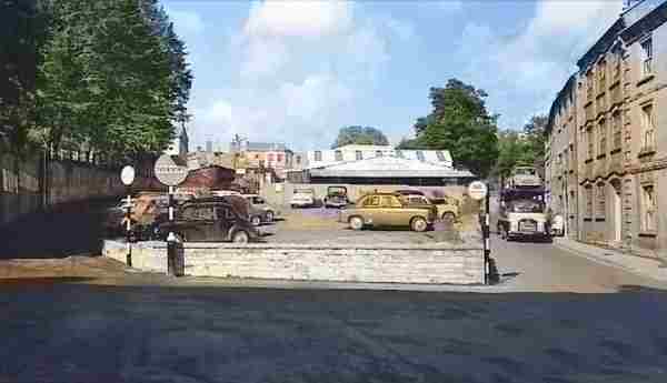
The same junction but taking looking down Court Ash, around 1960.

Bide's Gardens seen in a colourised photograph from Princes Street around 1960 with Court Ash running off to the right behind Vincent's showrooms just glimpsed at extreme right.
A still taken from a home movie of the early 1960s, showing the junction of Court Ash and Princes Street at the time Reckleford was being made dual carriageway.
This photo is
featured in my
book "Now
That's What I
Call Yeovil"
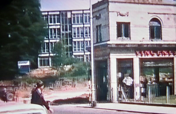
Court Ash photographed in 1964.
Courtesy of
Roger McElliott
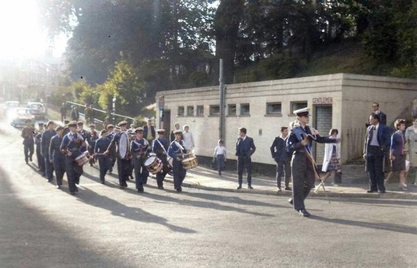
The band of 1032 Yeovil Squadron Air Training Corps in Court Ash, in a colourised photograph, probably of the late 1970s / early 1980s.
Courtesy of Jack
Sweet
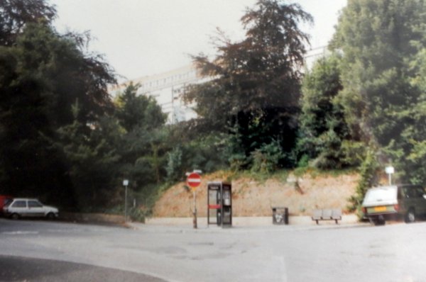
The site of the former toilet block (seen in the previous photo), removed in 1993 because of untoward behaviour carried on in the lavatories. Photographed in 1993.
Courtesy of
Chris Rendell
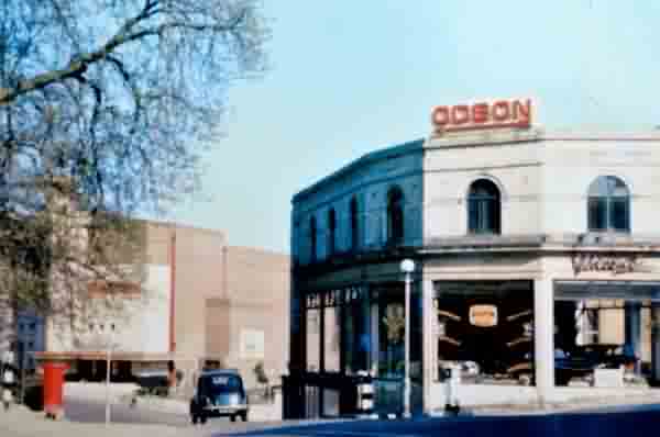
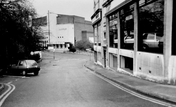
Photographed in 1985 - the Odeon is now part of the Cannon Group but Vincent's showrooms are still full of cars.

Court Ash, looking back to Kingston, in a colourised photograph of 1960. Vincent's showrooms at left, Bide's gardens at right.

This colourised postcard dates to the 1920's and shows the path along the edge of Bide's Gardens at right. At a much lower level to the left is Court Ash Terrace with vehicles waiting to get into the market. At extreme left is Court Ash House in the only photograph I know of it. The house was demolished in the early 1930s to make way for the new Odeon Cinema on its site. Court Ash runs across the photograph from Vincent's showrooms, glimpsed through the trees at centre right, then past Court Ash House.
An aerial view of the Court Ash taken in 1955 from Court Ash Terrace, running off behind the cinema, as far as Silver Street. St John's church is at bottom left and the Odeon cinema at top right. Note the cattle market at far right and the sheep pens in what is now the car park between Court Ash and North Lane.
From the Cave
Collection
(colourised).
Courtesy of
South Somerset
Heritage
Collection
Fair Ground in the mid-1960's seen from Silver Street with North Lane at left and the eastern end of Court Ash at right. The building at the rear of the car park was the poultry shed.
Courtesy of
South Somerset
Heritage
Collection
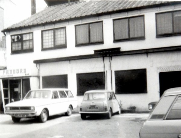
This old building, once a leather cutting factory, became Pandora's 'Discotheque & Bar' as seen here in the 1960s. The building survives today.
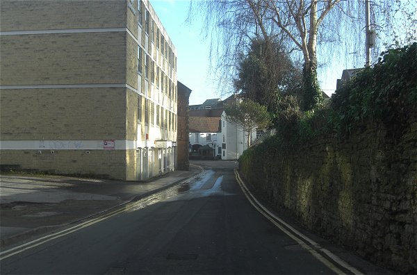
Court Ash, about half-way, looking to Silver Street. Photographed in 2014.