fair ground
fair ground
Also known as Sheep Fair and Fair Field
Fair Ground was
the name applied
to the
triangular area
between
North
Lane and
Court
Ash. The land
was known as
'Fair Ground' in
the 19th century
and had earlier
been called
'Sheep Fair' and
'Fair Field'
(not to be
confused with
Fairfield in
Huish) .
In medieval
times this area
was most likely
used us the
town's archery
butts. In early
times the area
was known as
'The Kennels'
and used for
badger-baiting,
dog fighting,
cock fighting,
single-sticks
and
cudgel-playing.
There again, it wasn't all plain sailing as the Bath Chronicle recalled in the death notices of its edition of 11 October 1781 "At Yeovil, Mr William Gover, a noted cock-fighter; his death was occasioned by a cock's sticking a steel spur into his knée, which turned into a mortification."
In the early part of the 19th century a rope walk had run from the very top, behind the Mansion House, to the very bottom, opposite the Pall Tavern. E Watts' map of 1829 noted the area as "Proposed Cattle Market". During the late 19th century a timber shed stood at its junction with Silver Street which housed the town’s fire engine.
The 1846 Tithe
Apportionment
noted that the
Fair Ground was
owned by William
Phelips with
John Cox as
tenant. The size
of the Fair
ground was
recorded as 0a
2r 20p.
In the middle of
the nineteenth
century the
cattle market,
was
held weekly in
Princes Street
(then known as
Cattle Market),
recalled in the
Hendford Herald
in an article
entitled 'A
Century of
Yeovil,
1846-1946' -
"Some 4,000
sheep and 600
beasts thronged
Cattle Market,
now
Princes Street,
and
Sheep Lane
(today's North
Lane) every
week. The
confusion so
caused must have
been very great,
and in 1856 it
was found
necessary to
remove the
market to its
present site;
then known as
'Fairfield' or
'The Kennels'
and at one time,
it is said, the
site of quarries
from which came
the stone for
the Parish
Church."
The area was set up as an official market by the Corporation in 1892 although the 1888 Ordnance Survey map shows this area as the cattle market with sheep pens at the bottom end. This market ended in 1979.
For details on historic land measurement (ie acres, roods and perches) click here.
MAP
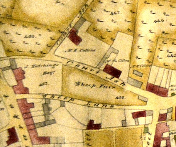
E Watts' map of 1806 shows 'Sheep Fair' sandwiched between Court Ash and Sheep Lane.
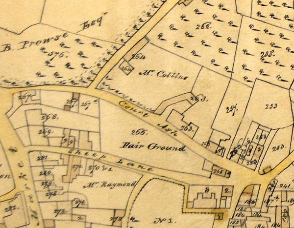
E Watt's map of 1831 shows the name now changed to 'Fair Ground'.

The 1886 Ordnance Survey of Fair Ground.
gallery
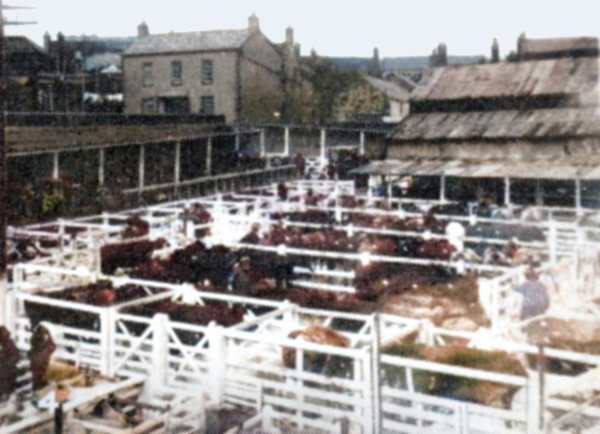
A 1920's colourised photograph of Yeovil cattle market being held in the Fair Ground. The house at the top left is North Lane House (seen at the top left in the next photograph), now the site of North Lane car park.
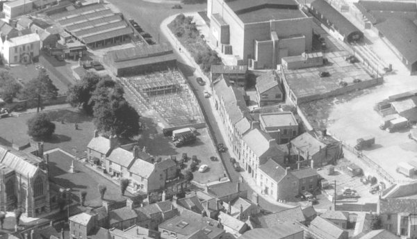
An aerial view of the Fair Ground taken in 1955 clearly showing the numerous buildings and sheep pens. St John's church is at bottom left and the Odeon cinema at top right. Note the cattle market at far right.
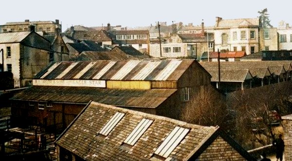
The Fair Ground with its animal sheds, etc. in a colourised photograph taken from the grass bank, seen in the photo above, by the Odeon Cinema in 1956. At top left is North Lane House and at top right is the Mansion House.
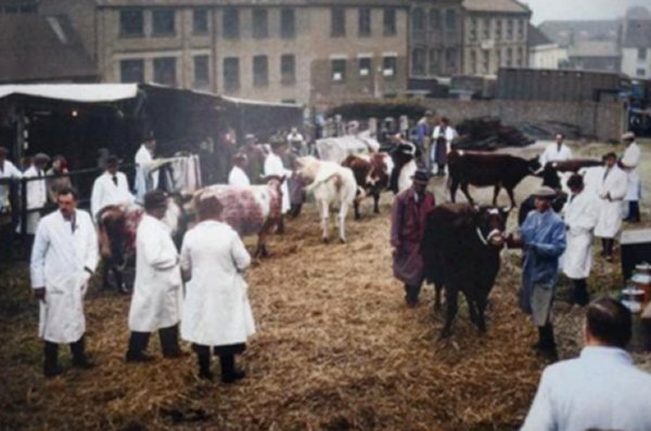
A colourised photograph of Yeovil cattle market on what is now the car park between North Lane and Court Ash. Probably in the 1950s or '60s.
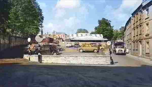
From the Cave
Collection
(colourised).
Courtesy of South Somerset Heritage Collection
Fair Ground in a colourised photograph of the mid-1960's. The building at the rear of the car park was the poultry shed.
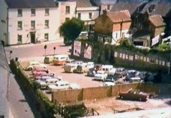
.... and the same area seen from an unusual angle, probably in the 1960s. Notice all the posters on the wall in North Lane, at the rear of Church Terrace. At top left is the Pall Tavern.
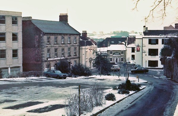
This photograph, taken from North Lane and looking towards Market Street, dates to January 1985 when it fell 'deep, and crisp, and even'.