Devonshire cottage
Devonshire cottage
Substantial house, later housing a community of Carmelite brothers
Devonshire Cottage was at the end of a short field access track known as Pound Close which ran north from Reckleford Hill (today's Reckleford) and contained the animal pound of Kingston Manor. Pound Close also gave access to two fields, one also called Pound Close and the other called Cheeseman's Close.
Edward Watts' 1831 map of Yeovil (see below) shows an early incarnation of Devonshire Cottage but it was clearly enlarged greatly before 1886 when the Ordnance Survey of that year shows either a new or a much rebuilt house. The building works were likely undertaken by glove manufacturer and later mayor of Yeovil John W Hill.
In the 1861 census John and his family were listed living in Devonshire Cottage. He gave his occupation simply as 'Glove Manufacturer'. The family were still living in Devonshire Cottage in 1871 when John gave his occupation as "Glove Manufacturer of the Firm of Bide & Hill employing from one hundred to one hundred and fifty Males and Females on the Premises".
In the 1881 census John and Charlotte, together with children William, Charlotte, Catherine and a servant were listed at Devonshire Cottage - the only time the cottage was named in a census. John Hill purchased the former field (Parcel 537 of the 1831 map below) that ran behind Devonshire Cottage all the way to today's Mary Street and turned it into the gardens of his home. John Hill died in Yeovil on 23 March 1889. He was aged 66.
Following John Hill's death the house was purchased by the Roman Catholic diocese to house a small group of Carmelite brothers, more properly called the Order of the Brothers of Our Lady of Mount Carmel. As a consequence the house became known as Whitefriars.
In 1903 it was acquired, together with the adjoining property, by the Sisters of St Gildas-des-Bois who originated in Brittany, France. They later (between 1912 and 1928) demolished Devonshire Cottage / Whitefriars and built the St Gildas convent on the site.
Map
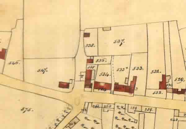
Edward Watts' 1831 map of Yeovil showing Reckleford Hill running across the map. At top centre is Pound Close with an early version of Devonshire Cottage towards centre top in Parcel 538.
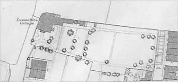
A portion of the 1886 Ordnance Survey map showing Devonshire Cottage, at top left. By this time John Hill had purchased the former field (Parcel 537 of the 1831 map above) and turned it into the gardens of Devonshire Cottage. The lane it stood in, Pound Close, would be developed as The Avenue and the cottage itself would later be known as Whitefriars.
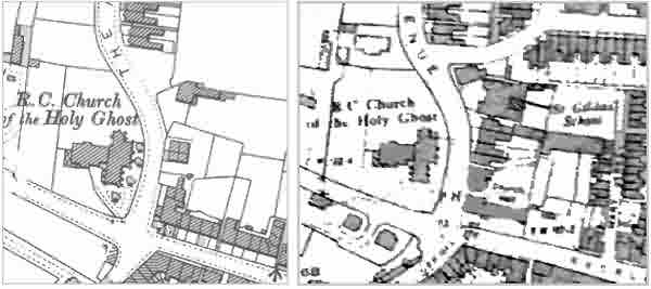
Two later Ordnance Survey maps. At left the 1912 map shows the new Avenue bypassing Devonshire Cottage / Whitefriars. At right the 1928 Ordnance Survey map shows that Devonshire Cottage had been demolished and replaced with the St Gildas' convent and school.
gallery
From my
collection
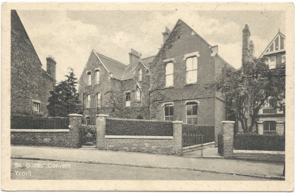
A postcard of St Gildas' convent dating to 1930. The former Devonshire House would have occupied the site of the left-hand half of the convent building.