great home close
great home Close
Now the approach to Wyndham Park
Great Home Close (Parcel 903) was the 'home' close (close of land near the farm house) of Great Lyde Farm (now the Great Lyde Inn) although in 1653, as seen on the first map below, it had been called the Hither Cowleaze (the name 'cowleaze' simply means pasture land on which cows were grazed). It was somewhat larger than the later Great Home Close at 11a 1r 22p because the western end was partitioned off as Little Home Close (901). It formed the western end of the northern side of a steep-sided valley through which ran Lyde Brook, the southern boundary of Great Lyde Farm.
A remnant of the steep valley profile may still be seen in the northern part of Lower Cowleaze (907) however in the late 1960s and 1970s the valley was used as a landfill waste site. When the valley was all but filled, earth was brought in to level this and the adjoining fields - forming the flat field surface we see today. Since it is made up ground it cannot have housing built on it and will remain a green (technically brown) site since there is a danger of gas build-up from the rotting waste below. A walk along the path to the River Yeo will show several vent pipes.
The 1842 Tithe Map showed that Great Home Close was bounded on its south by the Lyde Brook, to the west by Little Home Close (901), to the north by Great Lyde Farm (900) and Lower Eight Acres (904) and to the east by Lower Cowleaze (907). The 1846 Tithe Award noted that it was 8a 2r 7p in area but did not state its usage.
Today the northwest section of Great Home Close is occupied by the houses on the southern side of Romsey Road while the remainder is occupied by the Lyde Road / Great Mead roundabout at its western edge and the field running east as far as the stone 'Welcome to Wyndham Fields' markers (which was approximately its former boundary with Lower Cowleaze.
maps
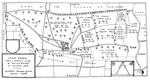
Philip Byles map of Lyde Farm dated 31 January 1653. Great Home Close is shown as 'Hither Cowleaze' at bottom centre.
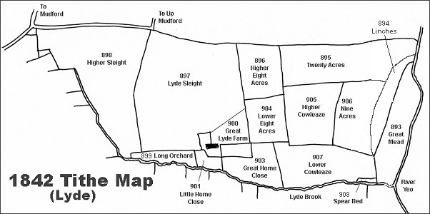
The Lyde area reproduced from the 1842 Tithe Map.
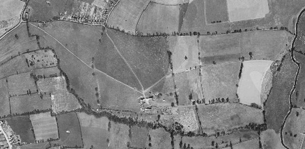
The 1946 aerial photograph of Great Lyde Farm
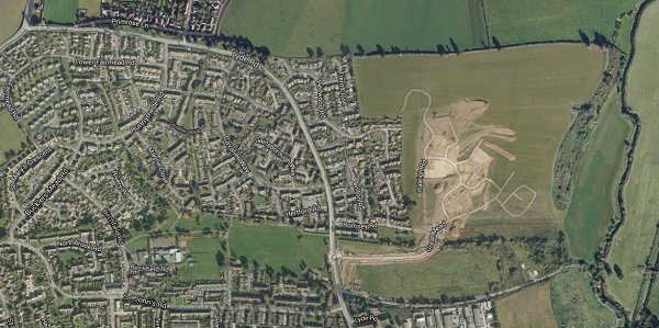
The same area today 'borrowed' from Google maps and taken around 2010 when the groundworks for Wyndham Park were being started. This is some twenty years after Great Home Close and Lower Cowleaze had been used as a waste disposal site and the valley leveled off.
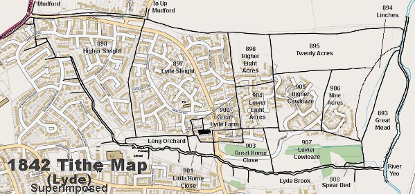
The 1842 Tithe Map superimposed over a modern map.
gallery
Courtesy of Tony
Davies
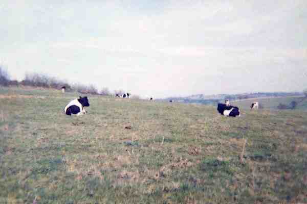
A photograph, looking north and taken from Great Home Close, dates to around 1966.
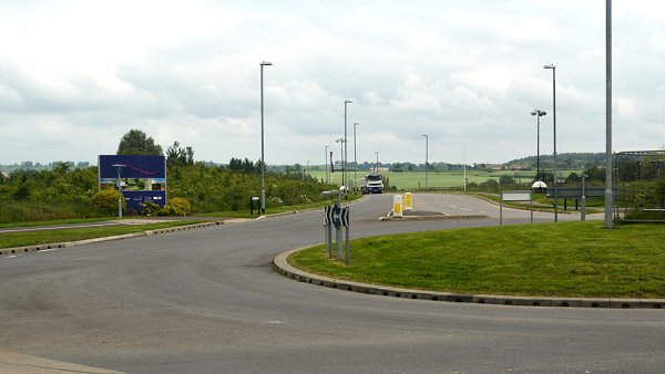
Great Home Close (903) looking east from its boundary with Little Home Close (901). Now the entrance to Wyndham Park. Photographed in 2014.
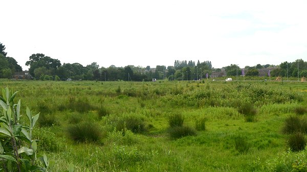
Great Home Close (903) looking west from approximately its boundary with Lower Cowleaze (907). Since this is all made-up ground after the valley was used as a landfill waste site, it is very difficult to now determine the exact boundaries, but Great Home Close would have been more towards the right half of this photo. Lyde Brook would originally have run down the centre of this field, so the left half of the photo would be Hanging Sleight (909). Photographed in 2014.