great lyde farm
great lyde farm
Lyde Lane
In the early 1990s metal detectorists accumulated a collection of Roman pottery and a coin of Constantine I, Roman Emperor from 306 to 337 AD, just to the east of Great Lyde Farm. Excavation of part of the site in 2009 revealed multi-period occupation, including a Romano-British component.
Lyde had been a manor in its own right at the time of the Domesday Book in 1086, although much more extensive than we might imagine today, stretching from the Yeo in the east almost to Combe Street Lane in the west and from Mudford Road in the north almost to Sherborne Road in the south. The name derives from the Old English hlyd or hlyde meaning a steep-sided watercourse which, of course, neatly describes the River Yeo on its eastern boundary but is more likely a reference to Lyde Gurl demarking its southern boundary..
Great Lyde Farm was very much reduced in size from the former manor and really was just a large farm. It was named as 'Great' to distinguish it from its smaller neighbour Little Lyde Farm to the south, although in earlier times they had been called Higher and Lower Lyde Farms.
It is likely that Great Lyde Farm was owned by gentleman William Forbes (d1726) who passed it on to his son Edward in his will of 1724. Edward, in turn left his estate to his nephew, Bani John Forbes, although there is no specific mention of Lyde in his will.
Great Lyde was farmed for many years by William Row Esq., who died "after a long and painful illness, aged 86" on 19 April 1832.
In 1841 the census shows that Higher Lyde Farm was occupied by farmer Charles Marsh his wife Hannah, their young daughter and a servant as well as William Rowe, described as of independent means, his wife Sarah, their two daughters and their servant.
At the time of the 1846 Tithe Apportionment, Great Lyde Farm, with several new additional fields to the south, mainly flanking the west bank of the Rover Yeo (see Map) was owned by William Hawker Helyar of East Coker, but farmed by tenant farmer John Longman.
By the time of the 1861 census the farms were known as Upper and Lower Lyde Farms with Upper Lyde Farm being farmed by 57-year old John Longman, originally from Mudford. He was described as 'Farmer of 260 acres employing 5 men & 1 boy' and lived at the farm with his wife Jane, unmarried older brother Emanuel, and a servant. Also at the farmhouse was his 81-year old father-in-law, a retired dairyman, with his nephew and niece acting as servants. Finally, living at the farmhouse was Robert Walden, his wife and five children. Confirming that the farm was a dairy farm, Walden and his three sons were all described as dairymen.
In 1871 the farm was called Great Lyde Farm and was occupied by Robert Pridham, his Portuguese-born wife Sarah, their three sons and a daughter together with two servants. Pridham described his occupation as 'Farmer of 325 acres employing 8 men, 3 boys & 2 women, Landowner'.
By 1881 George Pridham, now 28, had taken over the farm, once again called Upper Lyde Farm, from his father and described his occupation as 'Farmer of 264 Acres employing one man'. He lived there with his wife and daughter, both called Alice, and a house servant. Despite only claiming to employ one man, there were several dairymen and diary servants living on the farm including 26-year old Abner Ashford who was described as 'Dairyman (60 cows)'.
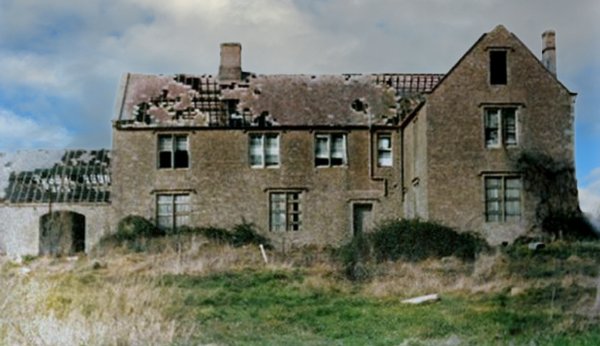
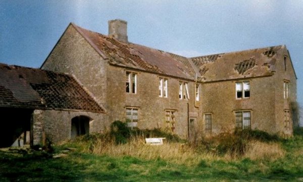
The farmhouse, probably late eighteenth or early nineteenth century in date, was abandoned by the 1960's and allowed to fall into decay as seen in the photographs below.
There was formerly a square dovecote to the east of Great Lyde Farm, just to the east of today's Lyde Road which, until the late 1970's, ended at St John's Road. The building was open on the east side and was being used as a cart shed in 1977. At this date it was soon to be demolished to make way for housing.
Great Lyde farmhouse was converted into the Great Lyde public house in the 1980's.
maps / aerial photographs
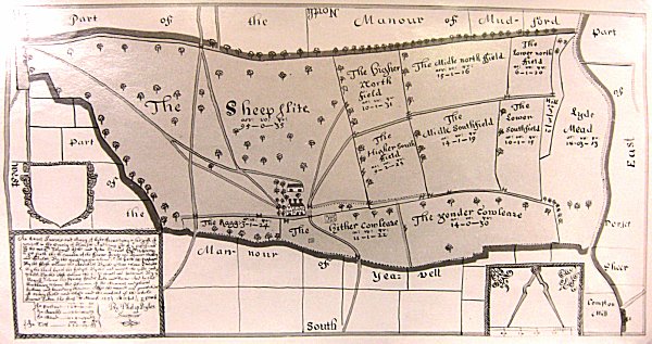
"An Exact Survey and Map of Lyde Farm lying in the parish of Yeovil in the County of Somerset and being part of the possessions of Thomas Hele and John Harris Esqs wherein is set forth the situation of the farm house and barns, stables and stalls. Taken the First of March 1653 by Philip Byles, surveyor". Compare this with the 1946 aerial photograph below and the boundaries remain completely unchanged.
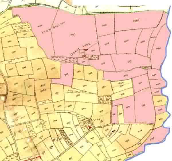
This map overlays the fields being part of Great Lyde Farm (shown in pink) on the 1842 Tithe Map. At this time the land was owned by William Hawker Helyar, but farmed by tenant farmer John Longman.
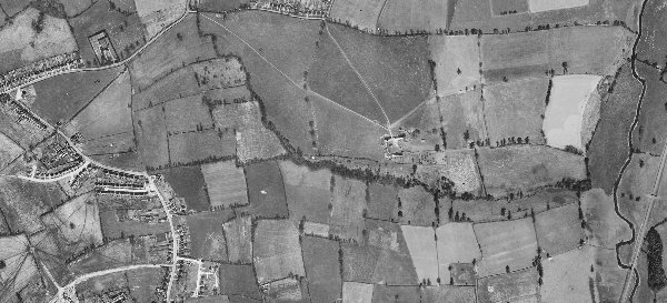
In this 1946 aerial photograph of Great Lyde Farm, at centre, shows Mudford Road at top left, St Michael's Avenue at lower left, the river Yeo and the railway at right. Note that the field boundaries remain unchanged after nearly three hundred years.
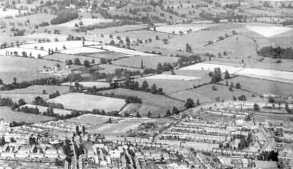
An aerial photograph of around 1955 featuring Great Lyde Farm towards the centre-left. St Michael's Avenue runs along the bottom and Rosebery Avenue takes up most of the lower right quadrant. Lyde Road hadn't been built this far yet.
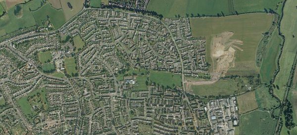
An aerial photograph taken from Google shows how Yeovil's suburbs have grown in the past sixty or so years. Nevertheless some former field boundaries are still discernible with close study - for example trees from former hedgerows have been retained around Bucklers Mead Road tracing former field boundaries. The markings in the fields to the right of the photograph were the preliminary groundworks of the new Great Mead / Collingwood Road estate in the former middle north and middle south fields.
The two green fields, formerly Hither Cowleaze and the Yonder Cowleaze, were an open land-fill waste disposal site in the 1970's and consequently cannot be built on.
Gallery
Courtesy of Tony
Davies
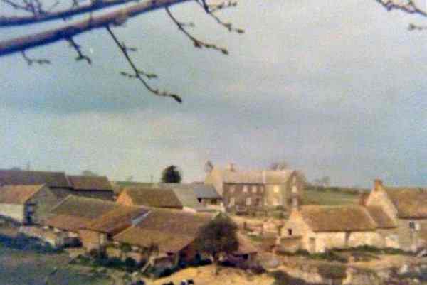
Great Lyde Farm, surrounded by its outbuildings, when it was still a working farm. Photographed roughly from the position of St John's Road (which didn't exist at the time) around 1966. The farmer at the time was Mr Hickman.
Courtesy of Tony
Davies
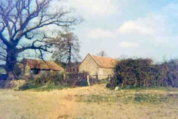
A photograph, also of around 1966, of a couple of the farm outbuildings.
Courtesy of Tony
Davies
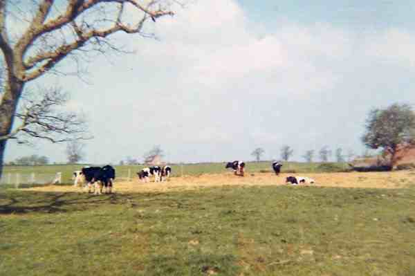
A photograph, looking north and taken from Great Home Close, dates to around 1966.
Courtesy of Tony
Davies
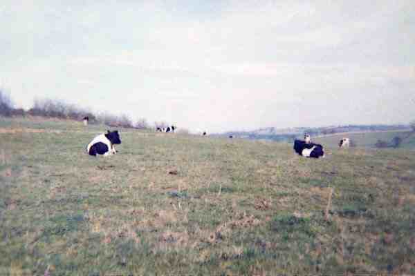
A photograph taken from Little Home Close around 1966. The field the other side of the fence is Lyde Sleight.
Courtesy of
Brian Roberts
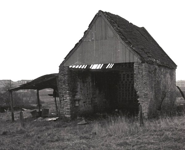
The barn behind Great Lyde Farm. Since the houses of St John's Road are visible in the distance at left, I'd guess this photo dates to the early 1970s.
This colourised photograph
features in my
book 'Yeovil
From Old
Photographs'
Great Lyde farmhouse, photographed from the south about 1975.
.... and seen from the southwest in a colourised photograph.

.... the (colourised) view from the northeast

.... and finally seen from the east - the (colourised) view you see today from Lyde Road.
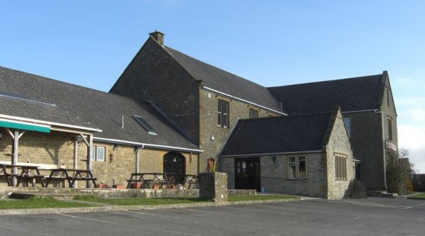
Great Lyde farmhouse, now converted to the Great Lyde public house. Photographed in 2009.