Hanging Ground
Hanging Ground
A field within the great manorial East Field
Hanging Ground (Parcel 909), was originally a large field orientated east-west and steeply sloping down to Lyde Gurl that formed its northern boundary. Indeed, 'hanging' derives from the Old English hangende meaning land on a steep slope.
Unfortunately the 1846 Tithe Apportionment omitted Hanging Ground, so its ownership, usage and size (I'm guessing around 10 acres) are unknown. Because of the steepness of its south to north fall, its use would have been severely restricted and was possibly just scrub.
Hanging Ground was bounded on the north by Lyde Gurl, on the west by Peckford's Close (Parcel 921), and on the south by On Down (Parcel 912a) and Eight Acres (Parcel 910). To the east it was bounded by In Great Mead (Parcel 892).
By the time of the 1946 aerial photograph seen below, Hanging Ground was still an open field.
The valley that included Hanging Ground to the south, was used as landfill during the 1960s and 1970s. The valley was later levelled with imported topsoil and the former Hanging Ground now forms the southern half of today's dog-walking area south of Great Mead (see Gallery) and is part of Yeovil Country Park.
For details on historic land measurement (ie acres, roods and perches) click here.
maps

This map, based on the descriptions in the 1589 Terrier and the 1846 Tithe Map of Yeovil shows the approximate boundaries of the Manors of Kingston and Hendford as well as the manorial three-field system used in Kingston.

A map of the great medieval East Field of Kingston Manor showing conjectured locations of several fields based on descriptions in the 1589 Terrier.
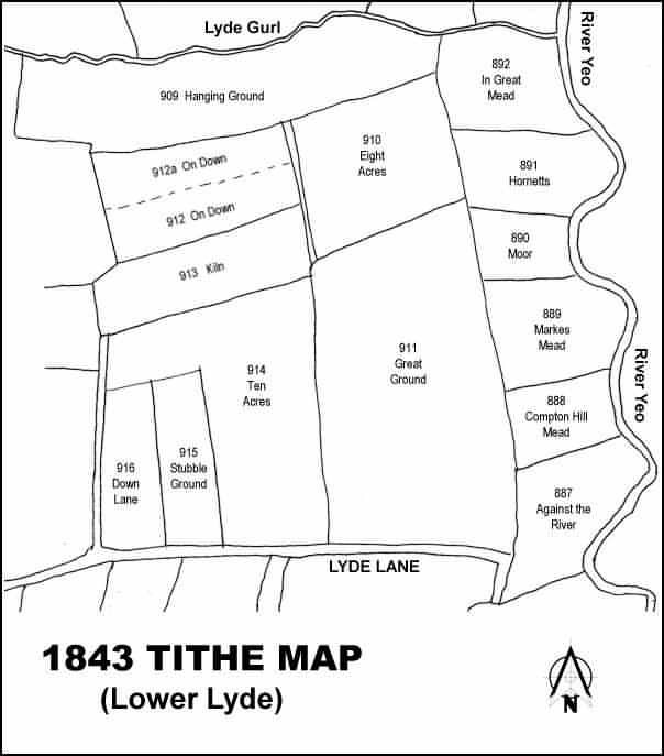
Drawn from the 1846 Tithe Map with field names added from the 1846 Tithe Apportionment, with Hanging Ground (Parcel 909) at the top.
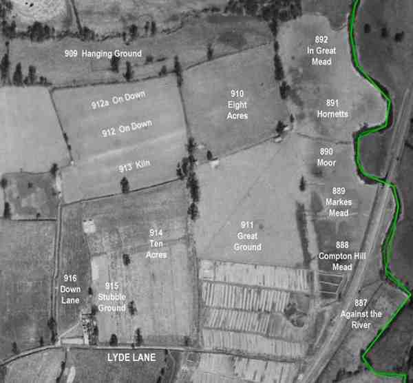
The 1946 aerial survey photograph with parcel numbers of 1846 plotted on. The green line is the county boundary running along the River Yeo.
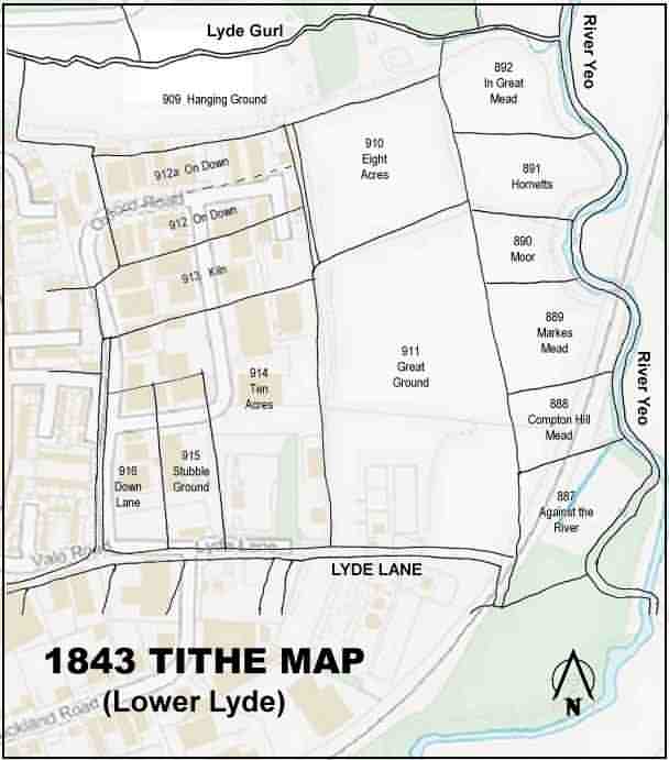
The 1843 Tithe Map overlaid onto a modern map of the area. The course of the Yeo just above the north point appears to have changed course somewhat.
Gallery
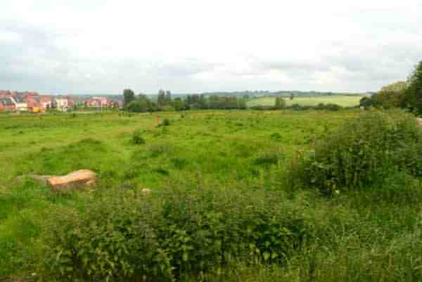
Looking east along the former Lyde Gurl valley. Hanging Ground would have been the right-hand half of this photograph, taken in 2014.