Lydegurl
lydegurl
An almost-forgotten valley
'Gurl', also found as goyle, goil, goyal and guile, is a Somerset dialect word meaning a ravine, gully or steep-sided narrow valley usually with a stream running down it. Lydegurl was the valley formed by Lyde Brook, which formed the southern boundary of Lyde. Indeed the name Lyde itself derives from the Old English hlyd or hlyde meaning a steep-sided watercourse which, of course, neatly describes Lydegurl.
The 1589 Terrier, referring to the boundaries of the great medieval East Field of Kingston Manor, recorded ".... from Stoney lake down by Lydegurl to the Great River...." and the 1743 Terrier referred to "The Guile".
Lyde Brook, for centuries, formed the boundary between Lyde (essentially Great Lyde Farm) and the great East Field of Kingston Manor. It rises in the area just south of today's Runnymede Road, between Rivers Road to the west and Magna Close to the east. It then flows southeast and then turns east in the area of Birchfield School fields, continuing east until it flows into the River Yeo. Over centuries of time the stream had cut a steep-sided narrow valley - the gurl.
Many of us can remember when Lyde Road stopped at the valley which, during the 1970s and 1980s, was the Council's rubbish dump. The little Lyde Brook was, apparently, piped through the valley while an endless stream of refuse lorries dumped their loads of the town's rubbish into the little valley - today politely called 'landfill'. The valley was eventually grassed over and Lydegurl almost disappeared forever.
The last fifty yards or so of the Lyde Brook is still visible as a steep-sided watercourse as it joins the River Yeo - as seen in the Gallery below.
maps
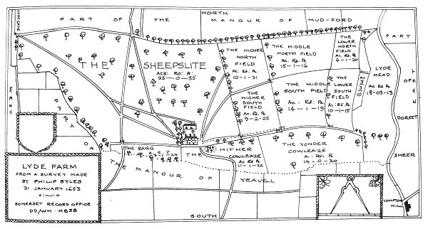
Philip Byles map of Lyde Farm dated 31 January 1653. Lower Cowleaze is shown as 'Yonder Cowleaze' at bottom right.

A map of the great medieval East Field of Kingston Manor showing conjectured locations of several fields based on descriptions in the 1589 Terrier.
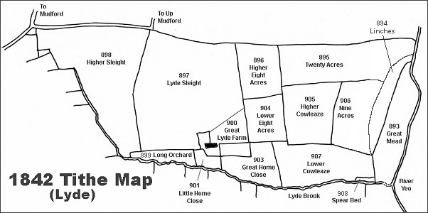
The Lyde area reproduced from the 1842 Tithe Map.
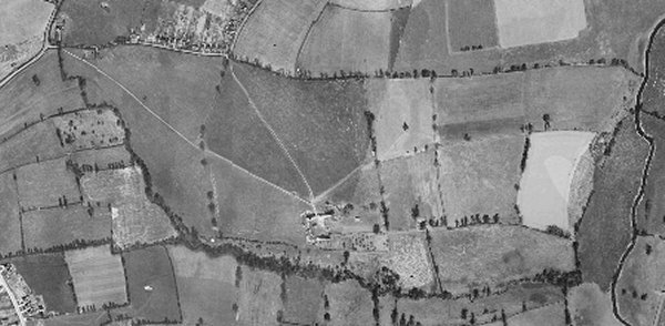
The 1946 aerial photograph of Great Lyde Farm - the course of Lyde Brook, within its 'Lydegurl' is clearly seen marked by the trees and undergrowth growing beside it.
gallery
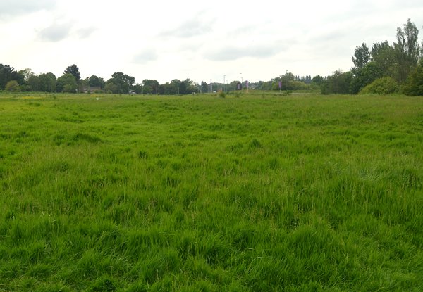
Lower Cowleaze (Parcel 907) seen from its eastern end and looking west. The streetlights seen right of centre are those of Great Mead and are in the northwest corner of what would have been Lower Cowleaze. This is all landfill that completely obliterated the original steep-sided valley - the Lydegurl. Photographed in 2014.
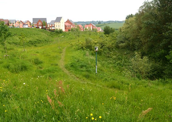
This is along the northeastern corner of Lower Cowleaze looking towards the new housing of Wyndham Park - the section shown here were built in the former Higher Cowleaze (905). Although there has been much in the way of landscaping earthworks in the area, note the steep sides of the valley that originally reached as far as Long Orchard (899) in the west. This is the only remaining part of the valley - Lydegurl - that wasn't completely used as landfill. Note the green post at centre - this is a vent to allow any potential gas build-up from the landfill to escape. Photographed in 2014.
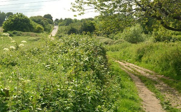
This photograph was taken from close to the Rive Yeo and looking west. The hill seen in the distance with people walking up the track is chiefly made-up ground after the valley was used as landfill. At the top of the hill (which wasn't originally there), to the right, is the southeastern corner of Lower Cowleaze which would have naturally been closer to the elevation where I stood to take this photograph. Lyde Brook is off-photo at right. Photographed in 2014.
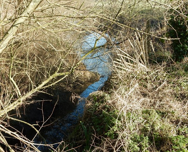
The remaining fifty yards or so of the Lyde Brook is not contained in pipes but is allowed to flow freely - albeit with not much water at this point - before it joins the River Yeo. Photographed in 2016.
This photograph
features in my
book "A-Z
of Yeovil"
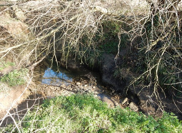
Note the steep sides of the 'gurl' as the Lyde Brook approaches the River Yeo. Photographed in 2016.
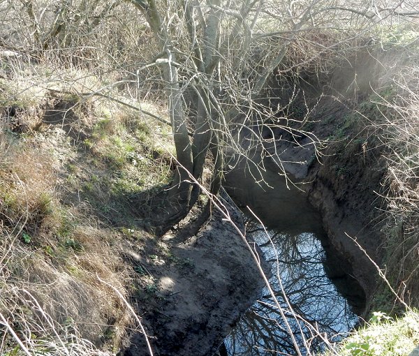
The Lyde Brook, flowing from bottom left, joins the River Yeo, seen at centre. The left bank of the Lyde Brook seen here was the southeastern corner of Lyde while the right bank where I stood to take the photograph was the very northeastern part of the former great medieval East Field of Kingston Manor. Photographed in 2016.