Higher Newton Hill
Higher Newton Hill
Now known as the higher northern slope of Summerhouse Hill
Higher Newton Hill (Parcel 815) was a large, steep field on the higher northern slopes of Newton Hill (although today we tend to call it Summerhouse Hill), adjoining the Newton Surmaville Estate.
At the time of the 1846 Tithe Apportionment, Higher Newton Hill was owned by George Harbin and let to William Pope as part of Newton Farm. It was recorded as pasture for grazing livestock and measured 12a 2r 30p.
Higher Newton Hill (Parcel 815) was bordered on the northwest by Under Newton Hill (Parcels 812 and 813) and Lower Newton Hill (Parcel 814) to the north. To the east it was bounded by Newton Copse (Parcel 817) and to the south it was bounded by Cottage & Garden (Parcel 816 - Round House), Five Acres (Parcel 818) and Hollow Close (Parcel 819).
Today, Higher Newton Hill is what we would today call the upper northern slope of Summerhouse Hill.
For details on historic land measurement (ie acres, roods and perches) click here.
maps

This map, based on the descriptions in the 1589 Terrier and the 1846 Tithe Map of Yeovil shows the approximate boundaries of the Manors of Kingston and Hendford as well as the manorial three-field system used in Kingston.
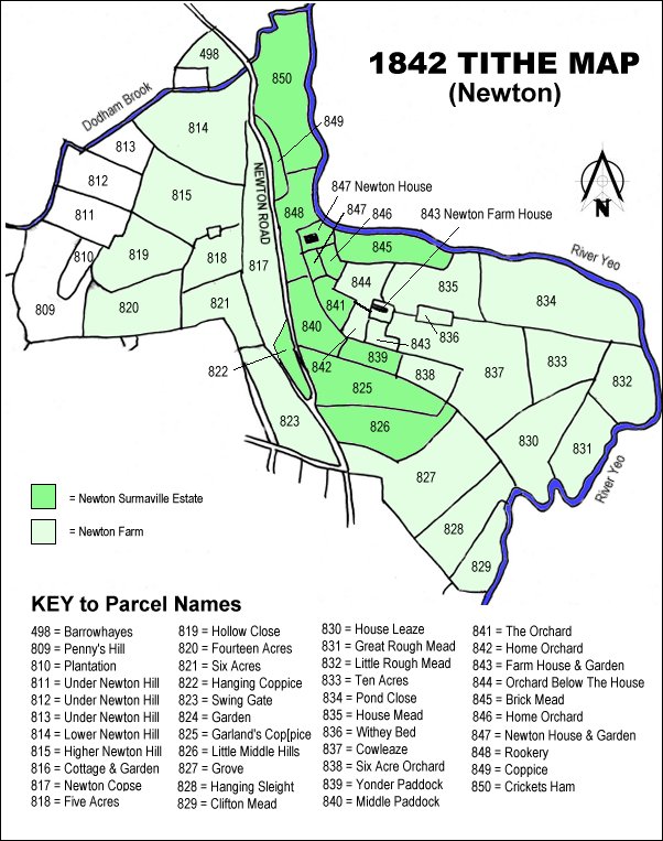
The 1842 Tithe Map showing the Newton Surmaville Estate shaded mid-green and the parcels of Newton Farm shaded light green. Lower Newton Hill (Parcel 814) is at the top, left of centre.
gallery
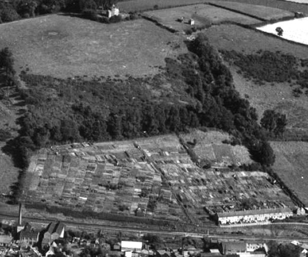
An aerial photograph of 1953, looking southeast and showing the Round House at top left of centre surmounting Newton Hill / Summerhouse Hill. The large field below it is Higher Newton Hill (Parcel 815). The patchwork of the lower slopes of the hill are allotments occupying the former Under Newton Hill (Parcels 812 and 813) with the railway line running across the bottom of the photograph. At bottom right are Victoria Buildings.