Lower larkhill Lane
Lower Larkhill Lane
A former part of the great West Field of Kingston Manor
Originally just a part of the great medieval West Field of Kingston Manor, Lower Larkhill Lane (Parcel 1443) was a long, narrow field at the end of, and to the immediate south of, a field access track called Lower Larkhill Lane (from which the name of the field derived) that would become today's Stiby Road.
A lease dated 28 September 1814 between John Daniell of Yeovil, Esq., and George Bragge Prowse of Yeovil, Esq., refers to the lease of ".... pasture (called) Higher Larkhill 6a, pasture x 2- Caymes Larkhill and Daniell’s Lower Larkhill 7a, a lane called Larkhill Lane leading from the Turnpike Road to Higher Larkhill containing ¾a. All in the Parish of Yeovil late in possession of Samuel Daniell Dec’d ."
The 1846 Tithe Apportionment noted Lower Larkhill Lane as 2a 0r 10p and used as pasture for grazing livestock. The Apportionment noted that the owner was John Winter and the tenant was Joseph Brook. By the time Larkhill Farm was sold in 1920, Lower Larkhill Lane had been purchased and incorporated into the farm lands.
Lower Larkhill Lane was bounded on the north by the field access track called Lower Larkhill Lane, on the west by Lower Little Larkhill (Parcel 1444) and on the south and west by Drang Ground (Parcel 1442).
By the time of the sale of Larkhill Farm in 1931 Lower Little Larkhill and Lower Larkhill Lane had been combined to form a single larger field. Today these former combined fields are still grass to the north and south but Westfield Academy has been built across the centre of the combined fields.
For details on historic land measurement (ie acres, roods and perches) click here.
maps & Aerial Photographs

This map, based on the descriptions in the 1589 Terrier and the 1846 Tithe Map of Yeovil shows the approximate boundaries of the Manors of Kingston and Hendford as well as the manorial three-field system used in Kingston.
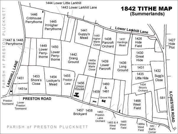
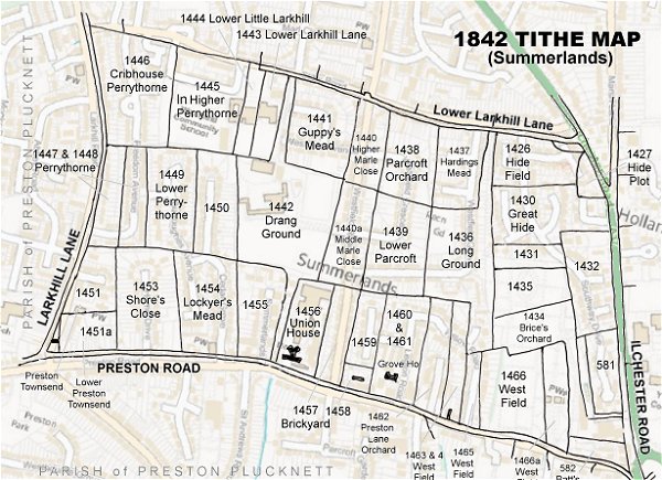
The Larkhill area reproduced from the 1842 Tithe Map. Lower Larkhill Lane is at top, left of centre.
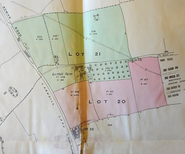
By the time of the 1931 sale of Larkhill Farm the size of the farm had been much reduced to just over 22 acres, including Great Larkhill.
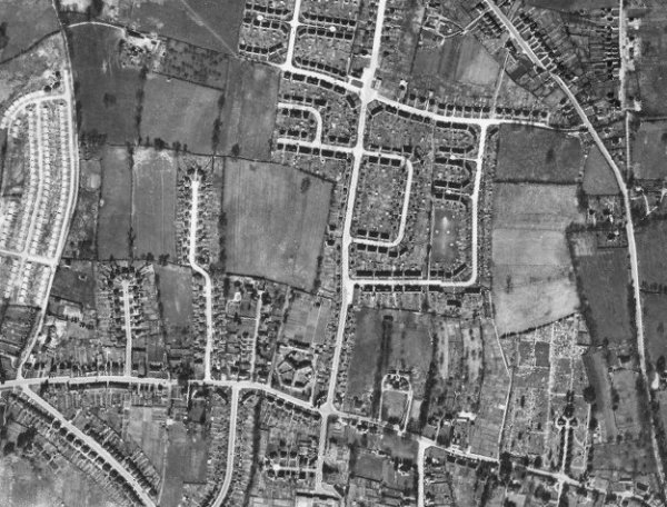
The 1946 aerial photograph - the combined Lower Little Larkhill and Lower Larkhill Lane is left of centre with the newly-built Westfield Place and Westfield Avenue to its immediate right and the incomplete Stiby Road at its top right corner.
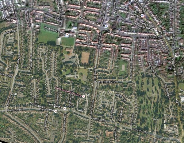
The same area today 'borrowed' from Google maps.
The 1842 Tithe Map superimposed (only very slightly out at the bottom) over a modern map.