Drang Ground
Drang Ground
A former part of the great West Field of Kingston Manor
There are several fields in Yeovil called Drang - there are two close to Little Lyde Farm and a further example in New Town. FT Elworthy in his "West Somerset Word Book" records that 'Drang-Way' was a passage or narrow alley, invariably between two walls, while FW Matthews in his "Glossary of the West Somerset Dialect" recorded that Drang, or Drong, was a narrow way between high hedges or walls or earth banks. The word is probably a British survival of the Welsh dre meaning a street or road.
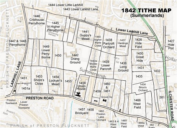
Drang Ground (Parcel 1442) was a large square(ish) field roughly half-way between Larkhill Lane to the west and Ilchester Road to the east and, again, half-way between a field access track called Lower Larkhill Lane that would become today's Stiby Road to the north and Preston Road to the south. The field had narrow extensions to both north and south thereby providing access between Lower Larkhill Lane and Preston Road.
The 1846 Tithe Apportionment noted Drang Ground as 12a 0r 20p and used as pasture for grazing livestock. The Apportionment noted that the owner was William Jones Prowse and the tenant was James Pope. At this time it was part of Larkhill Farm but had been sold off prior to 1920.
Drang Ground was bounded on the north by Lower Little Larkhill (Parcel 1444), Lower Larkhill Lane (Parcel 1443) a connecting strip to the field access track called Lower Larkhill Lane then by Guppy's Mead (Parcel 1441), to the west by Lower Perrythorne (Parcel 1450), to the south by Preston Lane (Parcel 1455) and a connecting strip to Preston Road, finally to the east by Middle Marle Close (Parcel 1440a) and the the Union Workhouse (Parcel 1456).
Today the former Drang Ground forms a large part of the Westfield Academy campus.
For details on historic land measurement (ie acres, roods and perches) click here.
maps & Aerial Photographs
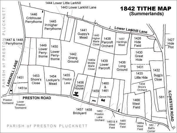
The Larkhill area reproduced from the 1842 Tithe Map. Drang Ground is left of centre.
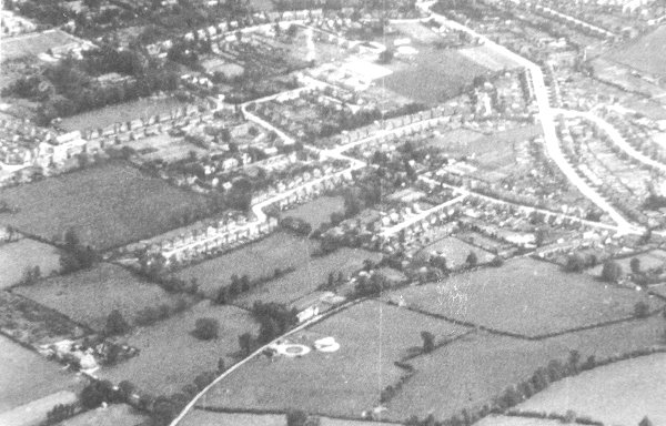
An aerial photograph of 1941 showing Larkhill Lane running from its junction with Preston Road at centre right, down past Larkhill Farm at bottom left. Drang Ground is seen at centre left. At centre bottom, the circular object is Yeovil's Barrage Balloon Site No 19, "Larkhill Lane".
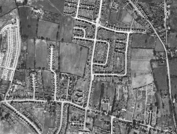
The 1946 aerial photograph - Drang Ground is left of centre with the newly-built Westfield Place and Westfield Avenue above, Cedar Grove to its left and Westfield Road to its right.
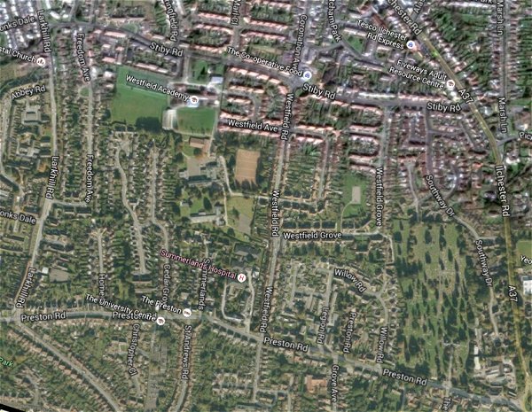
The same area today 'borrowed' from Google maps.
The 1842 Tithe Map superimposed (only very slightly out at the bottom) over a modern map.