Lower Pickets witch
lower pickets witch
A field name derived from Old English
The name Pickets Witch was originally applied to the triangular piece of land forming a very acute angle where Marsh Lane joins Ilchester Road, later known as Piccadilly (Parcels 1403 and 1404). The first element is Old English piccede meaning piked, pointed or an acute angle. The second element is also Old English wice meaning elm, particularly the wych elm.
A deed from the time of Richard II (reigned 1377-1399) refers to 'Pycit Cross' and the name Pyked Weeche occurs in the Woborn Almshouse records in the 15th, 16th and 17th centuries in the phrase "in the West Field (of Kingston near Yeovil) near Pyked Weech". In describing the boundaries of the great Middle Field of Kingston Manor, the Terrier of 1589 records "from Marshweeche to Brimsmore Tree and from thence to Picked Weech being oxen Furlong and wide Gore".
In his will dated 1813, John Ryall bequeathed Lower Picketty Witch to his grandson John Ryall Mayo, the future first mayor of Yeovil.
The 1832 Poll Book shows that Charles Vining lived at Picketwitch (shown on the 1842 Tithe Map below as Picketty). The house sits on a bank set back from the road overlooking the present bus lay-by. Vining used the garden of the house as his brickyard (1083) and this formed the northern boundary of Lower Pickets Witch (1074). Ilchester road bounded the field on the west, Quarry Plot (1076) to the east and Quarry Field (1070) and Andrews Field (1071) to the south.
Today much of Lower Pickets Witch forms the garden of Picket Witch House.
map

This map, based on the descriptions in the 1589 Terrier and the 1846 Tithe Map of Yeovil shows the approximate boundaries of the Manors of Kingston and Hendford as well as the manorial three-field system used in Kingston.
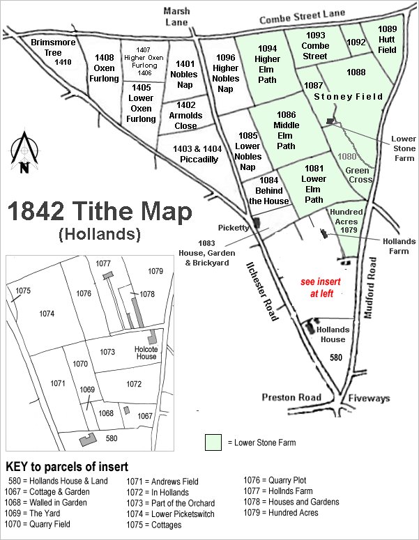
The Hollands area reproduced from the 1842 Tithe Map. Hundred Acres is centre right.
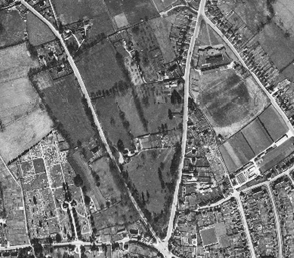
The 1946 aerial photograph showing Lower Pickets Witch at top left centre, almost square and edged with trees.
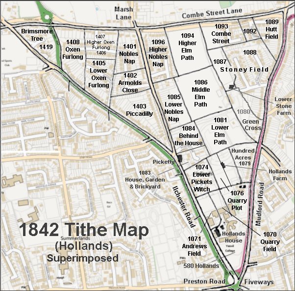
The 1842 Tithe Map superimposed over a modern map.