Quarry Plot
quarry plot
A clue is in the name
Originally part of the great medieval Middle Field of Kingston Manor, Quarry Plot is one of several fields in Yeovil where the name intimates that stone was once commercially extracted. The fact that stone was quarried so close to the town is confirmed by the many entries for masons, stone workers and quarry men in the Victorian census returns,
The large Stoney Field (1087 and 1088) is but a few hundred yards to the north and Quarry Field (1070) adjoins the southwestern corner of Quarry Plot.
Quarry Plot (1076) was noted in the 1846 Tithe Apportionment to be 1a 2r 20p but its use was not mentioned, perhaps intimating that is was either still in use as a quarry or was more or less waste ground after quarrying had finished. It was bounded to the north by Lower Elm Path (1081), to the east by Hollands Farm, to the south by the grounds of Holcote House and to the west by Lower Pickets Witch (1074).
Today Quarry Plot forms part of the Yeovil College campus.
map

This map, based on the descriptions in the 1589 Terrier and the 1846 Tithe Map of Yeovil shows the approximate boundaries of the Manors of Kingston and Hendford as well as the manorial three-field system used in Kingston.
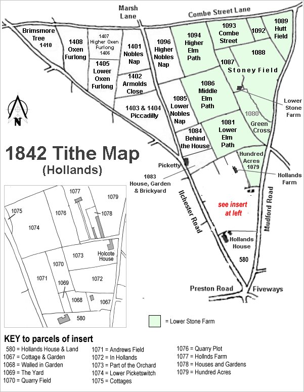
The Hollands area reproduced from the 1842 Tithe Map. Quarry Plot is lower right.
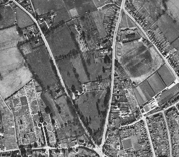
The 1946 aerial photograph showing Quarry Plot towards top centre - it is the long, thin field immediately below the light-shaded rectangle in the field above and appears to have a white line, almost certainly a made-up road surface, running its length..
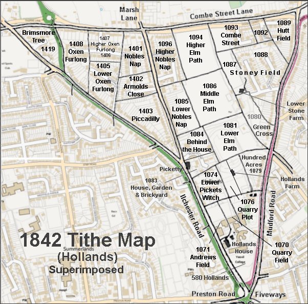
The 1842 Tithe Map superimposed over a modern map.