Perrythorne
Perrythorne
A former part of the great West Field of Kingston Manor
Originally part of the great medieval West Field of Kingston Manor, Perrythorne was a large field running along the eastern side of Larkhill Lane (today's Larkhill Road). The name derived from pear orchard (perry) and thorn bushes (thorne). By the end of the eighteenth century the field had been subdivided into several smaller parcels (see Cribhouse Perrythorne (Parcel 1446), Higher Perrythorne (Parcel 1445) and Lower Perrythorne (Parcels 1449 & 1450).
The Romans left evidence of their occupation in Perrythorne. It was reported in Notes and Queries for Somerset and Dorset in 1909 that much Romano-British pottery, a few coins dating from 306 to 350 AD, other objects and a number of burials were found at Larkhill Quarry over a number of years. A pit with a 1" layer of charcoal at the bottom and many burnt stones was found. The finds occurred directly on the line of the Ilchester to Dorchester Roman road. Between Freedom Avenue and Burroughs Avenue, in what would have been Perrythorne (Parcel 1448), about 400m from the Roman Road near the Larkhill quarry site, workmen discovered a human burial containing a coin of Constantine I in the skull while digging an electricity cable trench in 1949. It is believed that the coin was placed in the mouth of the deceased so that he could pay Charon the ferryman to take him across the River Styx on his journey to the Underworld. Constantine I was Roman Emperor from 306 to 337 AD.
In his will of 1719, John Saunders the Elder wrote "... And also all those my three Closes of Land and Pasture containing by Estimation Tenn Acres lying at or near and called Perrythorne ...".
In his will of 1751, John Sanders the Younger wrote "... and also all my Estate at Perrythorn by estimation Ten acres all lying in the Parish of Yeovil or Pitney To hold to my Nephew Richard Wright and his Heirs forever...".
In her will of 1754, spinster Anne Markes in referring to her land holdings, wrote "... fourteen Acres at Down and Perry Thorn... ".
Perrythorne became a small field to the south of Cribhouse Perrythorne and north of Preston Townsend (Parcel 1451). By the time of the 1846 Tithe Apportionment Perrythorne had itself been subdivided into two smaller fields (Parcels 1447, alongside Larkhill Lane, and 1448, to the east of 1447). If Perrythorne had earlier been part of a farm, it had ceased to be a farm unit by the time of the Apportionment and the two portions were owned by two individuals who each owned only one other parcel of land.
The 1846 Tithe Apportionment noted the western part of Perrythorne (Parcel 1447) as 2a 2r 30p and used as an orchard (presumably pear trees?). The Apportionment noted that the owner and occupier was William Rodber.
The Apportionment noted the eastern part of Perrythorne (Parcel 1448) as 3a 1r 20p and used as pasture for grazing livestock. The Apportionment noted that the owner and occupier was Thomas Hawkins.
Perrythorne was bounded on the north by Cribhouse Perrythorne (Parcel 1444), to the west by Larkhill Lane, to the south by Preston Townsend (Parcel 1451) and Shore's Close (Parcel 1453) and to the east by Lower Perrythorne (Parcel 1449).
By the middle of the nineteenth century the lower half of Perrythorne (Parcel 1447) was being re-worked as a quarry - as, indeed, it was in Roman times. The 1886 Ordnance Survey map shows that a lime kiln had been built on the site.
Today Larkhill Quarry is infilled and the former Perrythorne is occupied by houses and gardens along the eastern side of Larkhill Road and the southern end of Freedom Avenue.
For details on historic land measurement (ie acres, roods and perches) click here.
maps & Aerial Photographs

This map, based on the descriptions in the 1589 Terrier and the 1846 Tithe Map of Yeovil shows the approximate boundaries of the Manors of Kingston and Hendford as well as the manorial three-field system used in Kingston.
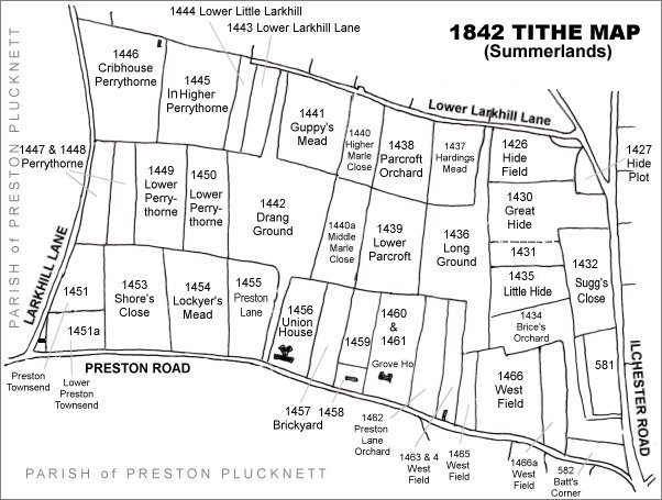
The Larkhill area reproduced from the 1842 Tithe Map. Perrythorne is centre left.
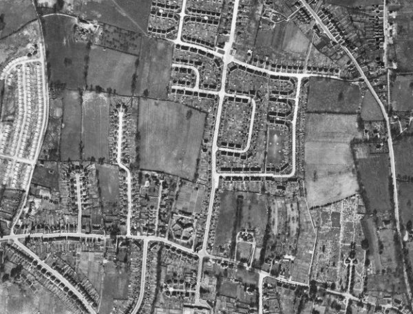
The 1946 aerial photograph - Perrythorne is centre left. At this time it is seen that the western half remained as orchard and the eastern part remained as pasture.
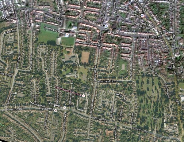
The same area today 'borrowed' from Google maps.
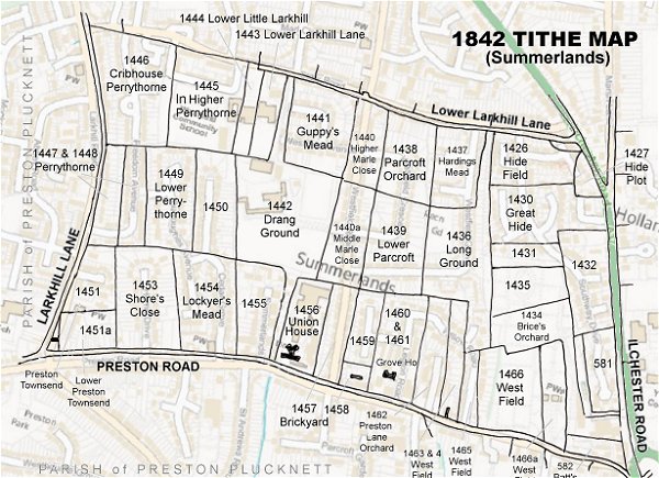
The 1842 Tithe Map superimposed (only very slightly out at the bottom) over a modern map.
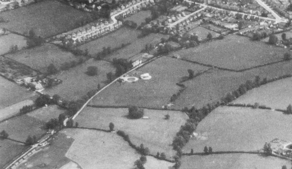
An aerial photograph of 1941 showing Larkhill Lane running from its junction with Preston Road at top right, down past Larkhill Farm at centre left. At centre, the circular object is Yeovil's Barrage Balloon Site No 19, "Larkhill Lane" - to its immediate left, with Larkhill Farm carved out of its corner, is Cribhouse Perrythorne. The two parcels comprising Perrythorne are at top centre with the northern end of Cedar Grove to its left.