Preston Lane Orchard
Preston Lane Orchard
A former part of the great West Field of Kingston Manor
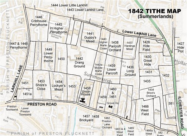
Originally part of the great medieval West Field of Kingston Manor, Preston Lane Orchard (Parcel 1462) was a long, thin rectangular field that got its name simply because it was an orchard that lay to the immediate north of the road known as Preston Lane (today's Preston Road). It lay to the immediate east of Grove House.
An agreement dated 10 September 1818 noted that Preston Lane Orchard was owned by Mr A'court Daniell but was sold by his brother George Daniell to Peter Daniell. It was noted elsewhere that "A’court Daniell has for many years been unsound in mind and consequently incapable of doing any legal acts or managing his affairs and George Daniell, his brother, had taken upon himself the management of his estate and effects."
The 1846 Tithe Apportionment noted Preston Lane Orchard as 3a 1r 9p and used as an orchard. The Apportionment noted that the owner and occupier was James Tucker.
Preston Lane Orchard was bounded on the north by Long Ground (Parcel 1436), to the west by Grove House and its orchard (Parcels 1460 and 1461), to the south by Preston Lane (the road) and to the east by one of the divisions of West Field (Parcels 1463 and 1464).
The 1842 Tithe Map showed Preston Lane Orchard used as an orchard, as indeed did the Ordnance Survey maps until 1889. By 1927 Preston Lane Orchard had been cleared of its trees, had been split into two along its length and two large houses built in each partition - one was built by 1901 while the other - Tyndale (photographed below) - was built after 1901. Both are now a residential home.
During the Second World War, Tyndale was the home of Captain WE Palmer, MA, MSc. He was the ARP Divisional Warden and was also responsible for the organisation of the Fire Guard Service.
For details on historic land measurement (ie acres, roods and perches) click here.
maps & Aerial Photographs

This map, based on the descriptions in the 1589 Terrier and the 1846 Tithe Map of Yeovil shows the approximate boundaries of the Manors of Kingston and Hendford as well as the manorial three-field system used in Kingston.
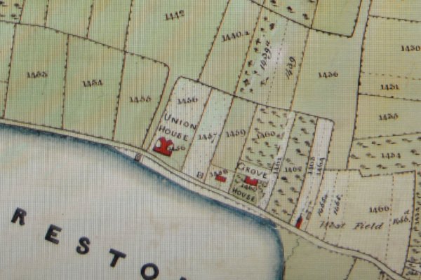
A section of the 1842 Tithe Map showing Preston Road running from centre left to bottom right with the Union House at centre and Grove House at right of centre. Preston Lane Orchard is to the immediate right of Grove House.
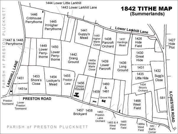
The Larkhill area reproduced from the 1842 Tithe Map. Preston Lane Orchard is bottom left of centre to the right of Grove House.
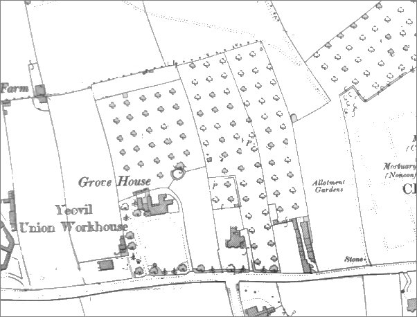
Map based on the 1901 Ordnance Survey showing that by this time part of Preston Lane Orchard had been sold off and a large house built.
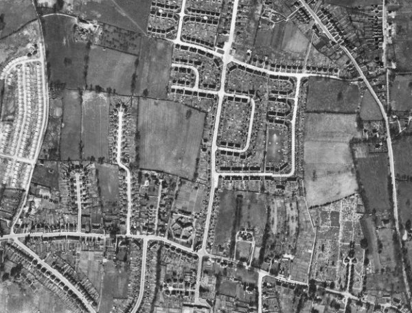
The 1946 aerial photograph - Preston Lane Orchard is bottom left of centre and by this time both houses built on it with the northern part of the former orchard as gardens.
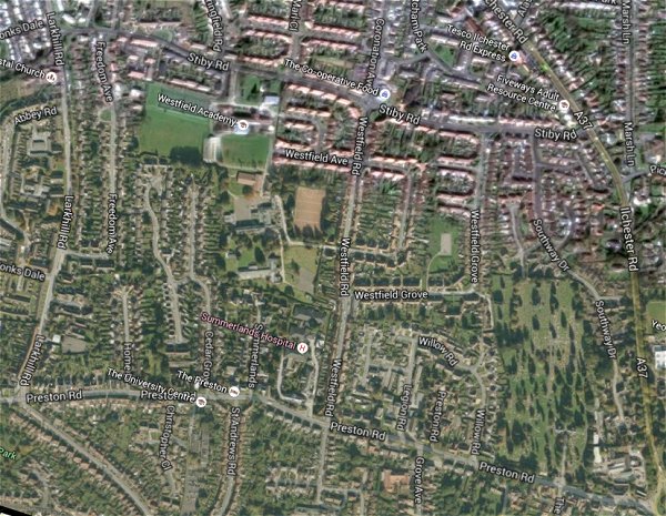
The same area today 'borrowed' from Google maps.
The 1842 Tithe Map superimposed (only very slightly out at the bottom) over a modern map.
Gallery
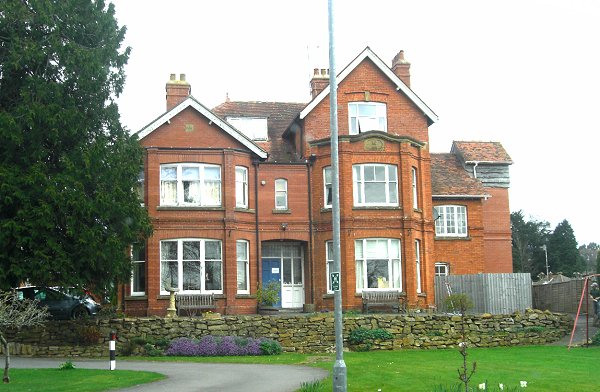
Tyndale (built after 1901), now a residential home but formerly a private residence built on the eastern part of Preston Lane Orchard. Photographed in 2015.