Spitt Croft
Spitt Croft
A field within the great manorial East Field
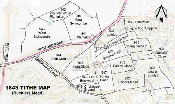
Spitt Croft (Parcel 944), was originally a large triangular field in the great medieval East Field of Kingston Manor. The 1589 Terrier, in referring to Yeovil's East Field, noted "15 Acres at Spitcroft".
The 1846 Tithe Apportionment noted that Spitt Croft was in the ownership of Henry Goodford Esq. of Chilton Cantello and occupied by Mrs Phillis Coles, as part of Stone Farm at this time. The Tithe Apportionment shows Spitt Croft was used as pasture for grazing livestock and measured 10a 3r 10p.
The difference between the 15 acres of 1589 and the 10 acres of 1846 is due to the use of 'Statute' measurements in the Apportionment which were actually smaller than local 'Customary' measurements.
Spitt Croft was bounded on the north by Mudford Road, on the southwest by Brickyard Lane (today's St Michael's Avenue) and on the southeast by Long Close (Parcel 945).
By the time of the 1946 aerial photograph, seen below, Spitt Croft was still an open field with only its western corner occupied by the newly-built (1936) Fleur-de-Lys. Today, Spitt Croft is occupied by houses and gardens on the south side of Mudford Road and most of Tower Road.
For details on historic land measurement (ie acres, roods and perches) click here.
maps

This map, based on the descriptions in the 1589 Terrier and the 1846 Tithe Map of Yeovil shows the approximate boundaries of the Manors of Kingston and Hendford as well as the manorial three-field system used in Kingston.

A map of the great medieval East Field of Kingston Manor showing conjectured locations of several fields based on descriptions in the 1589 Terrier.
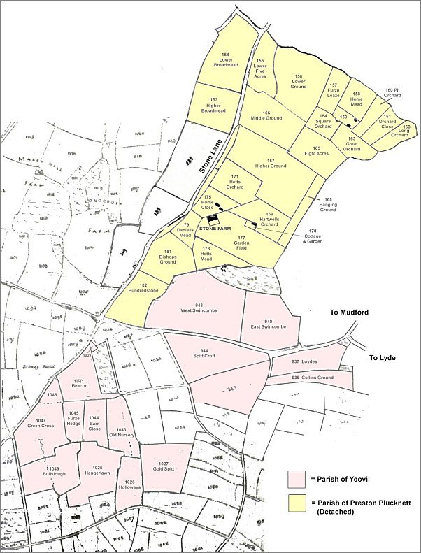
This map, based on the Yeovil Tithe Map of 1842 and the Preston Plucknett Tithe Map of 1849, shows in yellow the parcels of land of Stone Farm that were technically in the Parish of Preston Plucknett and in pink are the parcels that were technically in the Parish of Yeovil.
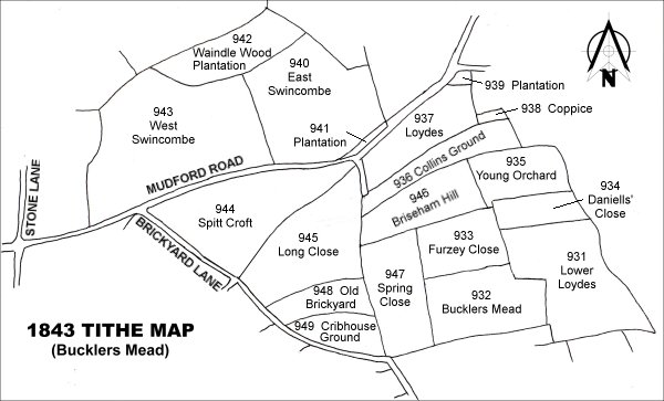
Drawn from the 1846 Tithe Map with field names added from the 1846 Tithe Apportionment, with Spitt Croft (Parcel 944) at centre left.
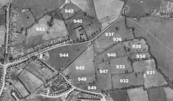
The 1946 aerial survey photograph with parcel numbers of 1846 plotted on.
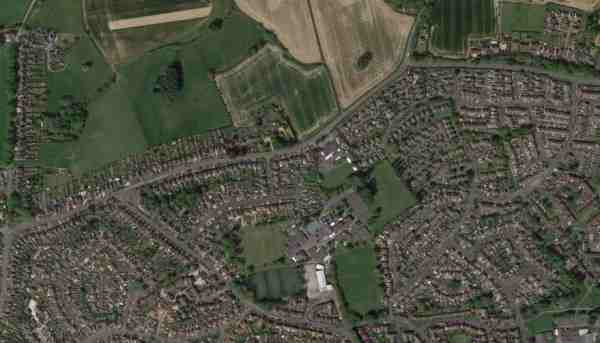
An aerial view (courtesy of Mr Google) of the area today.
The 1843 Tithe Map overlaid onto a modern map of the area.