Calvinist tabernacle
CALVINIST tabernacle
Giving its name to Tabernacle Lane
Earlier called Narrow Lane, in the mid-nineteenth century today's Tabernacle Lane was called Hannam’s Lane because Josiah Hannam, a senior member of the Society of Friends, had an ironmongery warehouse and a yard there. However Tabernacle Lane has been most often used since the founding of the Calvinist Tabernacle Meeting House in 1804.
In 1794 John Wainwright Morren became minister of the Congregationalist Church in Princes Street, resigning in 1804 after a doctrinal dispute which led to what the Church Record Book calls 'The Separation'. Led by John Hookins and his wife Elizabeth, a separatist group of the Congregationalists built a new meeting house in Narrow Lane.
In 1833 a plot of land 81 feet x 44 feet (24.7m x 13.4m) in Huish for a burial ground. The burial ground gave the name Paradise to this end of Huish. By 1886 the burial ground was disused. The site was later cleared and now lies under the magazines section to the south of the main entrance in the Tesco store in Huish.
In the 1850s Daniel Vickery wrote "The Tabernacle is situated in Hannam's-lane, and is a small, but very neat and commodious, place of worship. It was founded 50 years ago. The congregation has a burial-ground, in Huish, about 23 perches in extent. The present pastor is the Rev. J. Comfort".
|
Church Congregations From the Ecclesiastic Survey, March 1851 |
|
|
St John's |
614 |
|
Holy Trinity, Peter Street |
550 |
|
Congregational (now United Reformed), Princes Street |
530 |
|
Baptist, South Street |
300 |
|
Methodist, Middle Street |
250 |
|
Calvinist Baptist, Tabernacle Lane |
190 |
|
Brethren Hall, Vicarage Street |
93 |
|
Quaker Meeting House, Kingston |
8 |
The Tabernacle
had a
flourishing
congregation and
the
Ecclesiastic
census of 1851
recorded regular
congregations of
between 150 and
200. Indeed the
caption on the
map below reads
"Tabernacle
(Calvinist
Methodist) Seats
for 400".
However the
congregation
gradually
dwindled and by
the early
twentieth
century was
quite small.
Services finally
ceased in 1920
and the
Tabernacle
building itself
was demolished
in 1971.
MAPs
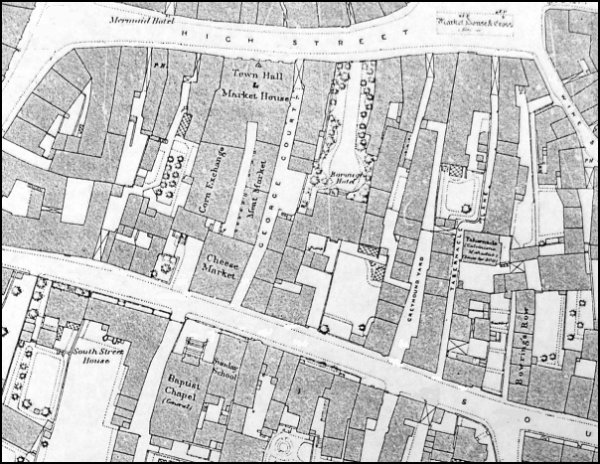
The 1886 Ordnance Survey showing High Street running across the top of the map and South Street at the bottom. Tabernacle Lane is at centre right running between the two while the Tabernacle itself is at the centre of Tabernacle Lane..
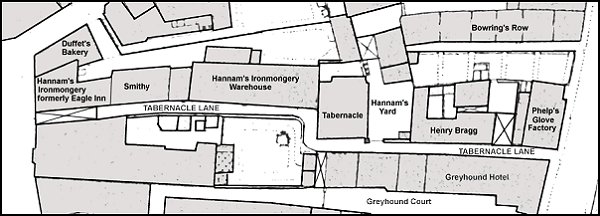
This map is based on the 1886 Ordnance Survey above, but rotated 90° with the Borough at extreme left and South Street at extreme right.
gallery
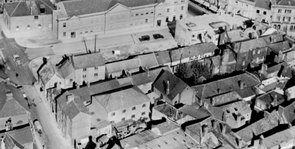
This aerial photograph dates to 1928 and shows South Street at left, High Street at top right and the newly-built King George Street running between the two at the top of the photo. Note that at this time the post office building along the eastern side of King George Street was yet to be built. At centre left, more or less on the corner of King George Street and South Street, is the thatched Cow Inn and behind it, and running parallel to King George Street are the dwellings in Greyhound Yard. The three-storey building next to the Greyhound Hotel was Henry Phelps' glove factory and to the right of it in the photo are visible the rooftops of the dwellings in Tabernacle Lane. At centre is seen the dark pitched roof of the Tabernacle itself.
This
colourised photograph
features in my
book "Lost Yeovil"
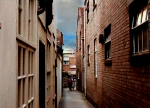
This photograph was taken around 1960, before the demolition of the buildings on the right. The gabled building at the end on the right by the two people is the tabernacle that gave this alley its name.
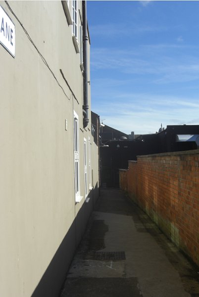
Almost the same view in 2013.
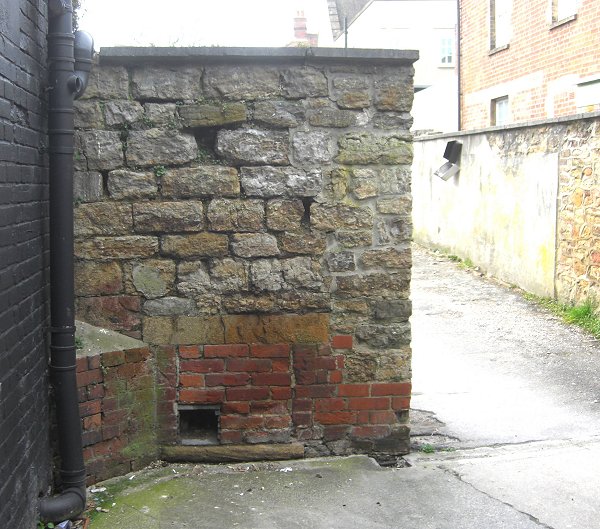
Approaching the dog-leg from High Street, this corner is about all that remains of the tabernacle. Photographed in 2013.
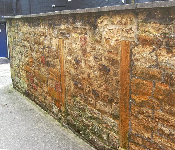
The wall by the dog-leg, these are the Ham stone door jambs of the original tabernacle. Photographed in 2013.