turnstile lane
turnstile lane
A 'cut' known as Lollipop Lane between Middle Street and South Street
The area known today as the Triangle is where Middle Street, South Street, Vicarage Street, Stars Lane and Fore Street (Lower Middle Street) met and in earlier times was the easternmost point of the Borough of Yeovil. It was originally called the Triangle because it was a small triangular piece of land containing buildings, shown on all known maps up to and including the 1886 Ordnance Survey, that was bounded by Middle Street on the north, South Street to the south and a small lane, some twelve feet wide but less than ten feet at its narrowest point, known as Turnstile Lane.
Turnstile Lane, running between Middle Street and South Street, was so called because of a restriction placed across it to prevent vehicular traffic driving through it. Its western side is now marked by the building built for the Co-operative Society in 1910 which now faces east across the open space we call the Triangle today.
For many years in the late nineteenth century it was known as Lollipop Lane because there was a bakery at one end and a grocery store which sold children's sweets including lollipops at the other end, both owned by a Mr Connock,
To the east of Turnstile Lane, where the open space known as the Triangle now is, was a block of cottages in the form of a triangle - hence the name of the area. Three cottages and a corner house and shop faced Middle Street, three faced Turnstile Lane and two faced South Street. The Middle Street shop included an oven and bakehouse, flour loft and stables. In the 1891 census two families in the gloving trade, a total of twelve people, lived in Turnstile Lane. This triangular block of buildings was demolished around 1900.
Interestingly, during the early summer of 2022 as landscaping works were being carried out in the Triangle, the original paved surface of Turnstile Lane was briefly exposed during excavation works - some three feet below the present road surface - see the Gallery.
maps
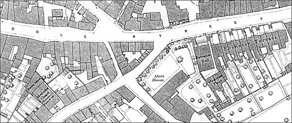
Map based on the 1886 Ordnance Survey shows the area now known as The Triangle to be built up. Turnstile Lane is the narrow lane between Middle Street and South Street.
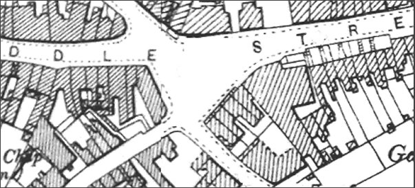
The same area seen on a map based on the 1901 Ordnance Survey showing the area known as the Triangle cleared of buildings. Only the building on the western side of Turnstile Lane survived and this was replaced in 1910 with the present building.
gallery
From my
collection
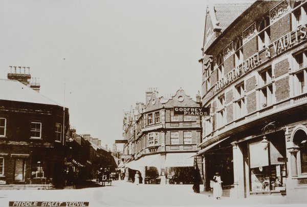
This is the earliest photograph I know showing the Triangle. It was taken between about 1900 (when the Coronation Hotel at right was built) and 1910 when the building at far left was replaced by the Co-operative Society building.
Courtesy of
Lynne & Tony
Cove
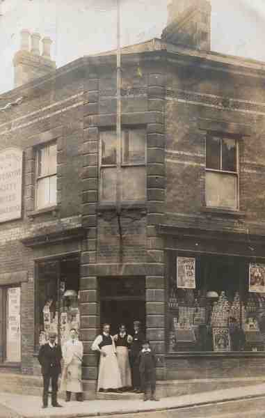
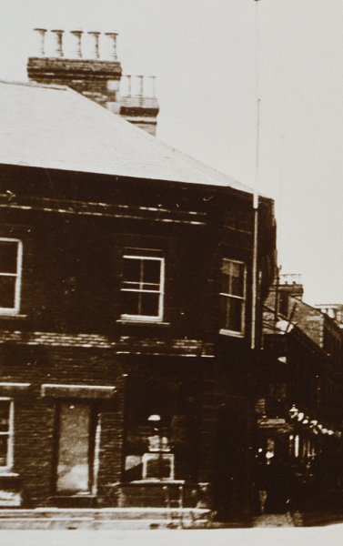
Photographed on 28 May 1908, this building (at the left in the previous photo) is the precursor to today's building in the Triangle that was most recently the Turkish restaurant. It was on the corner of Middle Street (running off to the right in this photo) and Turnstile Lane (running off to the left). The triangle of buildings on the eastern side of Turnstile Lane, opposite this building, were torn down around 1900 to create today's open space known as the Triangle. The man In the middle of the three standing in the doorway is Dennis Moore.
From my
collection
Originally this building, most likely the premises of Charles Foan from the 1830s to the 1850s, was on the northwest corner of Turnstile Lane. The eastern side of Turnstile Lane was demolished between 1886 and 1901, while this building was replaced by the Co-operative Society's shop and offices building (that survives today and appears in most of the images of the Triangle) by 1910.
Courtesy of Jack
Sweet.
This photograph
features in my
book "A-Z
of Yeovil"
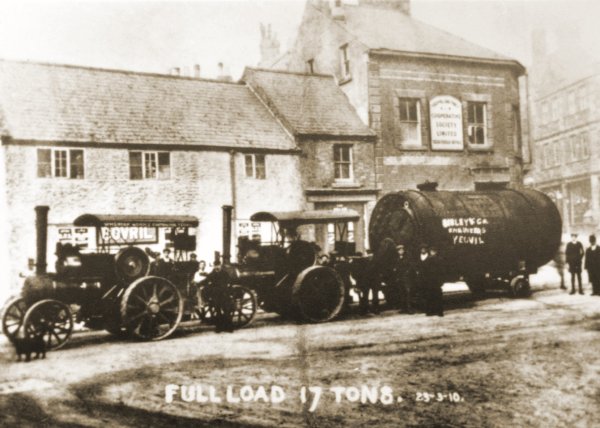
The buildings that were originally the west side of Turnstile Lane photographed on 23 March 1910. By this time occupied by the Yeovil & District Co-operative Society. The double tractor unit pulling the 17-ton load was owned by Sibley & Co. The buildings were demolished almost immediately after this photograph was taken.
The 2022 Excavation (A "Time Team Special")
From the summer of 2022 the Triangle is going through a re-vamp. During the works a small section of the original road surface of Turnstile Lane was unearthed, showing it to be composed of stone setts.
The following photographs were taken on 27 July 2022.
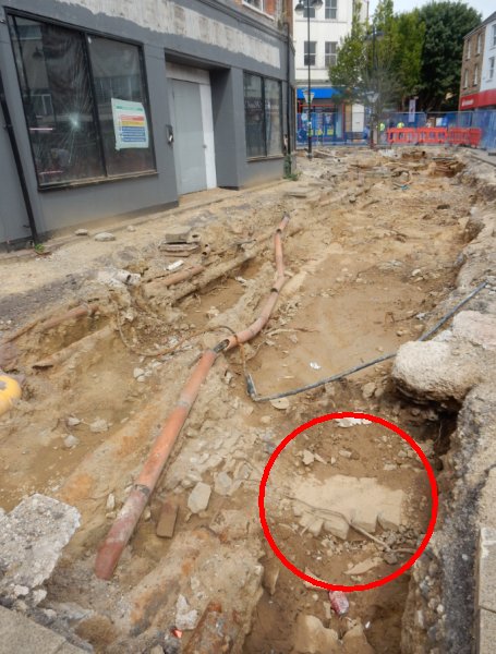
The excavation outside what had originally the Co-op building of 1913. The excavations reveal the original road surface of Turnstile Lane, circled red, was some two or three feet below today's surface level.
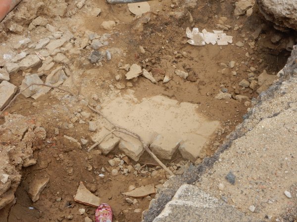
A close-up of the stone setts that made up Turnstile Lane's road surface.