Batt's Corner
Batt's Corner
A former part of the great West Field of Kingston Manor
Batt's Corner was originally part of the great medieval West Field of Kingston Manor.
The first part of the name of Batt's Corner (Parcel 582), also known as Butt's Corner, possibly derives from being "Land in a common field abutting more or less at right angle upon another section, or land which because of the irregular shape of the field, fall short of the full length." ('The Parish Chest', WE Tate, 1946). 'Batt' is a dialect word for the corner of a ploughed field deriving from the Middle English term for an irregularly-shaped end piece of a common field. The second part of the name comes simply from the fact that this former field lay in the corner formed at the junction of Preston Road and Ilchester Road.
Having said that, an indenture dated 6 April 1743 (see Gallery below), in referring to what would later become Batt's Corner, says ".... certain Field called West Field at or near a place there called Butter Corner...."
The Quaker's Burial Ground off Preston Road had been 'carved out' of the southwestern corner of Batt's Corner by 1689 and by the time of E Watts' map of 1806 a dwelling had been erected on a further subdivision to the immediate east of the burial ground (this site was later occupied by the Somerset Inn). Another dwelling had also been built in the southeastern corner, by the Fiveways crossroads.
By the time of Watt's 1831 map the terrace of cottages known as Tavener's Row (later Primrose Cottages) had been built along the edge of the former field abutting Ilchester Road.
What was left of Batt's Corner (Parcel 582) was shown in the 1846 Tithe Apportionment to be just 0a 3r 10p and an orchard. It was owned by James Ellis and Phoebe Mitchell was the tenant.
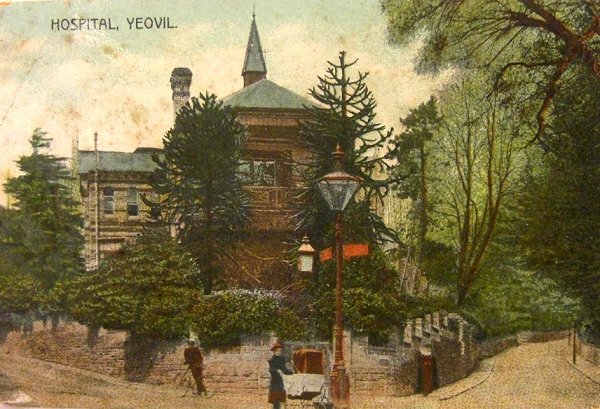
The last vestiges of the former Batt's Corner was purchased for £410 (about £230,000 at today's value) in 1868 as the site of Yeovil's new, permanent hospital. The hospital was demolished in 1969 and It wasn't very long afterwards that the whole of the Fiveways roundabout was remodelled and the southeastern corner of the former Batt's Corner was lost forever.
For details on historic land measurement (ie acres, roods and perches) click here.
maps & Aerial Photographs

This map, based on the descriptions in the 1589 Terrier and the 1846 Tithe Map of Yeovil shows the approximate boundaries of the Manors of Kingston and Hendford as well as the manorial three-field system used in Kingston.
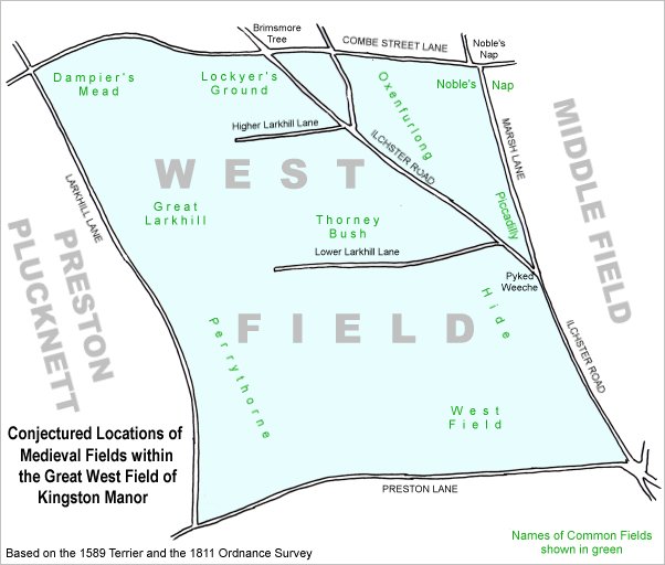
A conjectural map of the great West Field of Kingston Manor showing ancient sub-fields, most likely common fields, within the overall bounds of West Field.
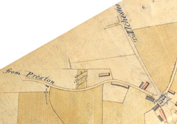
Batt's Corner shown on E Watts' map of 1806 (I've turned the map to align it with the other maps below, hence the white area top left which is actually the edge of Watt's map). By this time the Quaker's Burial Ground and a building to its east (on the site of the later Somerset Inn) had already been 'carved out' of Batt's Corner.
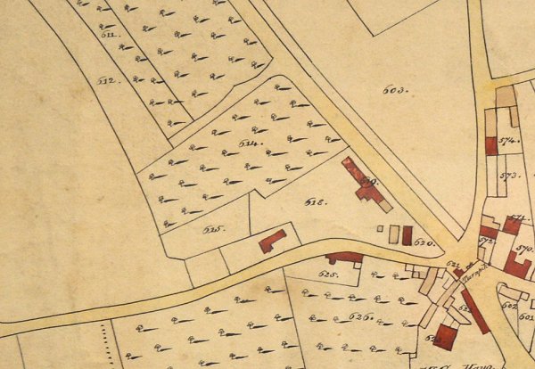
By the time of E Watts' map of 1831 Batt's Corner had been further split and the terrace of cottages known as Tavener's Row (later Primrose Cottages) had been built.
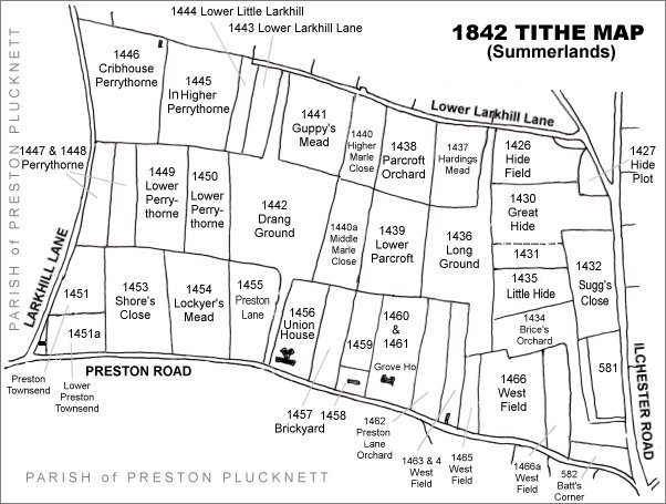
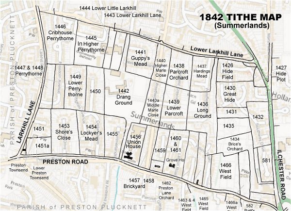
The Larkhill area reproduced from the 1842 Tithe Map. Batt's Corner is at extreme bottom right.
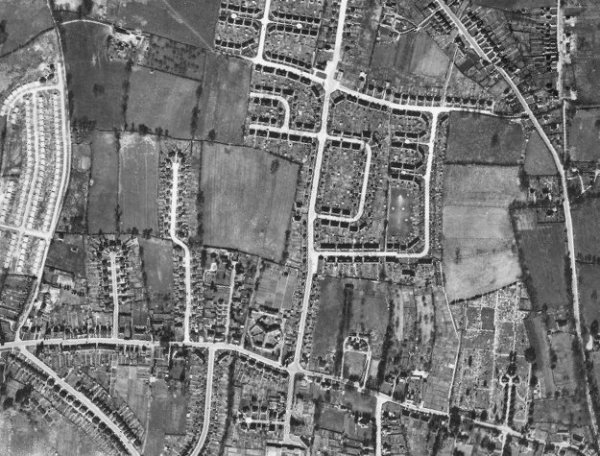
The 1946 aerial photograph.
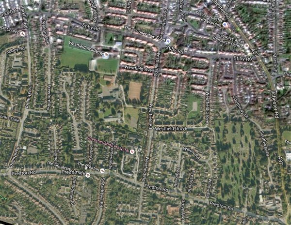
The same area today 'borrowed' from Google maps.
The 1842 Tithe Map superimposed (only very slightly out at the bottom) over a modern map.
gallery
![]()
An extract from an indenture dated 6 April 1743 (I've added the red lines on the image) which says ".... certain Field called West Field at or near a place there called Butter Corner...."
From my
collection
The hospital at Fiveways, with Preston Road running off to the left and Ilchester Road running off to the right. Judging by the size of the trees outside the hospital, this postcard dates to about 1908. All of the land in this postcard was the former Batt's Corner.
This colourised photograph
features in my
book 'Yeovil
From Old
Photographs'
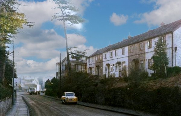
Tavener's Row / Primrose Cottages photographed in the mid-1960s.
The Fiveways Hospital was demolished in 1969, photographed from Fiveways Roundabout. At right is the terrace of houses called Tavener's Row, later Primrose Cottages. Both the hospital and Tavener's Row were built on the former Batt's Corner.
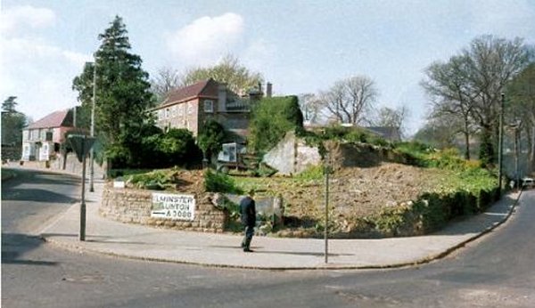
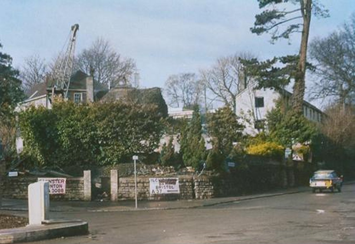
After the demolition of the hospital and Primrose Cottages the former Batt's Corner was relatively clear once more. At far left the Somerset Inn would have been about halfway along the former field's frontage to Preston Road. It wasn't very long after this late 1960's photograph was taken that the whole of the Fiveways roundabout was remodelled and this corner of the former Batt's Corner was lost forever.