church lane
church lane
Today's Church Street
St John's church has given its name to Church Lane, Church Path, Church Stairs, Church Steps, Church Street, Church Terrace, Church Walk and Churchyard.
Church Lane, today's Church Street, was most likely a medieval (if not earlier) lane running along the southern boundary of St John's churchyard, running parallel to High Street and linking today's Princes Street and Silver Street. Certainly it was known as Church Lane when gentleman Thomas Hobbs wrote in his will of 1797 "... I give and bequeath the Sum of Five pounds of like Money unto my Cousin John Barrett Cordwainer in Church Lane in Yeovil aforesaid ...". However, it was known as Church Street at least as early as the 1841 census.
Unlike today, where its eastern half is little more than a footpath, the lane was originally more or less the same width through its length, narrowing only at its junction with Silver Street but you'd still be able to drive your horse and cart for its whole length. The churchyard was fenced off from the lane until relatively recent times to stop horses, dogs, etc. wandering into the churchyard and the church itself.
Buildings of note in Church Street are the beautifully-proportioned Church House (built about 1770 for the Batten family) with the attached old County Court building, No 4 Church Street (built in the late 1840s, now also offices) and St John's Schoolrooms (built in 1854 and rebuilt in 1897).
maps
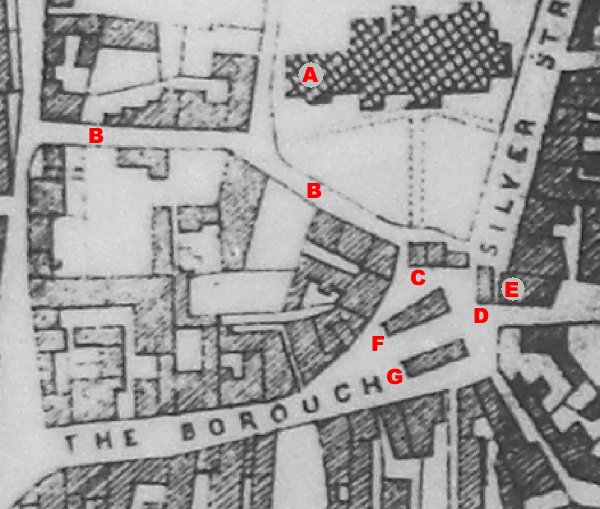
Day's map of
1831 showing the
Borough, plus a
few associated
features;
A = The
Chantry in
original
position,
B = Church Lane
/ Street, C =
Tolle Hall,
D = Bow,
E =
London House,
F = The
Butchers'
Shambles, G
=
Market House.
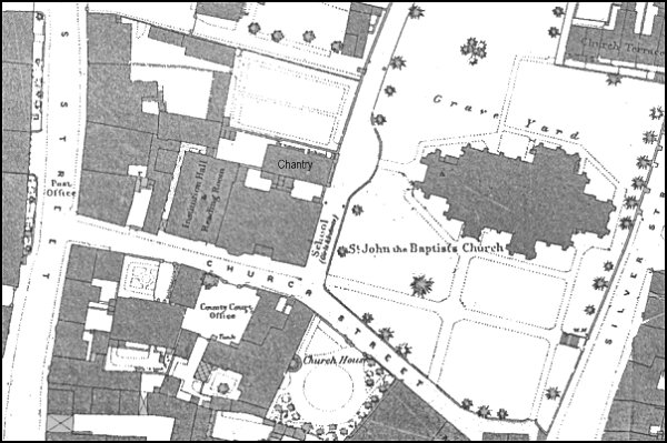
Map based on the 1886 Ordnance Survey.
gallery
This
colourised photograph
features in my
book "Lost Yeovil"
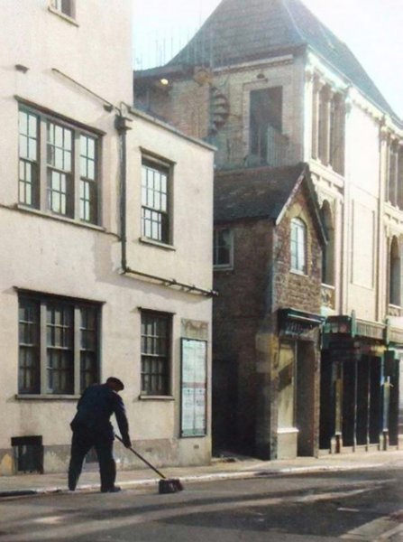
An evocative image of a road sweeper at the western end of Church Street, probably photographed in the 1950s, with the Central Cinema at right.
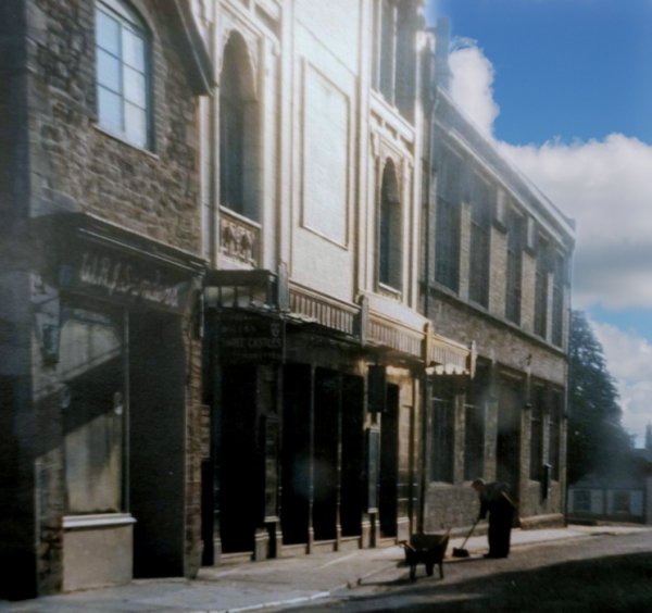
Photo by Bernard
White
(colourised). Courtesy of South Somerset Heritage Collection
Again, photographed in the early 1950s. Is that the same road sweeper?

A colourised photograph of 1942, seen from Church Street. Who remembers the Chelsea Tea Rooms?
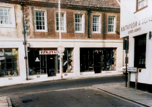
.... and then there were shops. The junction of Church Street and South Street in a colourised photographed of the 1960s.
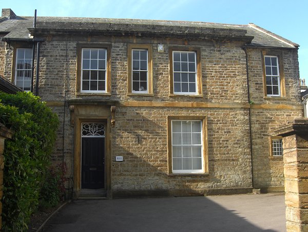
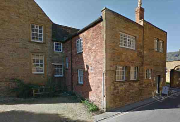
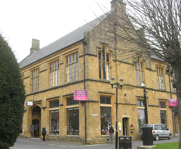
No 4 Church Street. Photographed in 2014.
Courtesy of Rob
Baker. This
photograph
features in my
book 'Now
That's What I
Call Yeovil'
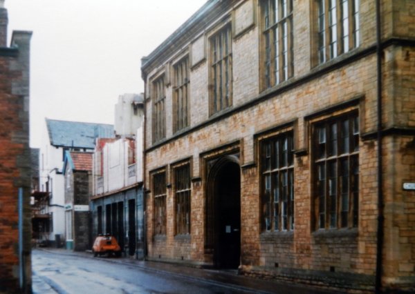
St John's schoolrooms in 1988 before being converted to shops. Note the half-demolished Classic Cinema next door.
The old County Court building in Church Street, attached to Church House, seen from the west. Photographed in 2014.
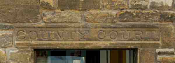
The sign above the door, facing Church Street. Photographed in 2014.
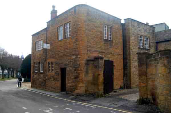
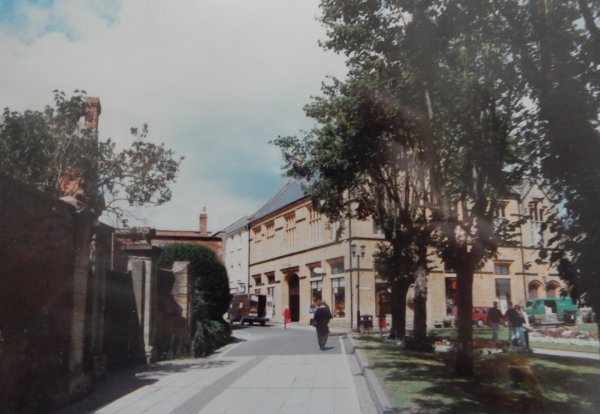
The old County Court building seen from the junction of Church Street and Church Path. To the left, the area now used as a car park for the Church House offices, was originally a wing of the house but was destroyed by bombing in 1940. Photographed in 2018.
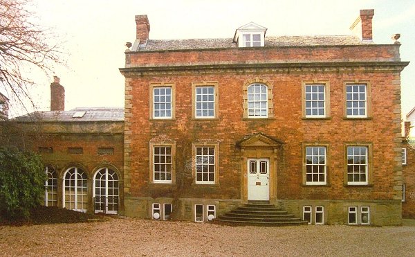
Church House, photographed about 1960.
Courtesy of Jack
Sweet
Church Street photographed in 1993.
St John's Schoolrooms photographed in 2013. Church Street runs to the left and behind where I stood to take the photo. Church Path runs to the right.
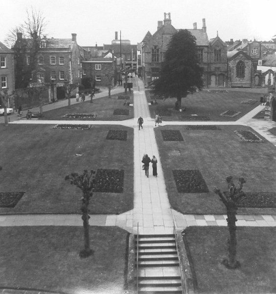
St John's churchyard, south side, photographed in the 1970s. Church Lane, today's Church Street, is at top left.

The original of
this photograph
features in my
book 'Yeovil
From Old
Photographs'
A colourised photograph of St John's churchyard photographed in the mid-1960s. Church Street is at centre and runs off to bottom left while Church path runs from centre to right, past St John's schoolrooms and the Chantry.
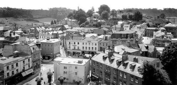
The Borough as seen from the top of St John's tower and photographed in the mid-1960s. At bottom left is the top of Silver Street, along the bottom is the eastern end of Church Street.
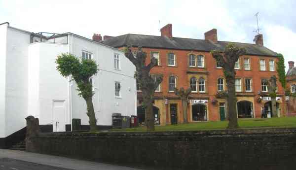
The eastern end of Church Street, facing St John's church. Photographed in 2013.