silver street
silver street
...also earlier known as Cornmarket and Stairs Hill
Silver Street
has been known
by several names
in the past; St
John’s
churchwardens’
accounts from
the sixteenth
century refer to
it as Stairs
Hill alluding to
the steps in the
churchyard wall
giving access to
the churchyard
from the street.
The original
steps were lower
down the hill,
closer to the
church, and a
slight recess in
the wall
indicates their
former position.
Indeed at this
point are two
date-stones, the
first of 1621
refers to the
major rebuilding
of the
churchyard wall
and slightly
below it the
date-stone of
1886 refers to
when the steps
were blocked up
and the present
steps, further
up towards the
Borough, were
installed.
It is said that a road called Silver Street often alludes to water, and in Yeovil’s case the Rackel stream created a shallow ford across the road, just outside the Pall Tavern, as it flowed into the Horse Pool by the side of the inn. The other side of the shallow ford the road was at one time known as Ford Street, a deed of 1355 referring to it called it "a street named Ford Street in Kingston" (that is, the Manor of Kingston). Later it became known as Rackleford or Reckleford and finally today's Market Street.
In the 18th century the top part of Silver Street, from the Borough as far as Vicarage Street, was often referred to as Cornmarket, alluding to the transactions that took place there on market days before the Corn Exchange was built behind the Town Hall in High Street.
Until the early 19th century a row of small dwellings, little more than shacks, were built up against the wall narrowing the roadway considerably. “The churchwardens appear to have received 6s. from six persons, for houses resting on the church yard wall, in 1706; but from 1708 to 1741, 9s. per annum appear to have been received from Edward Phelips, and Madam Phelips, and then ceased. The site upon which these tenements stood is a narrow strip of land, bounded on one side by the church-yard wall, the other being open to the street. At one end of it is a flight of steps leading to the church-yard ; at the other a public well, called Nuns' Well. The buildings on this land consisted of two pent-houses and a blacksmith's shop, which, becoming in the year 1806 very dilapidated, were taken down by the Rev. W. Phelips, who was lord of the manor, and the materials given away.” (Vickery, 1856).
One of these buildings appears in leases dated 1668 and 1771 and is referred to as a burgage called "Cold Harburrough over against Broad church steps".
In 1835 a fire that started in the King’s Arms destroyed the building along with several other premises. Following the fire all the premises from the King’s Arms to the Pall Tavern (there is a date-stone of 1836 on the corner of the Pall Tavern) were rebuilt further back from the road so that Silver Street could be widened thereby easing congestion in the centre of the town. Silver Street also had a third public house - the Half Moon Hotel.
|
Yeovilians
remember... |
gallery

This colourised
image
features in my
book 'Yeovil
- The Postcard
Collection'.
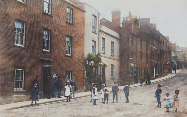
This photograph was taken around 1900 from the Borough, looking towards the junction of Silver Street at left and Middle Street at right. The large building on the corner was London House which belonged to Thomas Thorne, a Draper. It was demolished and replaced with the current bank building, Going down Silver Street was a boot stores, a greengrocer and then the Half Moon Hotel.

This photograph of Silver Street, taken from the Borough, was by J Slade and published as a postcard in 1913. At the extreme right side, with the awning, is London House which was demolished in 1913 and the present building built for the Midland Bank opened in 1914. The photograph features a single-light Sugg lamp at the centre.
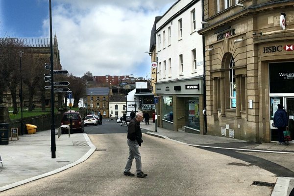
The 'top' of Silver Street following the 'Yeovil Refresh' project, with reduced road width and wider pavement. Photographed in February 2024.
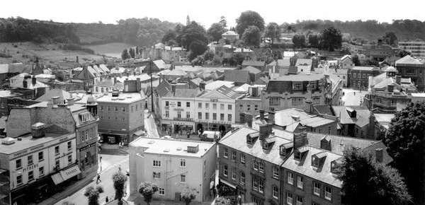
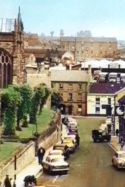
The Borough as seen from the top of St John's tower and photographed in the mid-1960s. At bottom left is the top of Silver Street, along the bottom is the eastern end of Church Street.
Taken about 1960, this colourised photograph is taken from the top churchyard steps. The row of shops at right have all disappeared with the building of the Quedam shopping centre. The entrance to Vicarage Street, another casualty of the Quedam, is just visible at centre, between the white building in Court Ash and the man walking along the pavement.
Courtesy of Toby
Newcombe, photo
by Simon
Newcombe
Almost the same view as the previous photograph, but this 1980's image is some twenty years later.
A colourised photograph showing the lower half of Silver Street. I'd guess the photograph dates to the late 1960s or early 1970s.
From the Cave
Collection
(colourised),
Courtesy of South Somerset Heritage Collection
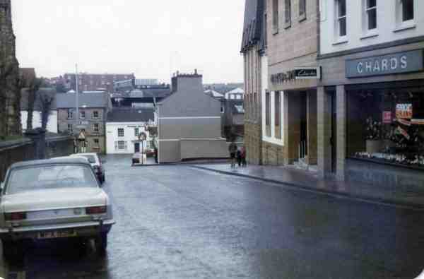
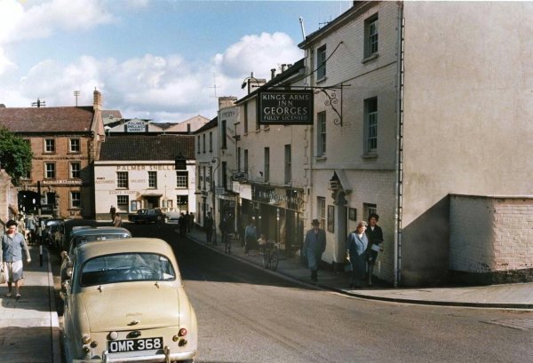
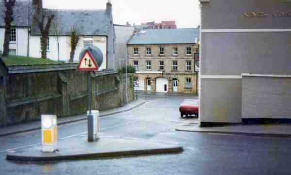
This photograph was taken in the 1960's and looks down Silver Street towards its junction with Court Ash and Market Street. The King's Arms Inn is the three story white building at right, at the junction with Vicarage Street.
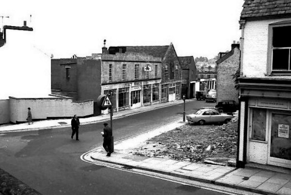
This photograph was taken from the churchyard about five years later and shows Silver Street along the bottom with the junction of Vicarage Street. Buildings have been demolished either side of the junction and the white building at left is the King's Arms. Compare this with the photo below taken in 2013.
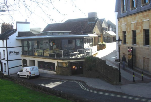
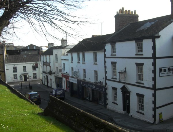
The same view as above but taken in 2013.
Courtesy of Toby
Newcombe, photo
by Simon
Newcombe
The lower end of Silver Street, photographed in the 1980s from the junction with Vicarage Street.
This
colourised
postcard
features in my
book 'Yeovil
- The Postcard
Collection'.
This postcard dates to around 1900. Henry Little's gun shop cum ironmongery was the three-storey, single-bay bow fronted building adorned with buckets and other ironmongery paraphernalia, next to the Pall Tavern (in naked brickwork!).
From my
collection
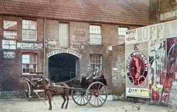
The Pall Tavern's yard, in a colourised photograph taken in 1908. The side wall of the Pall itself is at extreme right with 'Beecham' written on it at high level. The main building of this photograph is now an Indian restaurant.
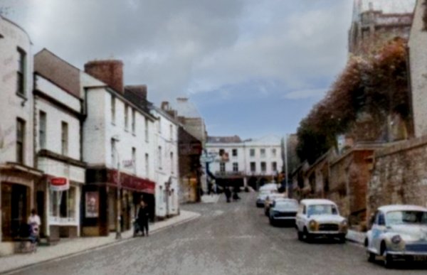
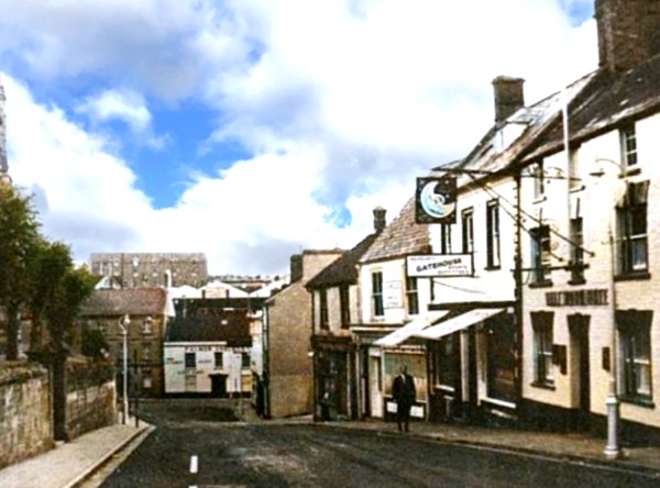
Just a few yards further up and dating to about 1965, this colourised photograph is taken from the bottom of Silver Street looking up towards the Borough. The junction of Vicarage Street is seen at left, about halfway up.
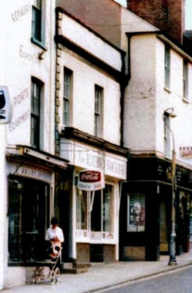
An enlargement of part of the previous photograph showing the Bluebird Snack Bar - well remembered by many Yeovilians of a certain generation.
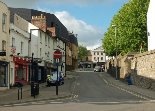
The same scene in 2013, little changed except for the proliferation of street furniture and, of course, the massive structure of M&S.
.... and seen from a slightly different angle in 2013.
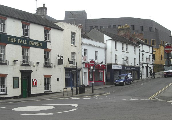
At least this scene has changed little since the rebuilding of these buildings from the King's Arms to the Pall Tavern following the fire of 1835, apart from changes of occupiers and modern traffic. Photographed in 2013 from St John's churchyard.
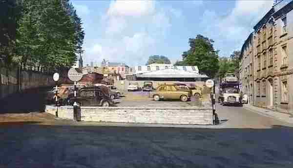
Fair Ground in the mid-1960's seen from Silver Street with North Lane at left and the eastern end of Court Ash at right. The building at the rear of the car park was the poultry shed.