Clarence Street
Clarence Street
Former Park Lane, renowned for its brewery
The earliest map we have of Yeovil was surveyed and drawn by Edward Bullock Watts, the Town Surveyor, in 1806 (see Maps). Although not named on the map, today's Clarence Street was called Park Lane at the time because it led from Huish in the south to Ram Park at its northern end. This map shows that to the west it was completely open to fields and gardens mostly owned by the Goodford family, except for Clarence Place..
Clarence Place was a small terrace of four dwellings off the west side of the southern end of Clarence Street. It was sandwiched between Joseph Brutton's malthouse to its north and the Yeovil Iron & Brass Foundry, owned by Sansbury & Savery then William Rowe and finally acquired by James Petter in 1872. Clarence Place was referred to in an indenture dated 1709 "Gardens adjoining Nos 1-4 Clarence Place". The Poll Book of 1832 shows that the houses were owned by John Thomas of Middle Street.
The only buildings on the eastern side at this time were the Congregational Church (the first church built on this site, erected in 1791) with its entrance onto Clarence Street and marked 'Chapel' on the map. To the north of this were two outbuildings that were possibly the buildings of a former brewery on this site in the late eighteenth century.
In 1824 Thomas Cave established a brewery in Clarence Street (actually behind his house in Princes Street), possibly in the buildings previously used as a brewery referred to above. The company originally started life as Kitson & Cave which was listed in Pigot's Directory of 1824 but by 1830 Pigot's Directory listed Thomas Cave as a 'Brewer & Maltster of Hendford' in his own right (This, in fact, although called Hendford was actually today's Princes Street and Cave's house was (today's) 23 & 25 Princes Street).
By the time of Edward Watts' 1831 map, the western side was beginning to be built up. On the very corner with Huish were two substantial three-storey houses originally known as Victoria Place. The manager of the Yeovil Iron Foundry Frank Edgar and his family lived at No 1 and the family of builder George Harris lived at No 2 (see Gallery).
During the 1860s Park Lane was renamed Clarence Street apparently in honour of Prince Albert Victor, Duke of Clarence and Avondale (1864 -1892), the eldest child of the Prince and Princess of Wales (later King Edward VII and Queen Alexandra) and grandson of the reigning British monarch, Queen Victoria. However, since Clarence Place is recorded in 1709, this attribution seems dubious.
Maps and aerial photographs
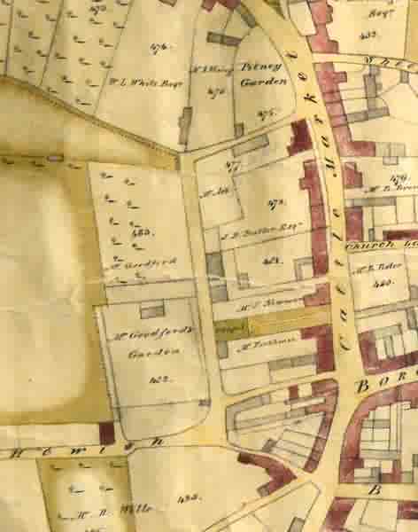
A section of the 1806 map of Yeovil by Edward Bullock Watts, showing today's Clarence Street at centre. To the west it was completely open to fields and gardens mostly owned by the Goodford family. The small building situated in "Mr Goodford's Garden" is probably Clarence Place
At top left the triangular piece of field is the corner of Ram Park and at this time today's Clarence Street was known as Park Lane since it led from Huish to Ram Park.
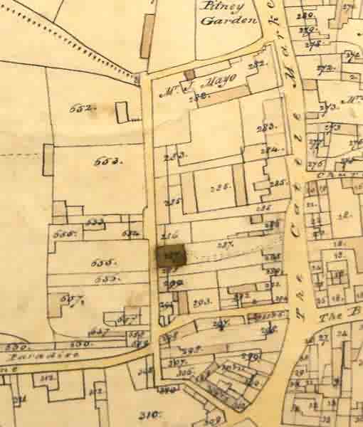
Part of the 1831 map of Yeovil also surveyed and drawn by Edward Watts. Just left of centre is today's Clarence Street. The road then running off to Cattle Market (today's Princes Street) would become Park Road. By this time the nascent Yeovil Iron Foundry
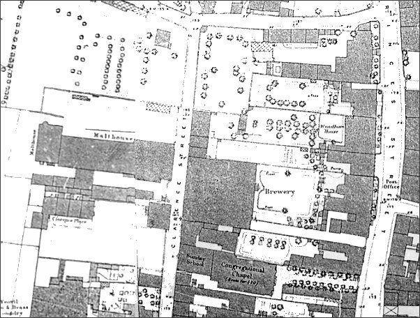
The 1886 Ordnance Survey of the Clarence Street / Princes Street area showing the brewery at centre and the malthouse at centre left. At very bottom left is the substantial Yeovil Iron & Brass Foundry run by Petter & Edgar.
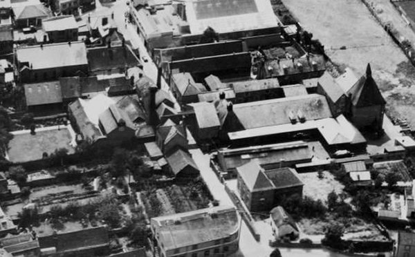
This 1935 aerial photograph shows Clarence Street running diagonally down the centre of the photograph to join with Park Road at bottom, right of centre. Almost at dead centre of the photograph is the high-level walkway spanning Clarence Street, with the brewery building to the left and the malthouse buildings to the right. At the very, very top right corner the small dark triangle is the start of the Yeovil Town Football Club's ground.
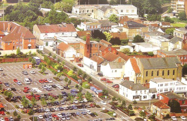
Clarence Street, photographed from the air in 1991. Brutton's malthouse has been replaced by Tesco's car park, which is yet to have its upper storey added. The main brewery buildings remain on the east side, later to be replaced by blocks of flats.
gallery
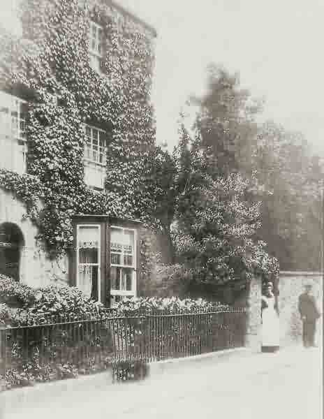
No 2 Clarence Street, formerly Victoria Place, the family home of builder George Harris photographed around 1900. The manager of the Yeovil Iron Foundry Frank Edgar and his family lived at No 1 Clarence Street immediately off-photo at left.

From the Cave
Collection,
Courtesy of South Somerset Heritage Collection
The 1960's, when Yeovil had 'proper' double-decker buses. The Heart of Oak (now the Westminster) is on the corner to the immediate right of the bus. The large building with the tower belonged to Douglas Seaton Ltd, the main Ford dealership in the area. This was built on the site of the former Victoria Place but was demolished as part of the Tesco redevelopment. Note at the far left Westminster Street continued directly into Huish.
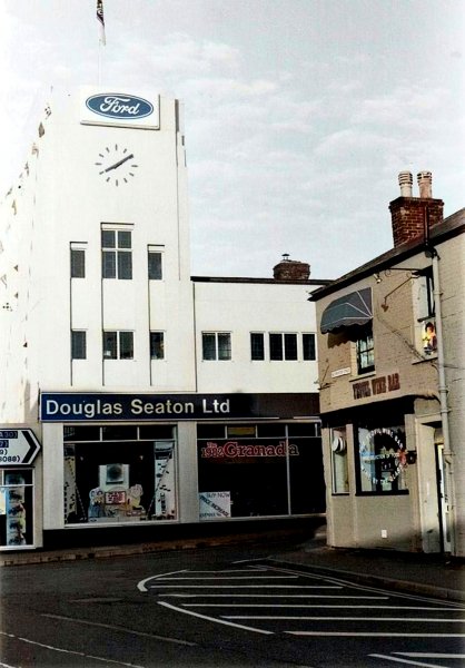
The iconic Douglas Seaton's tower and the Yeovil Wine Bar, on the corner of Clarence Street in this colourised photograph of 1982.
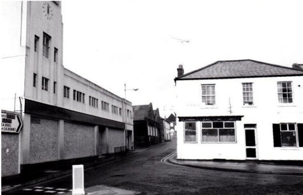
A view of the Hearts of Oak seen from Westminster Street, looking along Clarence Street which seems so narrow compared with today. Douglas Seaton's showrooms are empty and boarded up awaiting demolition for the new Tesco store and car park.
Courtesy of
Allan Harding. This
photograph
features in my
book "Lost Yeovil"
The former Douglas Seaton's showrooms are at left in this view taken in 1988 from a bit further along Clarence Street.
Courtesy of
Allan Harding
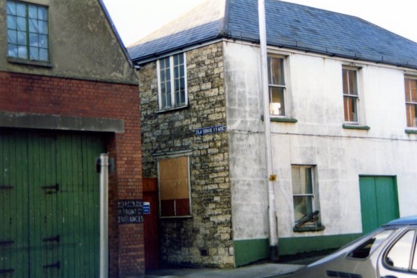
Also photographed in 1988, this is taken a bit further along and shows the entrance to Clarence Place - small cottages had originally been down what looks like an alley.
Looking north along Clarence Street from the side of the Westminster. Photographed in 2015.
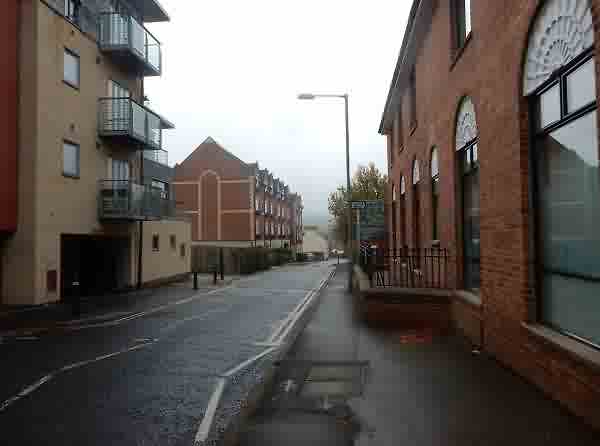
Looking back to the junction with Westminster Street. Directly opposite is Waterloo Lane and, until relatively recently, Huish ran off to the right. Photographed in 2015.
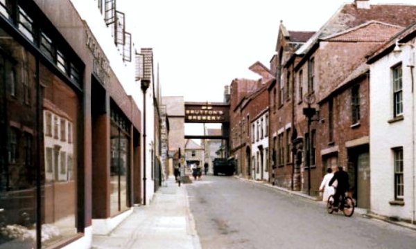
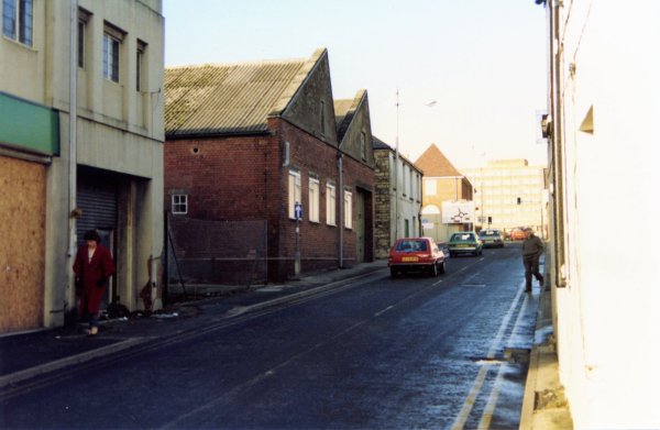
Looking north along Clarence Street in the mid-1960s. With the brewery on the right had side of the road and the malthouse on the left, the high-level covered bridge allowed staff to easily get from one site to the other.
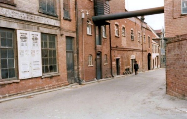
Looking back
down Clarence
Street from just
beyond the
covered bridge
in the previous
photograph, this
is a view of the
rear of the
brewery.
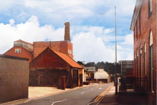
A 1960's photograph of part of the brewery buildings.
From the Cave
collection. Courtesy of South Somerset Heritage Collection
Clarence Street photographed in the 1960s. The remaining brewery buildings are seen above the white building on the left. The large building at centre was the original Congregation chapel fronting onto Clarence Street.
Courtesy of Jack
Sweet
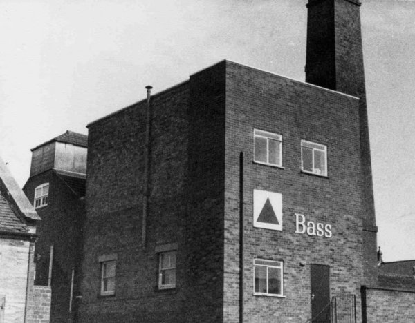
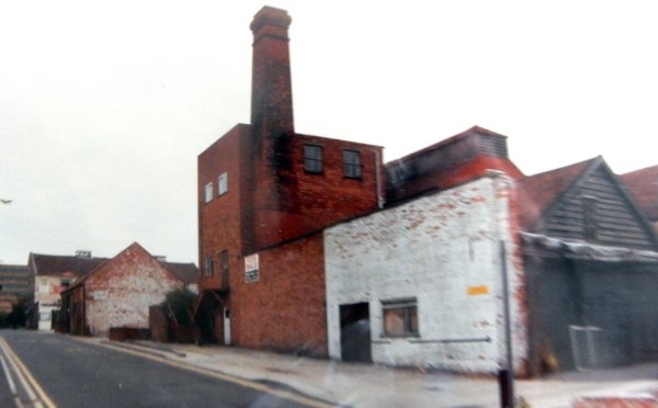
The brewery photographed in 1993.
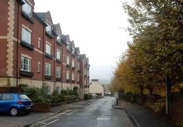
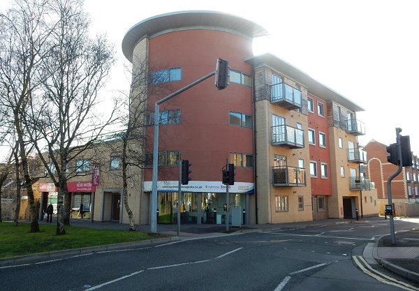
Still looking back to the junction with Westminster Street but moving halfway along Clarence Street. To the left Clarence House now dominates the streetscape while to the right the trees and shrubs mask Tesco's car park. Photographed in 2015.
This photograph of the 1960s, looks south along the whole length of Clarence Street from outside Telford House - glimpsed at the right edge.
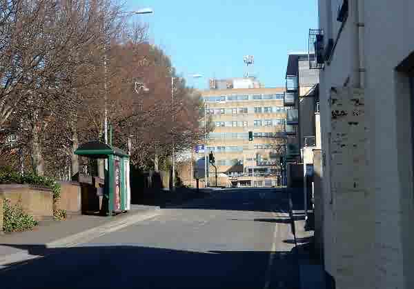
Almost exactly the same view as the previous photograph - the length of Clarence Street viewed from close to its northern end and the junction with Park Road. At left are the flats that were built on the site of the old Gardens nightclub and at right is Telford House. Photographed in 2015.
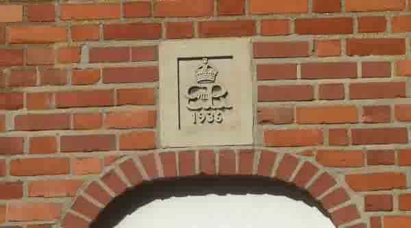
It is unusual to find a datestone for the year of 1936 when Edward VIII was briefly on the throne before his abdication. This is on the wall of Telford House, facing Clarence Street. Photographed in 2013.
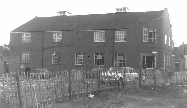
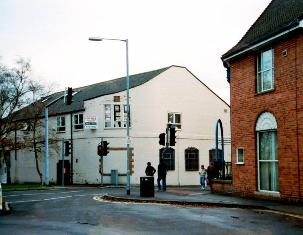
Edwin Snell's printing works on the corner of Park Road and Clarence Street. Photographed in the 1970s (?). Edwin Snell moved to Babylon Hill and the printing works were subsequently occupied by Haynes publishing company before becoming the Gardens nightclub in 1981.
This
photograph
features in my
book "Lost Yeovil"
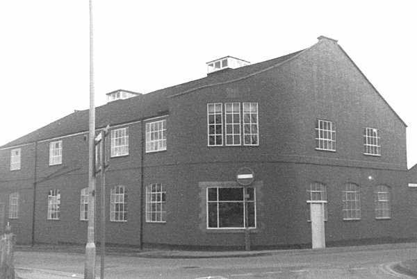
.... and seen from the opposite corner with Park Road running across the bottom of the photograph and Clarence Street off to the right.
Courtesy of
Vivien and John
Cornelius
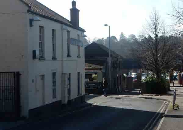
The corner of Park Road and Clarence Street photographed in 2006.
The same corner in 2015. Originally (well, certainly in 1806) Park Road only ran from Princes Street (off photo to left) to this corner and then continued as Park Lane (today's Clarence Street, seen here running off right).
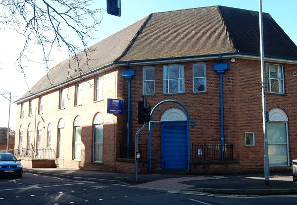
On the other corner of Clarence Street is Telford House, built in 1932 as Yeovil's telephone exchange and extended in 1936. (I worked here for a couple of years from 1973 when the Borough Architect's office was on the first floor before moving to King George Street). Photographed in 2013.