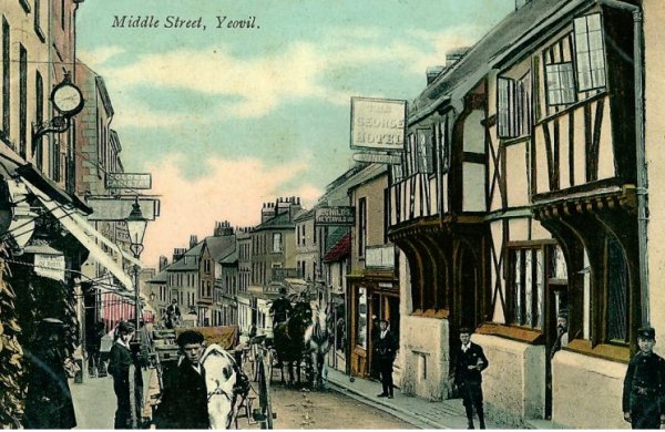
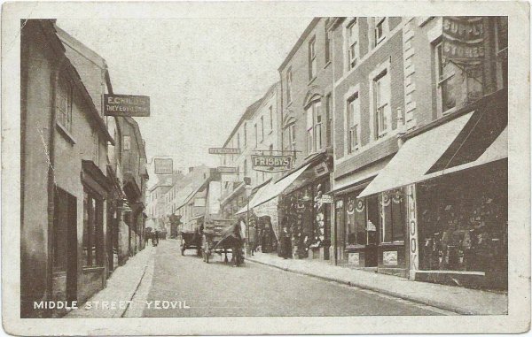
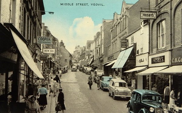
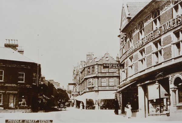
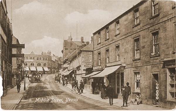
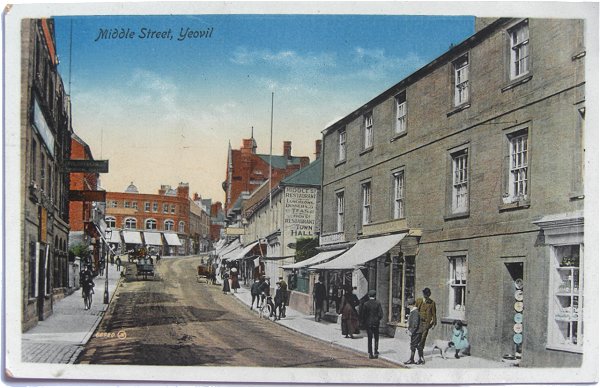
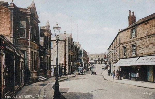
Middle Street
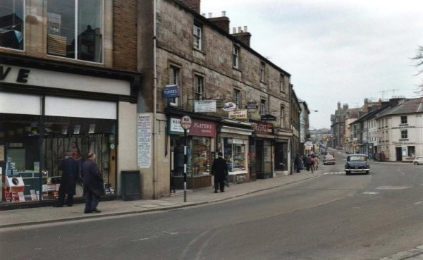
Middle Street
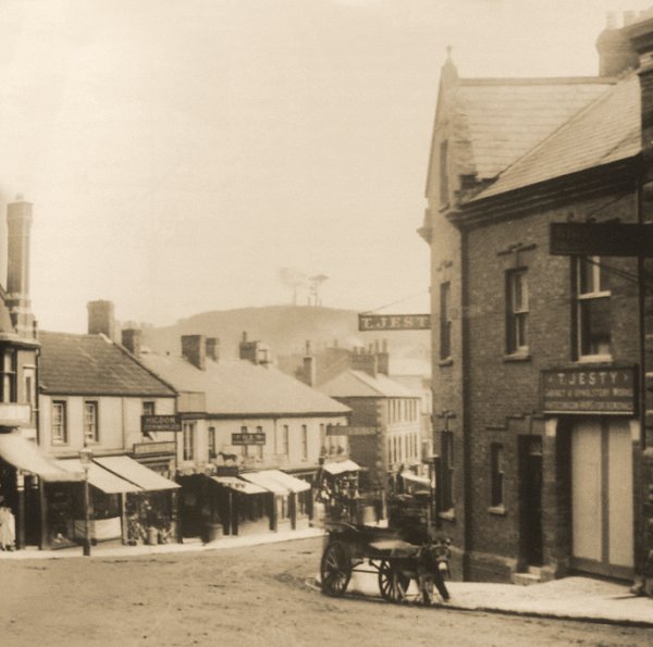
The medieval Pit Lane
From the 14th century at least that part of present-day Middle Street running from the Borough to the Triangle was known as Pit Lane or Pyt Lane, probably because of a number of flax pits or tanning pits were in the vicinity. A document in the Woborn Muniments, dated 1367, refers to it as “the royal strete de la Put” and In 1419 Middle Street was called Putlane in the following deed "Conveyance by Thomas Harlyng, parson of the church of Yevele and lord of that town, to Richard Muleward alias Bentele, 'webbe,' of Yevele, Joan his wife, and Thomas their son, for their lives, after the death of Joan late the wife of Walter Horsman, of a messuage with a curtilage adjoining, belonging to the chantry of the Holy Trinity of Yevele, within the free borough of the said town, in a street called 'Putlane.' Witnesses:—William Loumbard, provost of Yevele, and others (named). Friday the Annunciation, 6 Henry V. Seal". It was still being referred to as Pit Lane as late as the middle of the 19th century.
The area known today as the Triangle but in earlier times called Vennell's Cross, is where Middle Street, South Street, Vicarage Street, Stars Lane and Fore Street (Lower Middle Street) meet and was originally the easternmost point of the Borough of Yeovil.
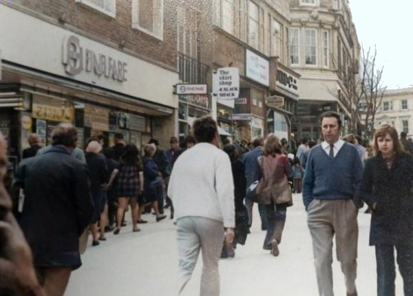
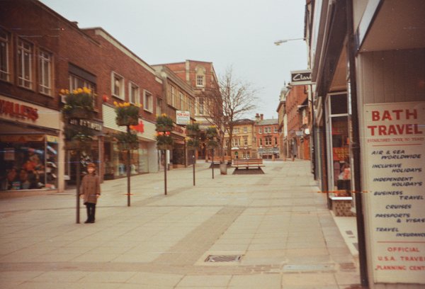
That part from the Triangle to Wyndham Street is variously known as Middle Street or Lower Middle Street while the section between Central Road and Wyndham Street is today colloquially known as 'Takeaway Alley' because of the large number of fast food establishments that have congregated here in recent years.
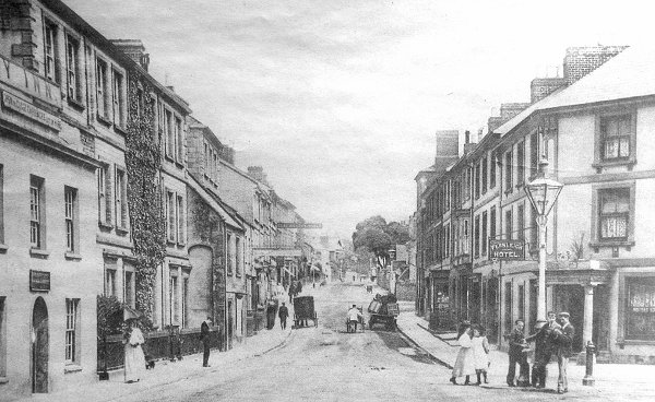
Part of the medieval borough, Middle Street had originally been very narrow indeed and lined with irregularly sited and mostly thatched houses which contributed greatly to its destruction through a series of fires. There were also a number of unsavoury ‘courts’ or infill housing for the very poorest such as the infamous Dean's Court where eight houses shared one privy that was so close to the court’s well that it became contaminated. The road was largely unpaved and had an open ditch, called a ‘sewer’, until at least the 18th century.
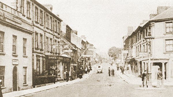
In 1856 Daniel Vickery wrote "In the year 1449, one hundred and seventeen houses in the town were destroyed by fire, and some years ago a large fire which took place in Middle-street burnt several houses, which led to the widening of the street.... Several streets have been widened, such as High-street and Middle-street, formerly the main coach line from London to Exeter, part of the latter being at one time only twelve feet wide."
There was only one large house in the street, a mansion on the site of the present WH Smith building. It was built by William Daniell (??-1779), a rich glove manufacturer, and boasted “a large vestibule, two parlours (one 17 feet by 22 feet with a bow window), good bedrooms, a servants’ hall, kitchen, brewhouse, stables and coach-house. Elegantly furnished, with a pleasant walled-in garden planted with fruit trees and flowering shrubs, it was to be let, the new owner preferring to live in his own Penn House.” (Hayward, 1987, p14). The new owner was Daniell’s son, Peter Daniell, the town developer.
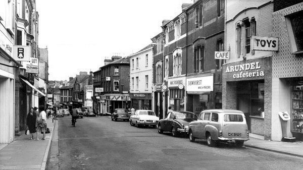
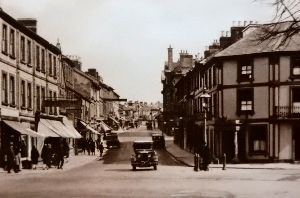
Two medieval buildings survived, the Castle Inn and the George Inn, but both were demolished in the twentieth century for street widening - until 1958 Middle Street was part of the A30 London to Exeter trunk road! The Castle Inn, demolished in 1928, was to be the site of a cinema which was never built and the George Inn was demolished in 1962, against much fierce local opposition, for street widening although that section of Middle Street was pedestrianised about ten years later.
gallery

From my
collection. This
colourised photograph
features in my
book "Lost Yeovil"
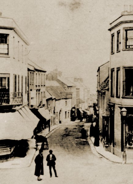
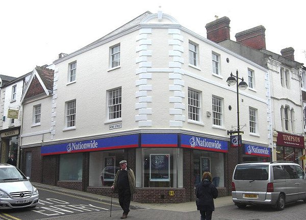
The western end of Middle Street joins The Borough, as seen from High Street in an early photograph dating to about 1865. Note the buildings either side of Middle Street - London House to the left and the Medical Hall to the right.

From my
collection.
This photograph
features in my
book 'Yeovil From Old Photographs'.
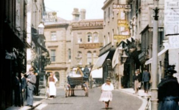
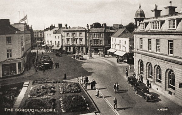
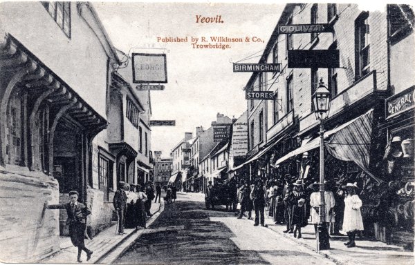
The Borough seen in a postcard dated 1908. At the centre is London House with Silver Street to its left and Middle Street to its right. At right is the Medical Hall with Wine Street off to is right.

This
colourised photograph
features in my
book 'Yeovil From Old Photographs'.
This photograph was taken by Yeovil Photographer Jarratt Beckett and published in his 1897 book "Somerset viewed through a Camera". At left is London House, at this time being run by George Wadman. At right is the side of the Medical Hall which, at this time was occupied by wholesale and retail chemists Gatward & Wright. Next door to the Medical Hall was the International Stores.
 From the Cave
Collection
(colourised),
Courtesy of South Somerset Heritage Collection
From the Cave
Collection
(colourised),
Courtesy of South Somerset Heritage Collection
This photograph
features in my
book 'Secret Yeovil'.
This colourised view looks towards the Borough from Middle Street around 1890. London House stands on the corner to the right of the horse and cart.
Courtesy of Jack
Sweet
The entrance to Middle Street seen from the Borough and photographed in the 1890s. At left is London House and at right is the Medical Hall.
Courtesy of the
Western Gazette
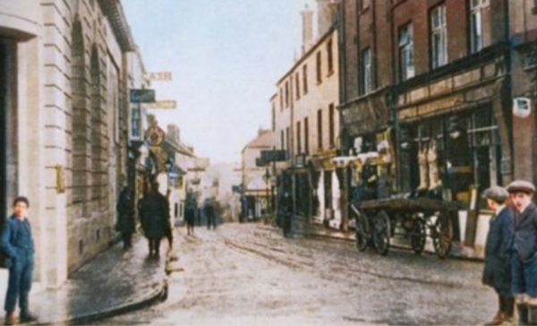
This colourised photograph of Middle Street seen from the Borough dates to around 1910. Note the pig carcasses hanging outside the butcher's shop window at right. This would later become the International Stores of the next photograph.
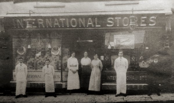
Staff of the International Stores pose outside the store during the 1920s. The store was eventually destroyed with the same bomb that destroyed the adjacent Medical Hall.
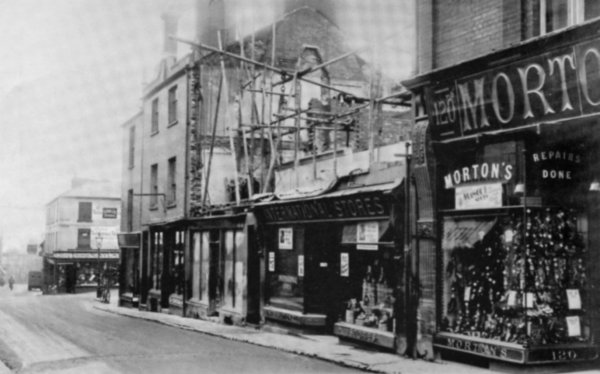
Seen here in 1932, the International Stores is being rebuilt on the south side of Middle Street above Union Street. The newly-built International Stores, seen in the following photograph with the very elaborate false gable, was designed by Yeovil architect J Nicolson Johnston, but destroyed with the same bomb that destroyed the adjacent Medical Hall.
The former post office premises, now WH Smith's, is obscured by the projecting buildings.
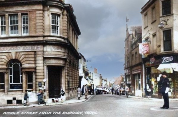
Almost identical to the previous photographs, this colourised postcard dates to 1938 - complete with traffic policeman!
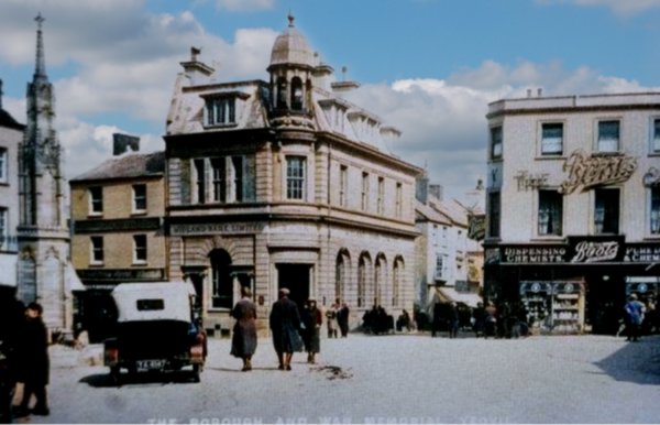
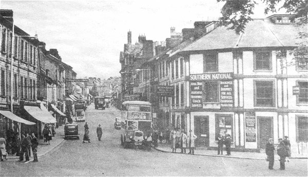
This colourised postcard is dated 1925 and is almost the same view as the 1908 photograph above. The new War Memorial stands to the left and at this time you could drive your car either side of it. At centre the Midland Bank building (now HSBC) has replaced London House but the Medical Hall, now Boots the Chemist, remains.
From my
collection
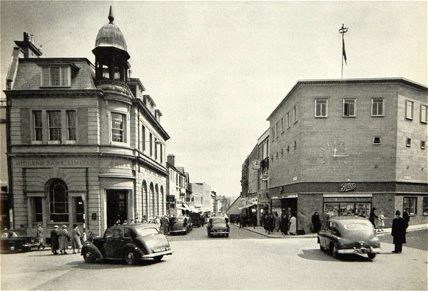
Middle Street seen from the Borough and featured in the 1962 Yeovil Guide.
From my
collection
-
This photograph
features in my
book 'Yeovil From Old Photographs'.
This postcard dates to 1947 and shows an unusual view of where Middle Street joins the Borough. Wine Street runs off to the left, High Street is at top left and Middle Street runs to the bottom right corner. The gardens at bottom left mark the site of the bombed Medical Hall.
From my
collection.
This
image
features in my
book 'Yeovil
- The Postcard
Collection'.
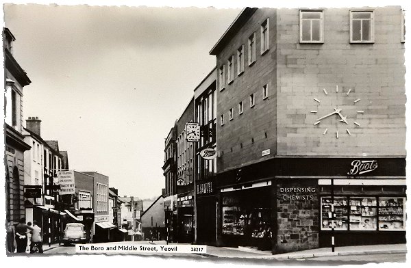
A postcard dated 1963 showing Middle Street seen from the Borough and featuring the new Boots' building.
Courtesy of
David Perry
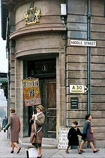
The Midland Bank on the corner of the Borough and Middle Street. A colourised photograph of December 1963 (when Frank Sinatra Jnr was kidnapped) when all inquisitive little boys wore short trousers - grey flannel in autumn and winter and khaki cotton in spring and summer.
Courtesy of
Chris Rendell
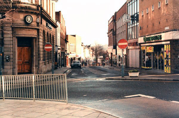
Middle Street seen from the Borough in early 1985. At left the Midland Bank is still there (now HSBC), but who remembers Greenfields? I certainly don't.
Courtesy of
Chris Rendell
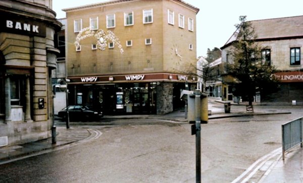
Middle Street joins the Borough, in a colourised photographed of 1985. Wimpy has taken over the old Boots building but I can't remember what type of shop Collingwood's (at right) was.
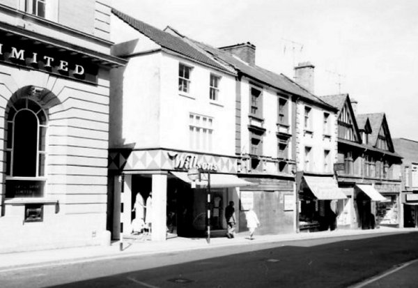
Next to the Midland Bank (HSBC) seen at extreme left is the site of an old pub, the Catherine Wheel, in the 1960's occupied by Wilson's dress shop, now occupied by Ryman's stationers shop. The Catherine Wheel was still open in 1856 when it was mentioned in Vickery's 'Sketch of Yeovil'.
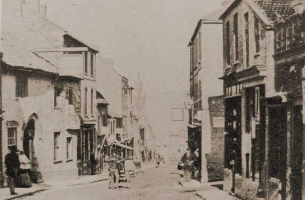
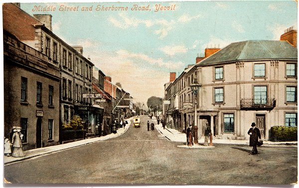
This sepia-toned photograph looking east along Middle Street dates to about 1875 and is probably one of the earliest photographs of the medieval Castle Inn at left. This is also the only photograph I know of that shows the original narrow entrance to Union Street opposite the Castle Inn.
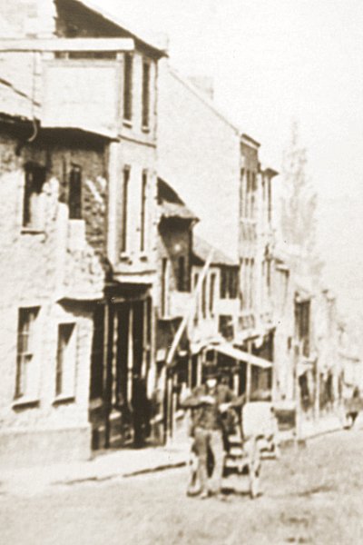
A detail enlargement of the previous photograph. The Castle Inn is at far left. The house and herbal shop of murderer Robert Slade Colmer was the three-storey building next to it - the building where the murder of Mary Budge took place!! Note also the stovepipe hat of the man pausing with his barrow in the centre of Middle Street. The tiny house seen immediately above this man was Thomas Hayward's beerhouse.
This
photograph
features in my
book "Lost Yeovil"
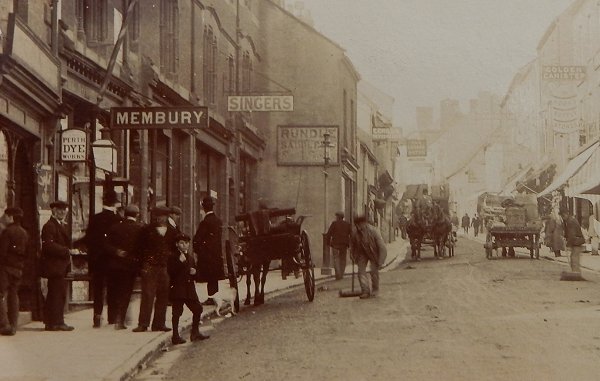
A photograph of around 1910 looking along Middle Street to the Borough, with two council road sweepers (one at centre, one at extreme right) with their horse and cart left of centre. For information and photos of the Corporation's horses click here. At left is the hairdressing salon, tobacconist and fancy goods store of John Membury.
A colourised photograph depicting Middle Street in the 1950s, looking west with the George Inn projecting into the street.
From my
collection
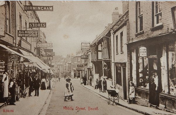
This postcard was posted in 1907 but the photograph was taken in 1896 or 1897 when the landlord of the George Inn was William Cridland and ironmonger William Godfrey was the proprietor of the Birmingham Stores opposite.
From my
collection
-
This photograph
features in my
book 'Yeovil From Old Photographs'.
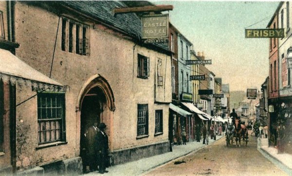
This hand-coloured postcard was post-marked 1904 but the original photograph actually dates to about 1890 when the licensee was John Wilkins and his name appears under the Castle Hotel sign that projects into the road at high level.
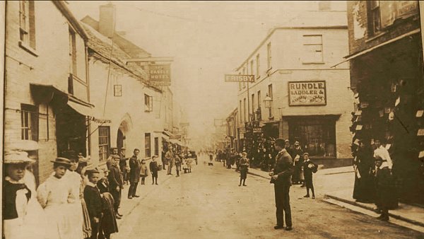
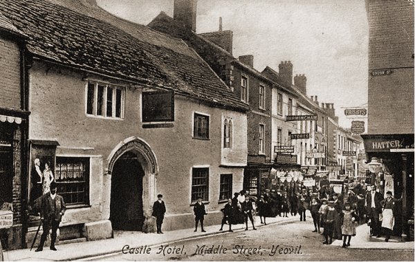
This photograph probably dates to about 1880 when John Rundle was the saddler and harness maker whose shop is at right, on the corner of Union Street, opposite the Castle Hotel.
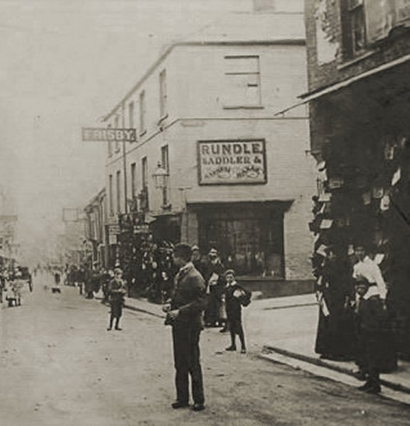
The junction of Union Street and Middle Street photographed about 1880 when John Rundle was the saddler and harness maker whose shop is on the corner of Union Street.
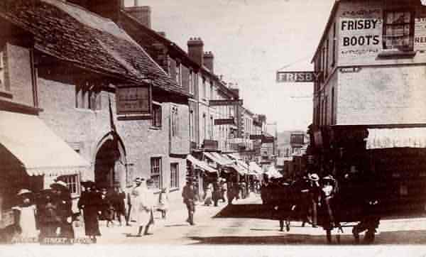
A postcard of Middle Street, featuring the Castle Inn opposite the entrance to Union Street. This postcard was used in 1904. Rundle's saddle and harness shop was now Frisby's shoe shop.
The junction of Union Street and Middle Street photographed in 1932. Rundle's / Frisby's shop, now Gaylard's, remains - but not for long. In this photograph the Post Office building of 1903 (now WH Smith's) is obscured by the projecting Middle Street buildings at extreme right.
From my
collection
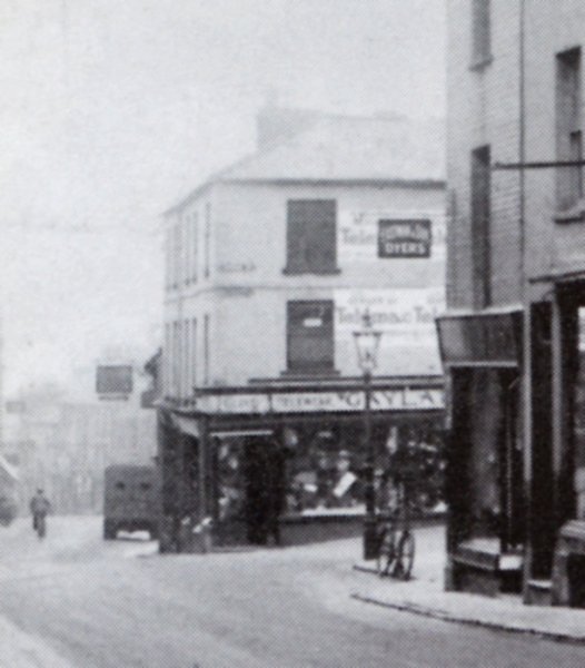
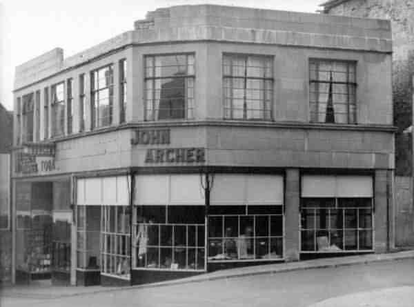
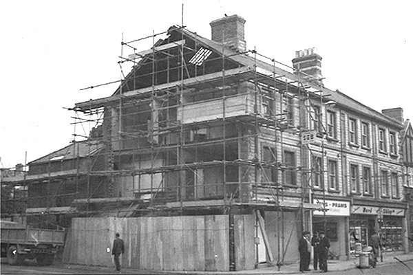
The Rundle's / Frisby's / Gaylard's premises of the four previous photographs, on the corner of Middle Street and Union Street was replaced in the 1930s (I'm guessing, based on the style of architecture) with this building. I'm guessing (again) the damage to the roofline parapet was war damage so the photo (by H Harvey of Yeovil) dates to between the mid-1940s and the mid-1950s. The building later became Dunn's gents' hatter and outfitters (see below for photos) by 1958.
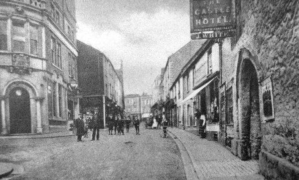
Looking back along Middle Street from Union Street (at left) towards the Borough in 1905. At left is the newly-built Post Office building (now WH Smith's) and at right is the Castle Hotel, when John White was Licensee.
From my
collection
The photograph for this hand-tinted postcard was taken in 1905, but the card is post-marked 1913.
From my
collection. This
photograph
features in my
book "Lost Yeovil"
A lovely sepia-toned postcard taken about 1905. Note the proximity to Union Street at extreme right.
A little earlier than the previous image, and a little closer to Union Street. At centre is seen the bomb damaged Burton's tailors shop - bombed in the first air-raid on Yeovil of Monday 7 October 1940.
Courtesy of
Robert Smith
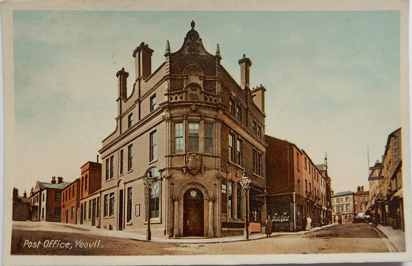
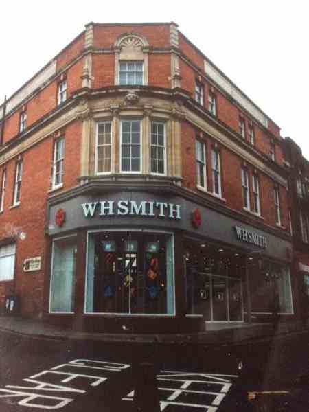
Originally built in 1903 as Yeovil's main Post Office on the corner of Middle Street and Union Street, it was later home to Marks & Spencer before becoming the premises of WH Smith - as it remains today. Photographed in 1991.

From my
collection
-
This colourised photograph
features in my
book 'Yeovil From Old Photographs'.
A postcard, sent in 1904, showing a busy Middle Street by the George Hotel (although most, if not all, of the people were added in the photographer's studio).
From my
collection
From my
collection
Middle Street
photographed
(I'm guessing)
in the early
1930s.
Courtesy of the
Western Gazette
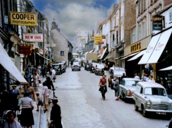
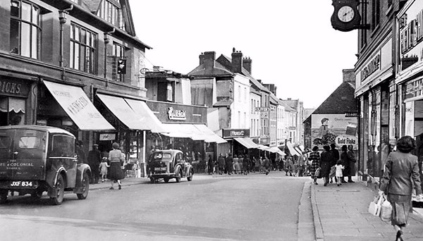
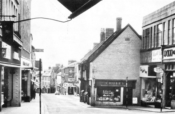
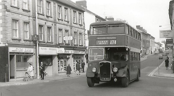
Middle Street photographed around 1960 and clearly showing how Chubb's and the George Hotel projected into the thoroughfare.
Taken in 1960, this colourised photograph looks down Middle Street. The George Inn right of centre was, by now, closed with its signage removed and the 'To Be Sold' sign for the row of premises had been erected. Chubb's bakers and confectioners store was still trading.
From my
collection.
This
image
features in my
book 'Yeovil
- The Postcard
Collection'.
This postcard dates to around 1955. Looking east along Middle Street, Union Street runs off right in front of Dunn's gents outfitters building (which probably dates to the early 1940s). Note that at this time the old post office building (now WH Smith's premises) were, at this time, occupied by Marks & Spencer.
The building occupied by Dunn & Co replaced the Rundle's / Gaylard's building of the previous two photos.
From my
collection
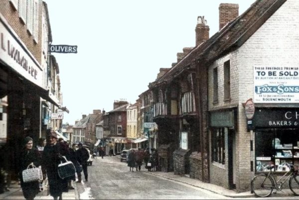
This hand-tinted postcard of Middle Street and the junction with Union Street dates to the late 1960s. The George Hotel and Chubb's bakery, were sacrificed to road widening in 1962 - their 'footprint' is visible jutting out into the road immediately beyond the two parked cars.
Courtesy of
Patricia Smith
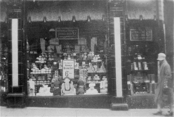
Yeovil Woolworth's shop windows in the 1920s - and signs displaying their famous logo "Nothing in these stores over 6d".
From the Cave
Collection
(colourised),
Courtesy of South Somerset Heritage Collection
And the footprint remains...
So, it was demolished to widen the road but some idiot at the Council forget to realise that they didn't own the land (not much of a surprise there then) so the road couldn't be widened after all. In any event within ten years the road was pedestrianised, so this wonderful 14th century building was, pretty much, wantonly destroyed for nothing.
On the site of the ill-fated George Inn, Yeovil's first supermarket, Elmo, nears completion in the mid-1960s.
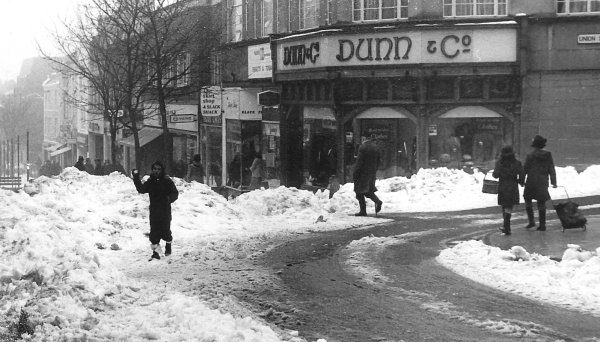
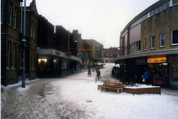
Almost the same scene but in February 1978. The snow lasted several weeks.
Courtesy of
Chris Rendell
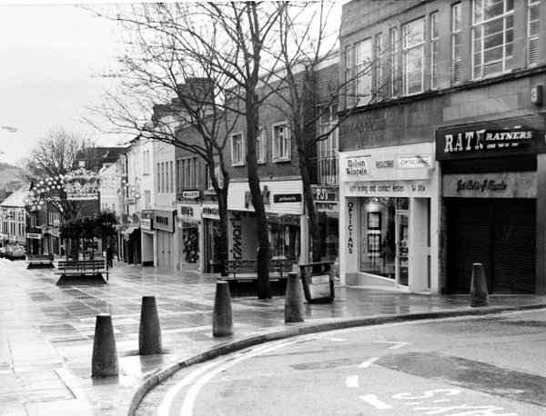
Another view, this in 1985. At far right the jeweller's shop was Ratner's, in the old Dunn & Co building. This branch of Ratner's closed in 1991 after Gerald Ratner made his famous gaffe by saying "We also do cut-glass sherry decanters complete with six glasses on a silver-plated tray that your butler can serve you drinks on, all for £4.95. People say, "How can you sell this for such a low price?", I say, "Because it's total crap." End of Ratner's.
The Primark building at centre (behind the trees) was built after the demolition of the George Hotel and was one of the country's earliest supermarkets - Elmo.
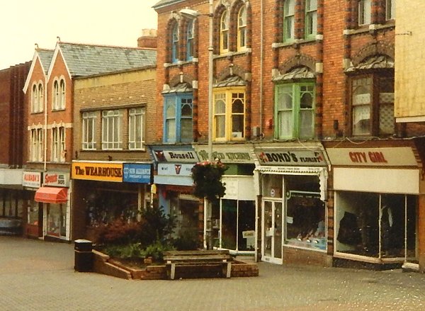
The upper portion of Middle Street was pedestrianised first, seen here in 1986, followed by the lower section. There were an awful lot of shoe shops in Yeovil during this period. Frisby's shoe shop had now moved to the south side of Middle Street.
This photograph
features in my
book "Now
That's What I
Call Yeovil"
An unusual view of Middle Street - I'm guessing late 1970s or early 1980s.
.... and photographed on a fine day in the mid-1980s.
This
photograph
features in my
book "Lost Yeovil"
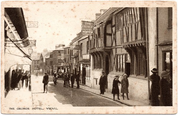
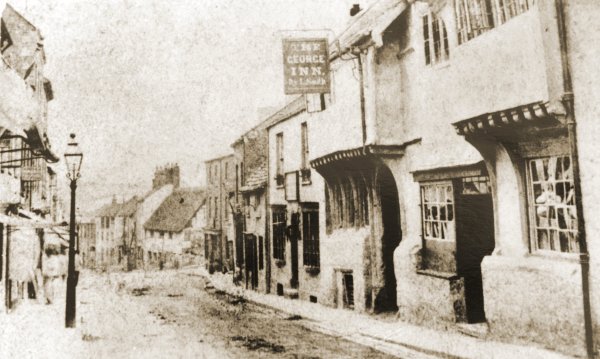
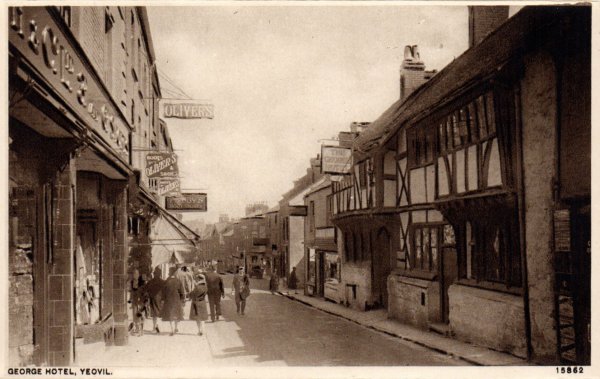
Probably one of the earliest photographs of this section of Middle Street, this was taken in 1871 when Louisa Smith was licensee of the George Inn.
Courtesy of Jack
Sweet
By 1913, the date of this postcard, many of the old buildings in the distance had been replaced.
From my
collection.
This
image
features in my
book 'Yeovil
- The Postcard
Collection'.
This hand-tinted postcard of Middle Street, looking west back towards the Borough and featuring the George Hotel, is from 1907.
This
photograph
features in my
book "Lost Yeovil"
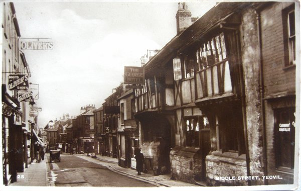
This sepia toned photograph of about 1905 clearly shows the severe narrowing of Middle Street by the George - bearing in mind, of course, that this was the main road from London to the West Country at the time.
From my
collection.
This
colourised
image
features in my
book 'Yeovil
- The Postcard
Collection'.
.... and as it appeared in a postcard of around 1920.
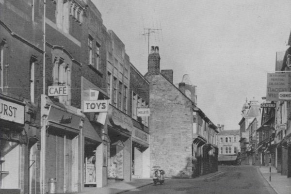
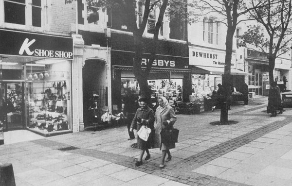
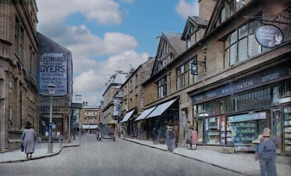
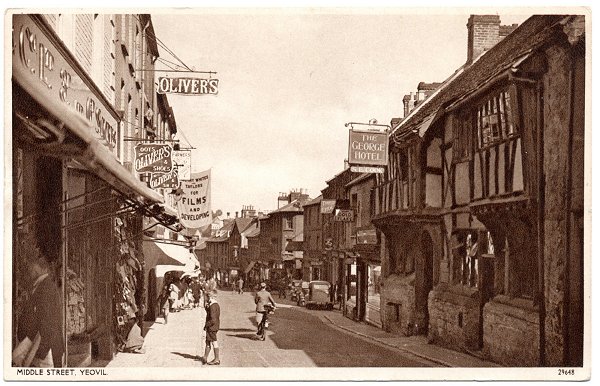
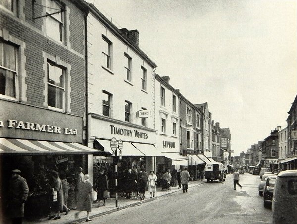
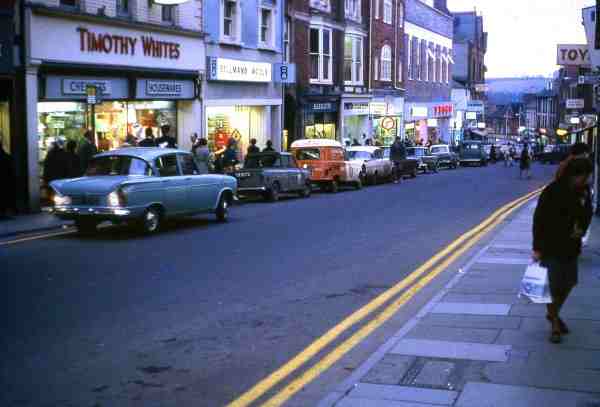
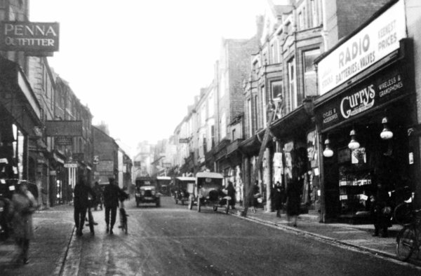
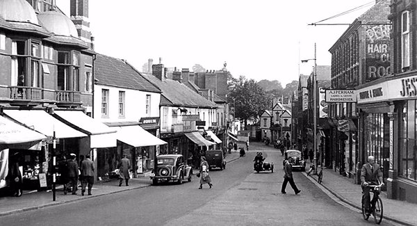
Almost the same view looking back towards the Borough, this photograph of the 1960s also demonstrates just how far the George Inn projected into the Middle Street streetscape. Originally almost all of Middle Street was this width. Some of the other shops will bring back memories - Dewhurst the butchers, the Arundel Cafe (with a milk churn outside), the Three Bears toy shop, Dorothy Perkins and Millett's outdoors shop with a Lambretta Li150 scooter parked outside. On the other side of the road is Oliver's shoe shop and national chain Timothy Whites, dispensing chemist and household stores. The Timothy Whites company was taken over by Boots the Chemist in 1968 although the brand name didn't disappear until 1985.
Courtesy of the
Western Gazette
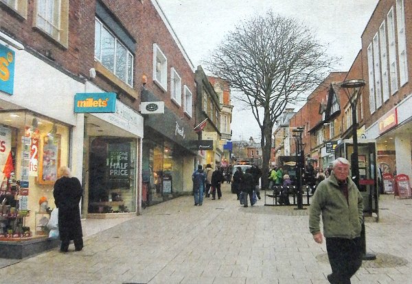
.... and Middle Street, photographed in 2007.

Now looking east, this photograph dates to 1896 (during William Cridland's brief tenure as landlord of the George Hotel) and shows George Dyke's shop premises next door at 107 Middle Street, displaying a selection of barrels, boxes and other items he had made himself. George and his family lived above the shop.
As a sidenote - in 1891 the really tiny house at far left (looking like a Wendy house compared to those either side) was the home of glove sorter Edward Lewis, his wife Caroline and daughter Mary, a dressmaker. All three must have been vertically-challenged in order to live there!
From my
collection
This hand coloured postcard of Middle Street dates to about 1910 (when Louisa Vincent was still the licensee of the George). See if you can spot how many of the people or horse and carts were added to the photograph by the photographer in the darkroom. (Clue: all of 'em).
From my
collection
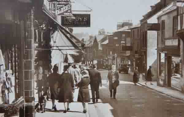
A general view of Middle Street in this postcard of 1933.
From my
collection
.... and the same view in a postcard of 1936.
From my
collection
.... and almost exactly the same view in this postcard of 1941.
From my
collection
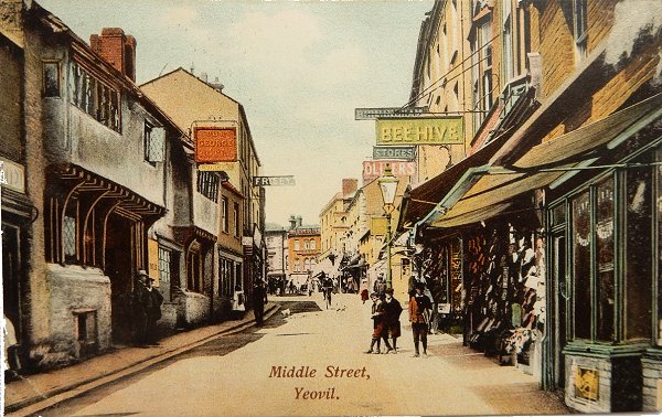
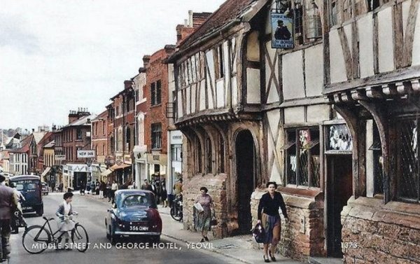
A similar view to the postcard above but some 50 years later. In this colourised postcard dating to about 1960, notice that the George Hotel sign has been replaced and features ales by the Lovibond brewery of Salisbury who purchased the George Hotel in 1920.
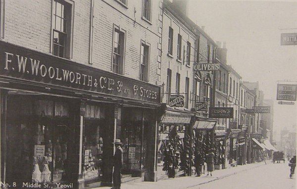
A postcard of the mid-1920s featuring FW Woolworth & Co Ltd's 3d and 6d Stores.
Courtesy of the
Western Gazette
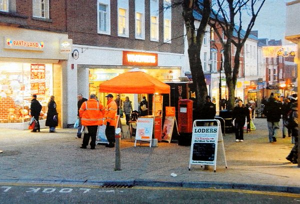
Middle Street, photographed at Christmas 2007.
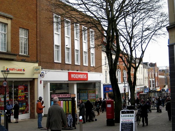
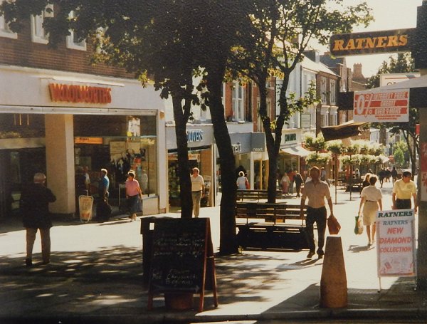
... and the same stretch photographed in 2008 just before Woolies closed.
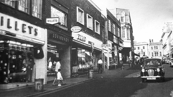
A mid-1960s photograph looking the other way with the George footprint to the left of the car. Elmo, at centre, was one of the first chain supermarkets of the 1960s. Elmo opened in Yeovil on 9 March 1965. In the pre-supermarket age of 1954, Yeovil had at least 69 grocery corner shops.
As a sidenote - Elmo Stores/Supermarkets was a company of about 28 stores turning over £8 million in the early 1960s in the south of England. The company fought off Jack Cohen's (Tesco) takeover but gave in to Fine Fare for £1 million. Later Fine Fare was sold to the Dee Corporation - later renamed Gateway / Somerfield - who in turn were bought out by the Co-op in 2006.
Elmo was replaced by the Fine Fare supermarket in the 1970s.
Courtesy of
Chris Rendell
Almost the same view in 1984.
This
colourised photograph
features in my
book 'Yeovil From Old Photographs'.
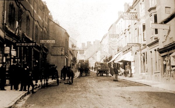
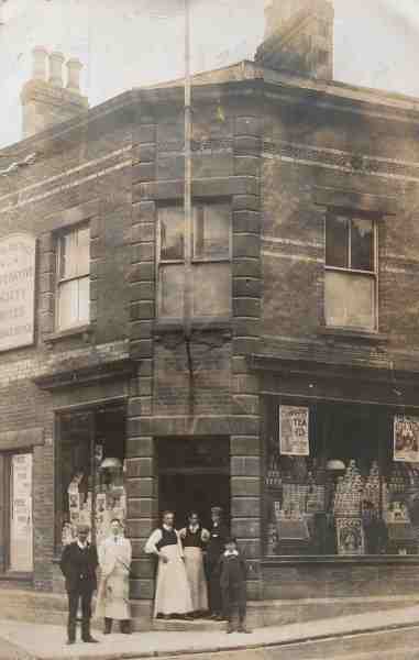
Charles Hook's supply stores on the north side of Middle Street, under the sign of the 'Golden Canister', in this photograph of 1897 by Jarratt Beckett. To give an idea of where this is, the entrance to Frederick Place is beneath the two single windows at the left end of the Albany Hotel.
From my
collection
The same buildings in Middle Street as featured in the 1962 Yeovil Guide.
Courtesy of Nick
Hyde
Middle Street photographed before pedestrianisation.
.... and pedestrianised in the 1980s - clearly photographed on a Sunday morning.
Who remembers a FotoFirst shop and a chemist being there?
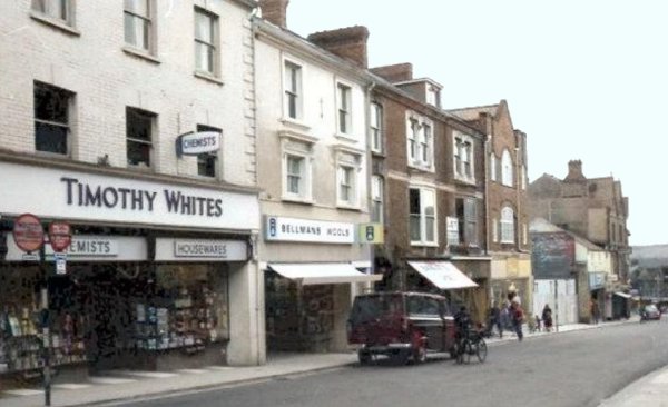
This view of Middle Street dates to the later 1960s with Lipton's being replaced by Bellman's Wools. The entrance to Frederick Place is immediately behind the van at centre.
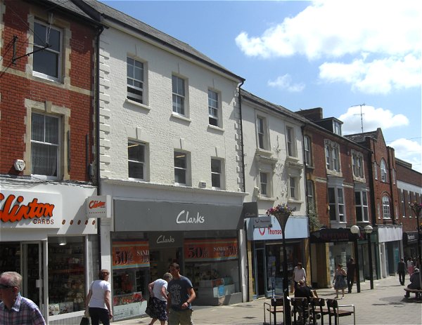
Hook's supply stores, later Timothy White's, now Clark's, photographed in 2013. It's nice to see that Richardson's and the Albany Hotel buildings also survive.
From my
collection.
This
image
features in my
book 'Yeovil
- The Postcard
Collection'.
A postcard of about 1905 looking up Middle Street towards the Borough, CJ Hook's Supply Stores is at right.
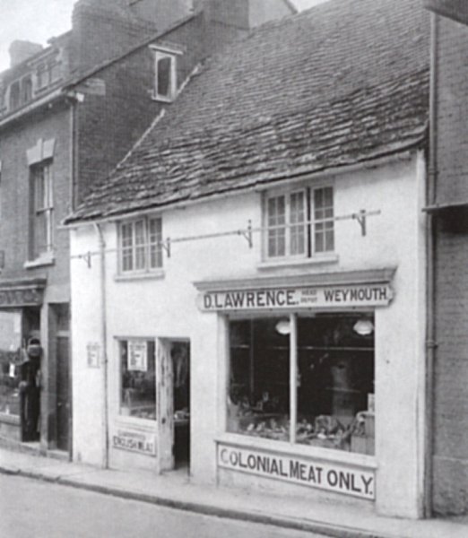
Photographed in 1935 in Middle Street, this is the building at extreme left in the previous photograph. The butcher D Lawrence displayed English meat in the left window and Colonial meat at right. Note the bar at high level for hanging meat.
This type of building was once common in Yeovil, with first-floor three-light windows and graded stone tiles to the roof.
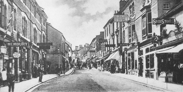
Taken about 1900, this photograph looks west along Middle Street towards the Borough. Hook's 'Golden Canister' sign is seen just right of centre. At left is the shop premises of hairdresser and tobacconist John Membury, probably with John himself standing in his doorway and wearing a white apron.
Moving slightly further east, and looking back west towards the Borough, this photograph dates to 1932. Just glimpsed at left is the entrance to Bond Street.

From my
collection.
This
image
features in my
book 'Yeovil
- The Postcard
Collection'.
A postcard of Middle Street, dated 1967, showing the entrance to Frederick Place at right.
From my
collection. This
image
features in my
book 'Yeovil
- The Postcard
Collection'.
A 1970s postcard of Middle Street, looking towards the Borough, with the entrance to Frederick Place at extreme right.
Pretty much the same view, photographed in 2013.
Looking down towards the Triangle, circa 1965.
From my
collection.
This
image
features in my
book 'Yeovil
- The Postcard
Collection'.
Looking east along Middle Street during the 1940s (this card was posted in 1947). That this card was produced between 1939 and 1945 is confirmed by the printed message on the back, from the Prime Minister (Winston Churchill) "We shall continue steadfast in faith and duty till our task is done." At extreme left is the entrance to Frederick Place and at right, by the New Inn sign, is Bond Street.
Courtesy of
Chris Rendell
Almost the same scene photographed in 1984.
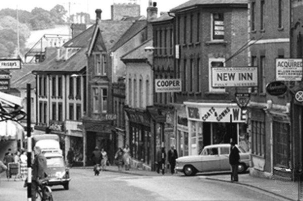
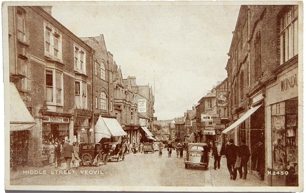
This photograph was taken during the early 1960's and looks down Middle Street. The New Inn is seen at right, with the car just entering Middle Street from Bond Street. Most of the buildings in this photograph survive although the 'Coats & Covers' shop, on the corner of Bond Street, is now the new building occupied by Robert Dyas.
The next building, behind the sign of HA 'Jack' Cooper the photographer, remains and is now Vision Express and the next, white building has been replaced by the relatively new building occupied by the Edinburgh Woollen Mill outlet.
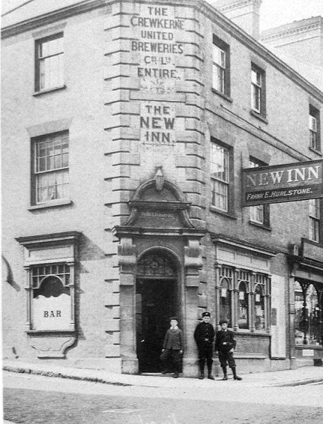
This photograph dates to 1909 and shows the detailing around and above the corner entrance of the New Inn building as well as above the ground floor windows. The photographer was standing in Middle Street, which runs off to the right, and Bond Street is at left.
From the Cave
Collection
(colourised),
Courtesy of South Somerset Heritage Collection
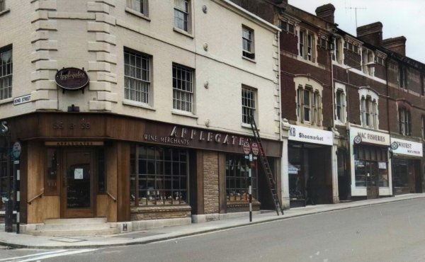
Another 1960's photograph with the New Inn building now occupied by Applegate's Wine & Spirits shop. Note the wraparound shop front with new windows and a nasty signage fascia - the architectural integrity of the building is well on its way out.
From my
collection.
This
image
features in my
book 'Yeovil
- The Postcard
Collection'.
Middle Street, looking west, in a hand-tinted postcard. The original photograph was taken in 1957.
.... and just a bit further down (the New Inn is visible above the lorry), seen in 1955.
A photograph dating to about 1975 of the pedestrianised Middle Street with the New Inn in its guise as the Flying Machine on the corner of Bond Street at left. Note the 1970's Ushers and Watneys signage, so typical of the period. Did you remember that Tesco's store was opposite Bond Street? The building is now Waterstone's and Boots.
This Tesco store finally closed on Saturday 29 February 1992 and the new Tesco store in Huish, opened at 9am on Tuesday 3 March 1992.
Taken in 2012, shows what a fine building the old New Inn is, above the ground floor travesty of large (and largely unnecessary) plate glass windows and the gaudy and incongruous signage fascia. Note too the absence of the corner entrance.
Courtesy of the
Western Gazette
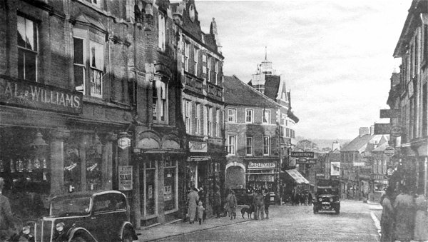
This photograph dates to around 1938. Looking east along Middle Street, the truck right of centre is in the Triangle and Vicarage Street joins Middle Street where the arch is seen at centre. At extreme left is Neal & Williams (builders merchants) Middle Street store.
Courtesy of the
Western Gazette
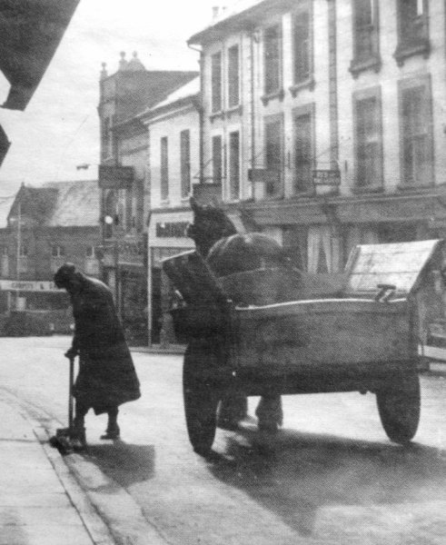
This photograph, showing a Council street cleaner with his horse and cart, probably dates to around 1930 and was taken from outside Neal & Williams' premises of the previous photograph and looks towards the Triangle. When I worked in the Technical Department of the Council in the 1970s I remember in the Chief Officer's bookcase was a Register of Corporation Horses that recorded all the details of the Council's horses.
From my
collection
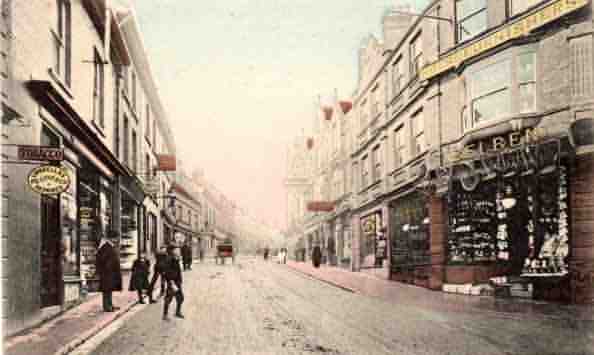
This hand-coloured postcard dates to1905 and looks west along Middle Street. Belben's emporium, seen here on the right, was located on the corner of Middle Street and Vicarage Street as they met at the Triangle (it's the shop with three awnings right of centre in the next photograph).
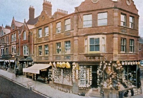
This
colurised photograph
features in my
book 'Yeovil From Old Photographs'.
This photograph was taken by Yeovil Photographer Jarratt Beckett and published in his 1897 book "Somerset viewed through a Camera".
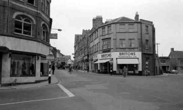
This photograph, of around 1965, looks back along Middle Street from the Triangle with Vicarage Street at right. By the mid-1960s the former Belben Brothers' store was Briton's furniture store.
From my
collection
This is the earliest photograph I know showing the Triangle. It was taken between about 1900 (when the Coronation Hotel at right was built) and 1910 when the building at far left was replaced by the Co-operative Society building.
From my
collection
This is a rare photograph showing this building. Originally it was on the northwest corner of Turnstile Lane. The eastern side of Turnstile Lane was demolished between 1886 and 1901, while this building was replaced by the Co-operative Society's shop and offices building (that survives today and appears in most of the images of the Triangle) by 1910.
Courtesy of
Lynne & Tony
Cove
Photographed on 28 May 1908, this building is the precursor to today's building in the Triangle that was most recently the Turkish restaurant. It was on the corner of Middle Street (running off to the right in this photo) and Turnstile Lane (running off to the left). The triangle of buildings on the eastern side of Turnstile Lane, opposite this building, were torn down around 1900 to create today's open space known as the Triangle. The man In the middle of the three standing in the doorway is Dennis Moore.
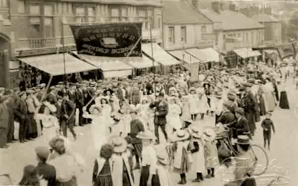
Photographed around 1910, children of the Wesleyan Sunday School parade along Lower Middle Street towards the Triangle and the Wesleyan Methodist church in Vicarage Street.
This
photograph
features in my
book "Lost Yeovil"
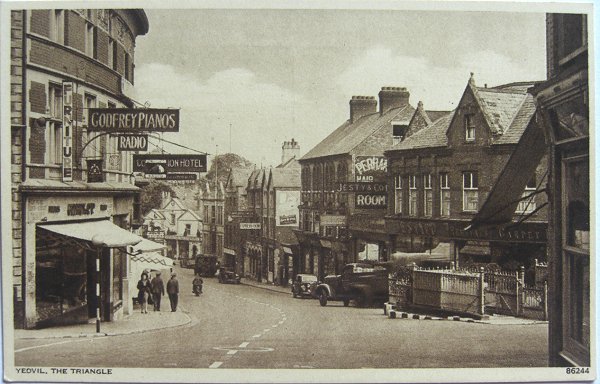
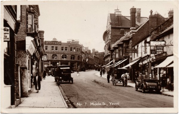
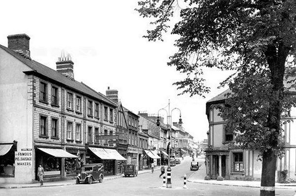
The earliest photograph I've found of this part of Middle Street, photographed around 1890 and looking east from the Triangle. Thomas Jesty's furniture emporium is at extreme right and in the distance is seen the triple-gabled offices of the gasworks (now premises of St Margaret's Hospice). At extreme left the cottage with a small front garden was soon to be demolished and replaced with the block of shops (next to the Coronation Hotel) surmounted by a series of four small domes seen in a photograph lower down this page. The two blocks of shops at centre, with the awnings, remained until the 1960s.
Thomas Jesty's premises featured in this postcard of Middle Street, postmarked 1914.
From my
collection
The Triangle, looking down Lower Middle Street, in a postcard of about 1940. Note the underground toilets at right.
Courtesy of
Chris Rendell
Looking along Lower Middle Street from the Triangle, photographed in 1985. At left is the entrance to Glover's Walk, built over what had been Whitby's glove factory (hence the name). At right - hands up if you remember Bejam.
From my
collection
-
This photograph
features in my
book 'Yeovil From Old Photographs'.
A postcard of around 1912 of Lower Middle Street looking towards the Triangle with the new Co-operative Society building built in 1910.
From my
collection.
This
image
features in my
book 'Yeovil
- The Postcard
Collection'.
.... and the same photograph issued as a hand-coloured postcard around the same date.
From my
collection
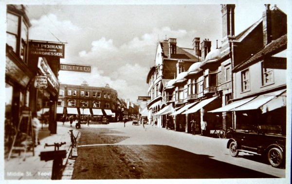
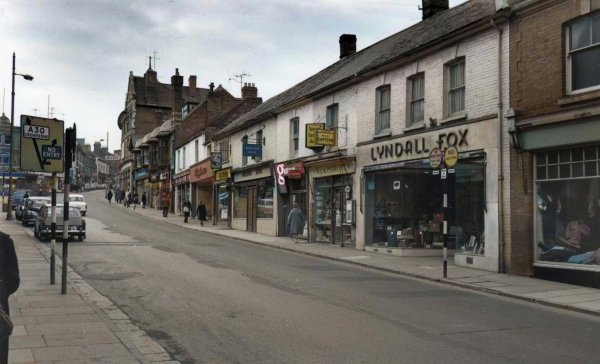
Pretty much the same view, this is a 1940s postcard but the photograph was taken around 1923 when Mary Slann was running the Coronation Hotel. (The Jesty & Co sign is suspended from a building to the left and is not on the Co-op building). At right are seen the ironmongery business of Herbert Higdon and the stationer's of Lyndall Fox.
... and another postcard - same view, same era.
Middle Street looking west towards the Triangle in a colourised photograph of the mid-1960s. Appleby & Childs premises are at extreme left.
... and a colourised photograph looking in the opposite direction around the same time, or possibly slightly earlier.
From the Cave
Collection
(colourised),
Courtesy of South Somerset Heritage Collection
Again, photographed in the 1960s, this photograph gives a better indication of the shops running down from the Coronation Hotel.
From the Cave
Collection
(colourised),
Courtesy of South Somerset Heritage Collection
Photographed at the same time as the previous photograph, but slightly further east.
For comparison with the previous photographs, this one dates to January 1985 and looks towards the Triangle from Lower Middle Street. Which Yeovil do you prefer - 1925 or 1985?
From my
collection.
This
image
features in my
book 'Yeovil
- The Postcard
Collection'.
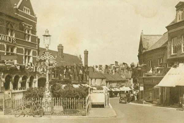
A hand-coloured postcard dating to 1905 and looks down Middle Street from the Triangle. At left is the Coronation Hotel and Vaults and to the right is the large three-light Sugg gas lamp which was removed when the underground toilets were built - the location is now the bandstand.
I have six different postcards all using this image that were posted between 1909 and 1917, including one on which the stamp box on the reverse reads "Affix Halfpenny Stamp" which dates the postcard to before 3 June 1918, when the price rose to one penny.
From my
collection
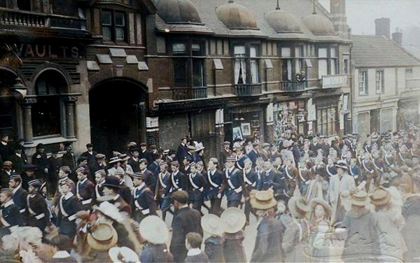
A colourised photograph of the Yeovil Boy's Brigade parading along Middle Street, outside the Coronation Hotel and Vaults, around 1910.
Courtesy of the
Western Gazette
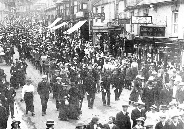
Looking in the other direction towards the Triangle, volunteers march towards the railway station as they go off to war in August 1914.
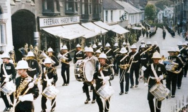
The band of the Royal Marines parades in the Triangle as part of the Centenary of Yeovil Corporation Celebrations on 3 July 1954.
The three gas-fired Sugg lamps were replaced by a single electric light, seen in this photograph, in the mid-1920s and the same happened at the junction of High Street and Princes Street. Since the Yeovil & District Co-operative Society is in the old Thomas Jesty's building at extreme right this photo must be after about 1954, but because the Coronation Hotel is still standing at extreme left it must be before about 1964.
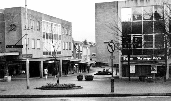
.... and today, looking down Lower Middle Street from the Triangle. The flower-bedecked bandstand at far right replaced the underground toilets (much nicer) and the featureless mass of 1960s concrete and reconstructed stone cladding replaced some wonderful old buildings - you can decide for yourself on the merits/demerits of 1960's architecture, but I'm pretty sure I know what most Yeovilians think. Photographed in 2009.
An early photograph of the 'top' of Lower Middle Street, probably dating to about 1905, of Thomas Jesty's premises, often known as "Jesty's Corner". (To get your bearings, the tall chimney at extreme left appears at centre of the photo before last). In the background is, of course, Wyndham Hill.
Thomas Jesty's furniture emporium in a colourised photograph of around 1950. At extreme left is the office building of the Town Gasworks, lately the furniture showroom of St Margaret's Hospice.
From the Cave
Collection
(colourised),
Courtesy of South Somerset Heritage Collection
A better angle of the same parade of shops in the photograph above, but this one was taken in the 1960s.
Looking down Lower Middle Street from the Triangle during the mid-1960s.

.... and almost the same view - remarkably traffic-free in the late 1960s. At right is Jesty's store, by this time Yeovil & District Co-operative Society's furniture branch store.
Photographed in 1968 and looking back towards the Triangle. At centre the Glovers Walk project is underway and at right the old shops are empty and awaiting demolition.
Courtesy of Mark
Rowe
Almost the same view, but taken during the snows of 1982.
From the Cave
Collection
(colourised),
Courtesy of South Somerset Heritage Collection
This photograph
features in my
book 'Yeovil
From Old
Photographs'
A more direct view of the store that was originally Thomas Jesty's furniture store, with the old Methodist chapel at centre. The chapel was demolished in 1972 and the site is now occupied by Poundland. The three-storey shops at extreme left (which still stand today) were built after 1901 on the site of the old row of cottages known as Ebenezer Terrace. The Co-op building has now been replaced by today's Poundland building.
The buildings are the same, just the traders have changed. Photographed in the 1980s.
This photograph of the Liberal Club was taken by Yeovil Photographer Jarratt Beckett and published in his 1897 book "Somerset viewed through a Camera".
The Liberal Club building decorated for the Coronation of King George and Queen Mary on 22 June 1911.

Courtesy of
Colin Haine
Middle Street, circa 1905. At left are the gasworks offices, at centre the Liberal Hall and to the right are the offices of the Western Chronicle. Taken from a newspaper cutting.
From the Cave
Collection
(colourised),
Courtesy of South Somerset Heritage Collection
This colourised photograph dates to the mid-1960's and shows Lower Middle Street with Commercial Buildings at centre next to the Railway Tavern (now replaced by the Wetherspoons' pub, the William Dampier) at right. At far right is Central Road and the photograph was taken from Station Road (now called Old Station Road or South Western Terrace).
Courtesy of
Chris Shoemark
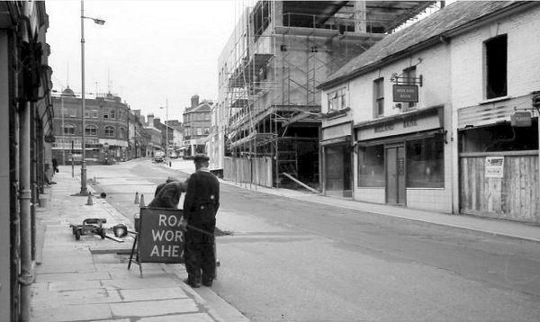
This photograph was taken on 2 October 1961 and shows renovation works being carried out to Lloyds bank by Chris' father's building firm, BNA Shoemark of Montacute.
From the Cave
Collection
(colourised),
Courtesy of South Somerset Heritage Collection
This photograph again dates to the mid-1960's but here Commercial Buildings are seen from further along Lower Middle Street before pedestrianisation. At right is the old Fernleigh Temperance Hotel, most recently an Indian restaurant but now (since November 2016) vacant.
A colourised postcard of the 1930s, taken from outside the Gasworks offices and showroom, looking back towards the Triangle.
Courtesy of the
Western Gazette
Lower Middle Street, photographed around 1895. The Railway Inn at left and the Fernleigh Temperance Hotel at right.
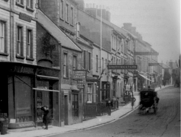
A photograph of Lower Middle Street, dating to about 1900, shows the first Railway Inn at extreme left projecting slightly beyond the terraced building next to it. The photographer is standing roughly outside where the William Dampier is today and looking along the eastern end of Middle Street with Station Road (now Old Station Road) at right. The large building on the junction at right was the Fernleigh Temperance Hotel and was most recently an Indian restaurant. This section of Lower Middle Street is today colloquially known as Takeaway Alley.
From my
collection.
This
image
features in my
book 'Yeovil
- The Postcard
Collection'.
An all but identical view to the previous photographs, this postcard appeared in several forms - monochrome and at least three different hand-coloured versions. This one was used in 1907.
Courtesy of
Martin Luca
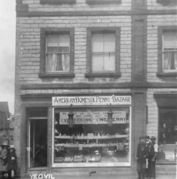
A photograph of around 1915, showing the American Domestic Penny Bazaar occupying the premises on the corner of Middle Street and Central Road (glimpsed at the left).
.... and almost the same scene in a photograph of about 1930.
.... and pretty much the same view in the 1940s. Note that the head of the island street light has changed and that the bollards now have wartime blackout markings of black and white stripes.
Lower Middle Street in 1952.
Courtesy of the
Western Gazette
Lower Middle Street, photographed around 1955. By this time the island street light had been removed and the Fernleigh Temperance Hotel at right had become the offices of the Southern National bus company. Is it me, or does that bus look particularly tiny?
Photographed in the 1990s when the corner building was occupied by Palmer's fish & chip shop.
This photograph dates to 1903 and shows the north side of Lower Middle Street with the South Western Arms clearly marked by its large projecting sign.
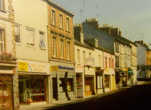
Almost the same view as the 1903 photograph above but taken in the 1970's shows the two-storey South Western Arms building now used as a shop (with the pink upper storey) almost dwarfed by its neighbouring three-storey building towering over it.
Courtesy of
Chris Rendell
.... and seen again in this photograph of 1985.
Courtesy of
Vivien and John
Cornelius
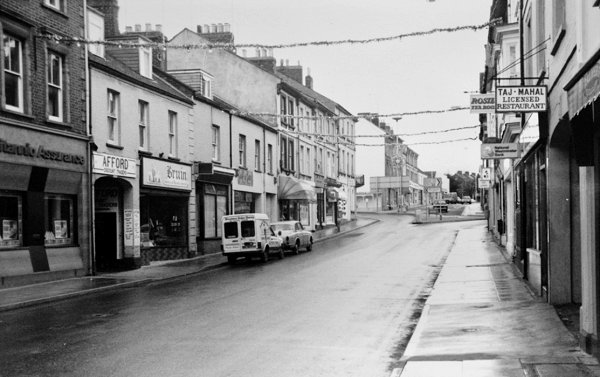
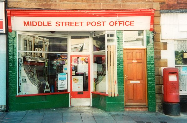
The Middle Street Post Office, photographed in 2003. The postbox is still there but the post office closed in January 2004 - it is now a tanning studio.
This photograph
features in my
book 'Yeovil From Old Photographs'.
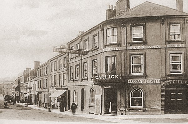
The eastern end of Middle Street / Lower Middle Street. Photographed in 1905, during the period William Garlick was licensee, this view of the Elephant and Castle Hotel includes many neighbouring buildings in Middle Street that remain to this day.
Courtesy of
George Hallett
-
This
colourised photograph
features in my
book 'Yeovil From Old Photographs'.
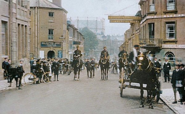
The very eastern end of Middle Street / Lower Middle Street is marked by Newton Road at left (by the Salvation Army Temple) and Wyndham Street at right, with the Elephant and Castle on the corner.
By 1918, the date of this Rendell photograph, the former Western Gazette offices were being used as a Salvation Army Temple. Note the gas holder dominating the view into town.
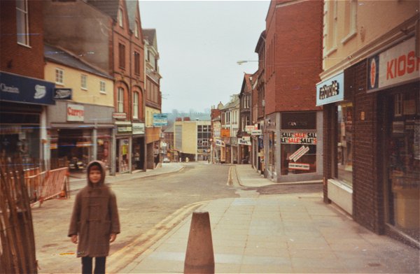
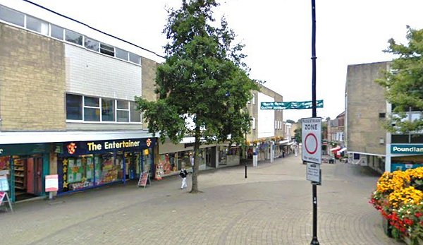
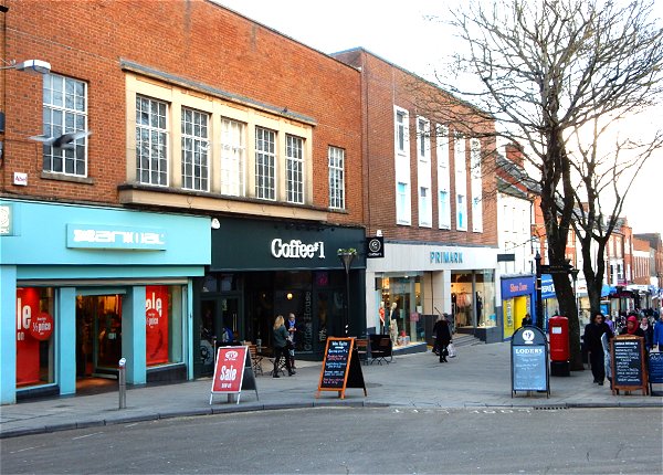
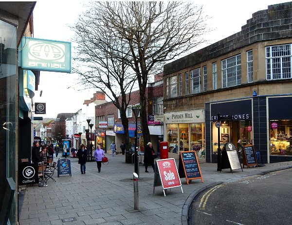
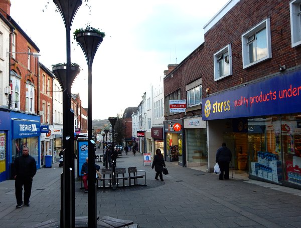
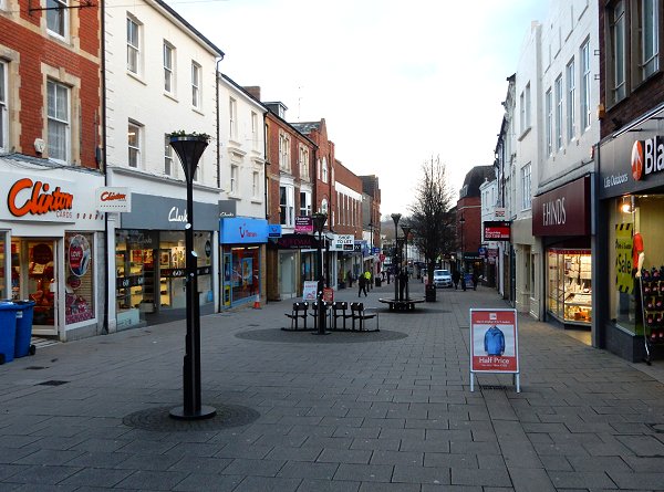
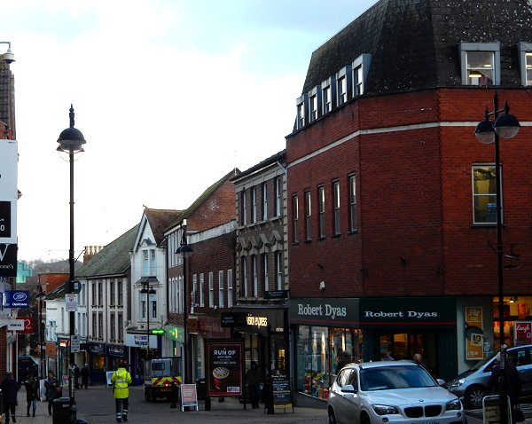
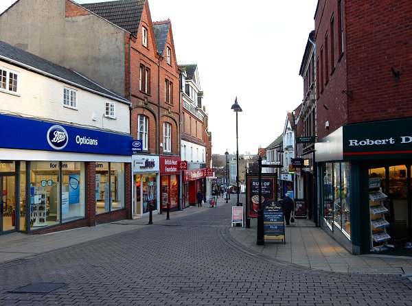
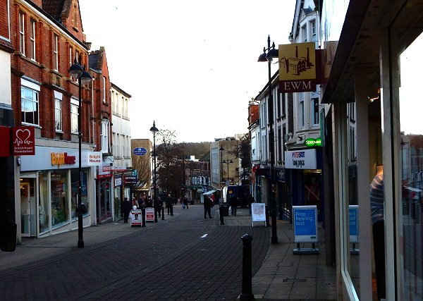
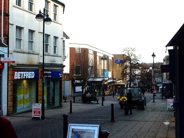
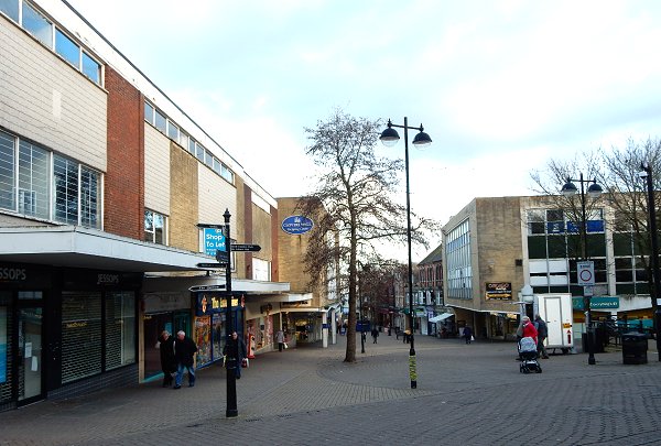
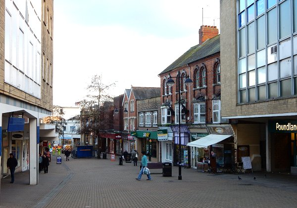
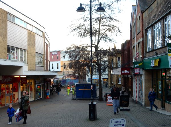
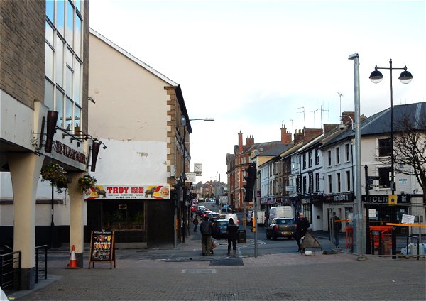
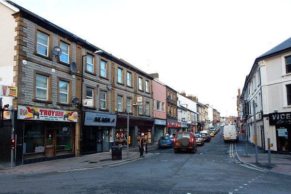
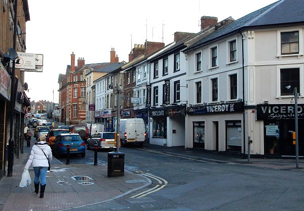
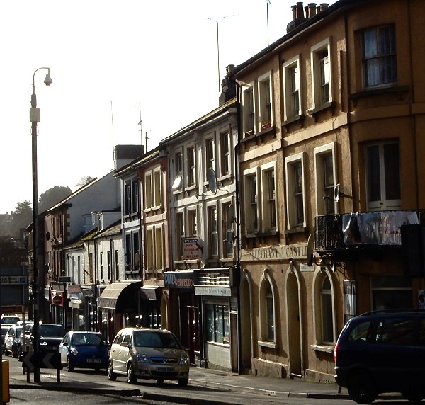
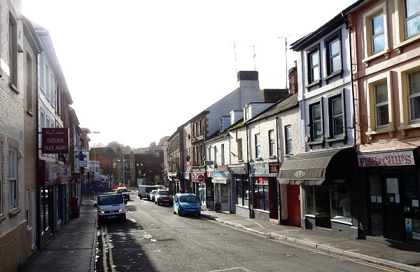
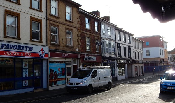
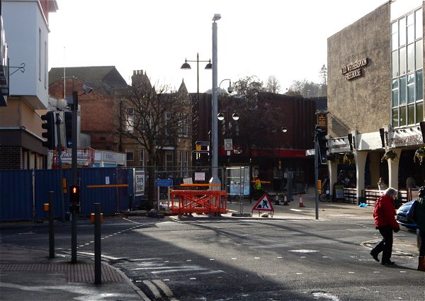
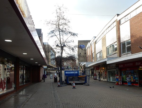
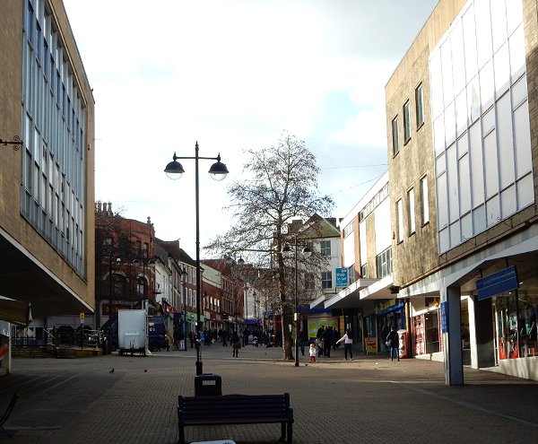
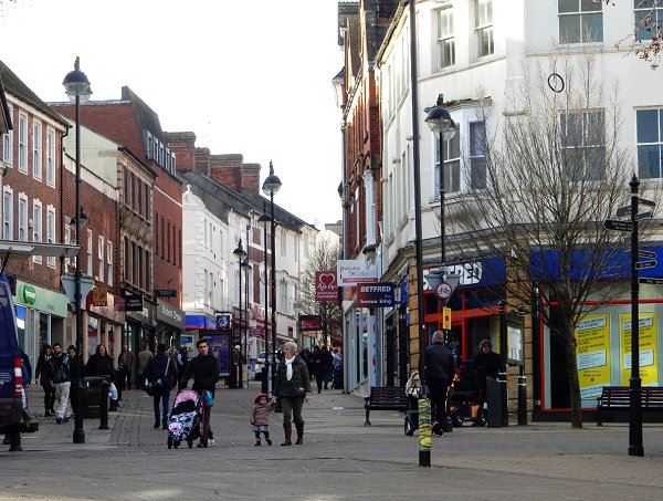
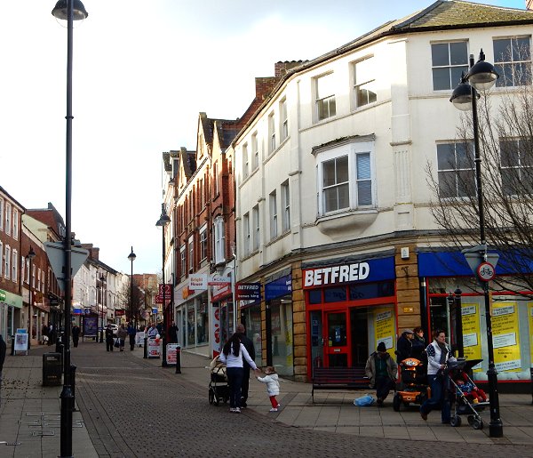
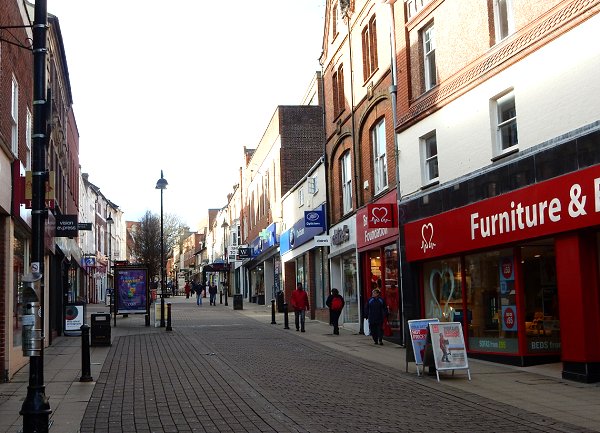
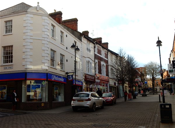
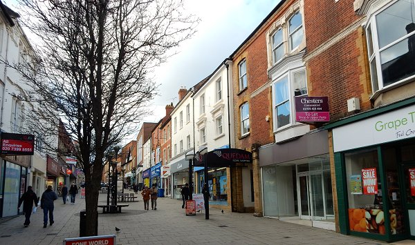
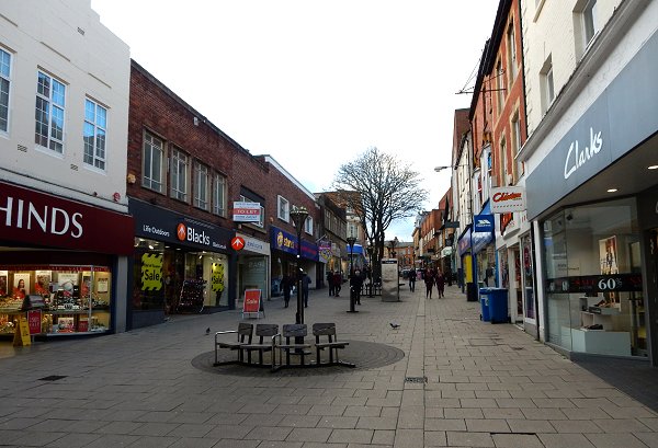
Up and Down Middle Street, 2015
The following sequence of photographs were taken during a cold Wednesday afternoon in January 2015. They start at the Borough, proceed to the Elephant and Castle at Wyndham Street, then return to the Borough. It should be noted that Yeovil wasn't quite as empty as it might appear from the photos since I waited for most people to get out of the way before I took each shot.
.... and back again
Demolition of the glovers walk PART OF mIDDLE sTREET 2025

Preparing the Middle Street buildings of the Glovers Walk project for demolition, seen from outside the entrance to the Glovers Walk precinct, looking east. Photographed on 13 January 2025.
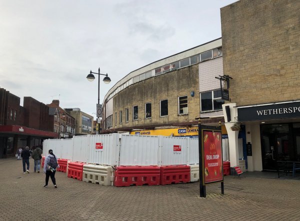
... and seen from outside Wetherspoons, looking west. Photographed on 13 January 2025.
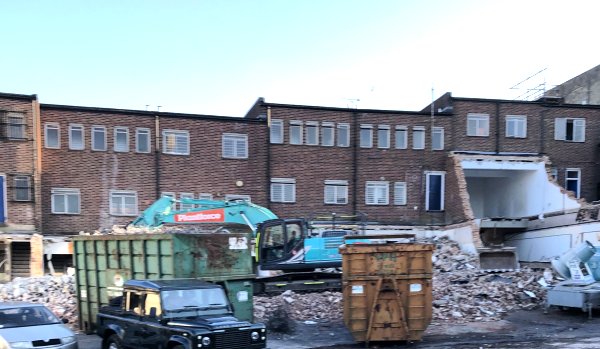
Demolition gets underway on the Middle Street buildings - the rear of the buildings seen from the access road between Wetherspoons and the Bus Station. Photographed on 9 April 2025.
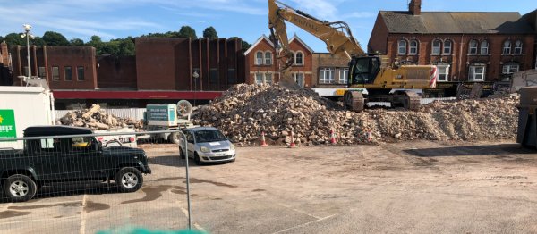
Again, seen from the access road between Wetherspoons and the Bus Station, demolition is all but complete. Photographed on 29 May 2025.
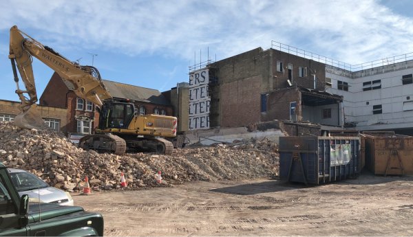
... and panning right. Photographed on 29 May 2025.