cromwell road
cromwell road
Off Lyde Road
Cromwell Road was laid out around 1900 in a field called Priddle's Mead (Parcel 974). The 1901 Ordnance Survey shows the first eight dwellings at the eastern corner of the junction with Lyde Road. Cromwell Road itself was, at this time, not constructed and is shown by dotted lines on the map extending the length of the field in which it was being built.
Eventually it would be doubled in length and extended to join St Michaels Road, itself constructed post-1901. All eight of the original houses survive.
A datestone on a pair of semi-detached houses (opposite the original terrace of eight) shows these were built in 1908. Almost all the properties in Cromwell Road are identical in style to the original eight giving the whole street a harmonious appearance.
MAP
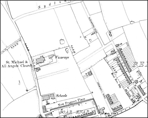
The 1901 Ordnance Survey showing Cromwell Road laid out towards bottom right. It would eventually extend into the next field to join St Michaels Road which has tentatively been laid out.
gallery
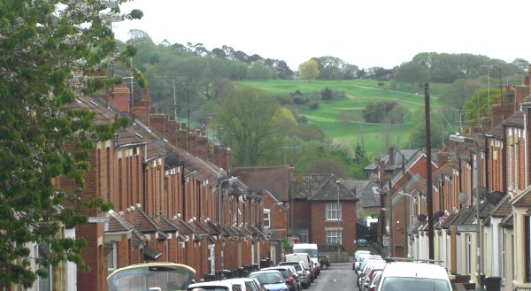
Cromwell Road, looking south towards Lyde Road and the western flank of Babylon Hill beyond. Photographed 2013.