Priddle's Mead
Priddle's Mead
A field within the great manorial East Field
Priddle's Mead (Parcel 974) was originally a five-acre field, rising gently from south to north, within the great East Field of the Manor of Kingston.
At the time of the 1846 Tithe Apportionment, Priddle's Mead was owned by William Hawker Helyar and let to ironmonger and postmaster (and slum landlord) of Silver Street, William Jennings. Priddle's Mead was used as meadow for growing hay. It measured 5a 2r 0p.
Priddle's Mead was bounded on the south by Meadway (today's Lyde Road), on the west by four narrow strip fields (three of which were let to William Jennings above) - Nursery (Parcel 981), Jennings Buildings (Parcel 982) also known as New Prospect Place, and Goar Nap Field (Parcels 983 and 984). Priddle's Mead was bounded on the north by Penny's Orchard (Parcel 975).
Today, the houses and gardens of Cromwell Road occupy the former Priddle's Mead.
For details on historic land measurement (ie acres, roods and perches) click here.
maps

This map, based on the descriptions in the 1589 Terrier and the 1846 Tithe Map of Yeovil shows the approximate boundaries of the Manors of Kingston and Hendford as well as the manorial three-field system used in Kingston.

A map of the great medieval East Field of Kingston Manor showing conjectured locations of several fields based on descriptions in the 1589 Terrier.
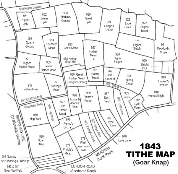
Drawn from the 1846 Tithe Map with field names added from the 1846 Tithe Apportionment, with Priddle's Mead left of centre bottom.
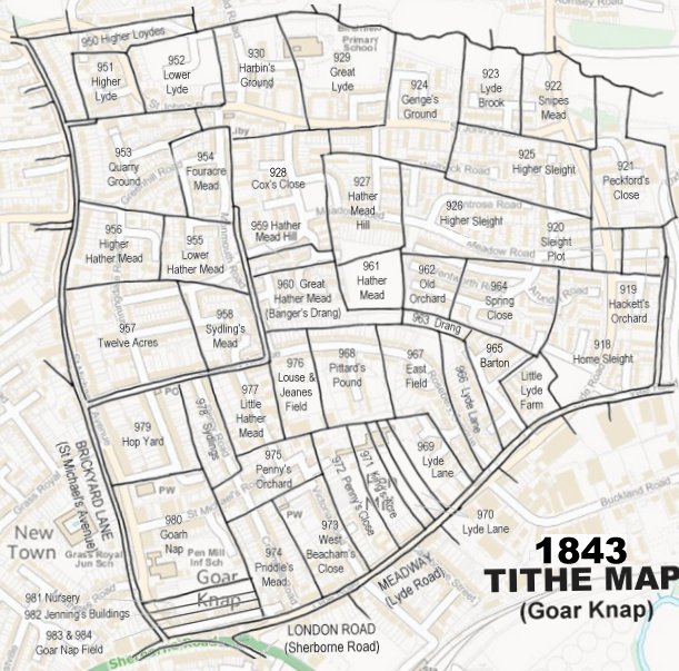
The 1843 Tithe Map overlaid onto a modern map of the area.
Gallery
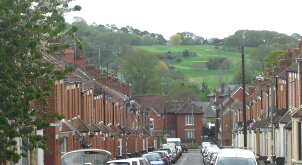
Built on the former Priddle's Mead, this is Cromwell Road, looking south towards Lyde Road with the western flank of Babylon Hill beyond. Photographed 2013.