ebenezer ROW
ebenezer Row
Middle Street
Ebenezer Row, later known as Ebenezer Terrace, was a terrace of houses somewhat derogatorily named after the Methodist (Wesleyan) chapel they were built next to in Middle Street, just east of the Triangle, between 1806 and 1831 - they don't appear on Watts' map of 1806 but are shown on his map of 1831, see maps below. The land had been owned in 1806 by Mr GR Corry.
‘Ebenezers’ was the commonly-applied term to non-conformists of any denomination.
Edward Leach was listed in the Poll Book of 1846 by virtue of owning freehold houses in Ebenezer Row.
The buildings were demolished around 1972 and the site is now roughly where Poundland is today.
MAPS
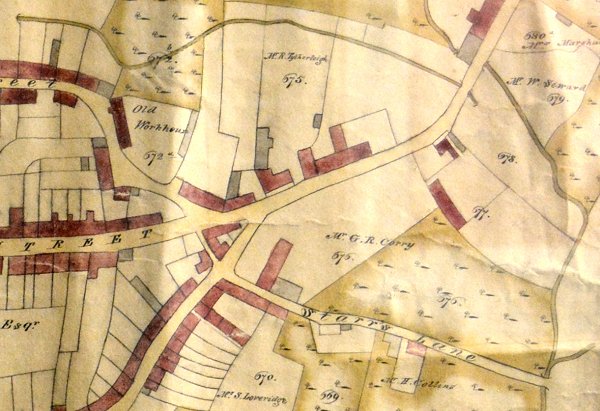
E Watts' map of 1806 shows the southern side of Lower Middle Street beyond the Triangle completely devoid of buildings and notes that the land was owned by Mr GR Corry.
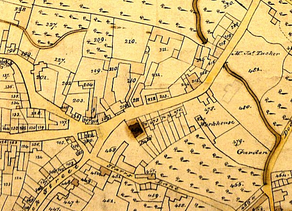
Watts' map of 1831 shows Ebenezer Row next to the newly-built Wesleyan Chapel.
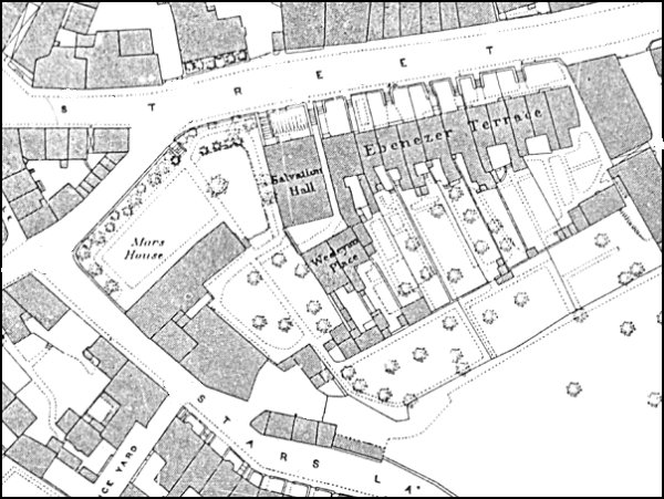
The 1886 Ordnance Survey showing Mars House at left and Ebenezer Terrace, built in the former grounds of Mars House, facing Middle Street.
By the time of the 1901 census Thomas Jesty's premises had been built (see photograph below).
GALLERY
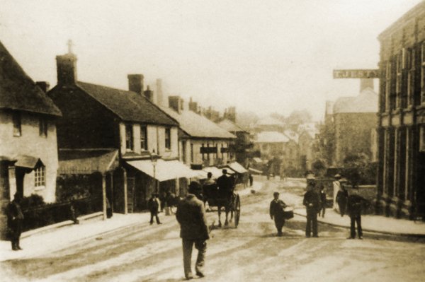
The earliest photograph I've found of this part of Middle Street, photographed around 1890 and looking east from the Triangle. Thomas Jesty's furniture emporium is at extreme right and the short front gardens of Ebenezer Terrace are seen immediately next door to Jesty's premises. At extreme left the cottage with a small front garden was soon to be demolished and replaced with the block of shops (next to the Coronation Hotel) surmounted by a series of four small domes. The two blocks of shops at centre, with the awnings, remained until the 1960s.